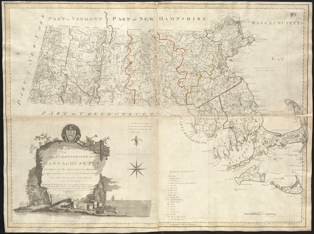
An accurate map of the Commonwealth of Massachusetts exclusive of the district of Maine : compiled pursuant to an Act of the General Court from actual surveys of the several towns, etc. taken by their order exhibiting the boundary lines of the Commonwealth, the counties and towns, the principal roads, rivers, mountains, mines, islands, rocks, shoals, channels, lakes, ponds, falls, mills, manufactures & public buildings, with the true latitudes & longitudes, &c
This map is also available in American Revolutionary Geographies Online (ARGO), a collections portal especially built for material relating to the American Revolutionary War Era. Visit ARGO to learn more about this item and explore the historical geography of North America in the late eighteenth century.
Item Information
- Title:
- An accurate map of the Commonwealth of Massachusetts exclusive of the district of Maine : compiled pursuant to an Act of the General Court from actual surveys of the several towns, etc. taken by their order exhibiting the boundary lines of the Commonwealth, the counties and towns, the principal roads, rivers, mountains, mines, islands, rocks, shoals, channels, lakes, ponds, falls, mills, manufactures & public buildings, with the true latitudes & longitudes, &c
- Creator:
- Carleton, Osgood, 1742-1816
- Name on Item:
-
by Osgood Carleton.
- Date:
-
[1795]
- Format:
-
Maps/Atlases
- Location:
-
Boston Public Library
Norman B. Leventhal Map & Education Center - Collection (local):
-
Norman B. Leventhal Map & Education Center Collection
- Subjects:
-
Massachusetts--Maps--Early works to 1800
- Places:
-
Massachusetts
- Extent:
- 1 map : col. ; 84 x 117 cm.
- Terms of Use:
-
No known copyright restrictions.
No known restrictions on use.
- Publisher:
-
Boston, Mass :
Published and sold by O.Carleton and I. Norman
- Scale:
-
Scale [ca. 1:281,600]
- Language:
-
English
- Notes:
-
Relief shown pictorially.
Prime meridian: Washington.
"Sold also by W. Norman, No. 75 Newbury Street."
Shows distance of each town from Boston and the shire town.
- Notes (date):
-
This date is inferred.
- Identifier:
-
06_01_002589
- Call #:
-
G3760 1795 .C3
- Barcode:
-
39999058995893


