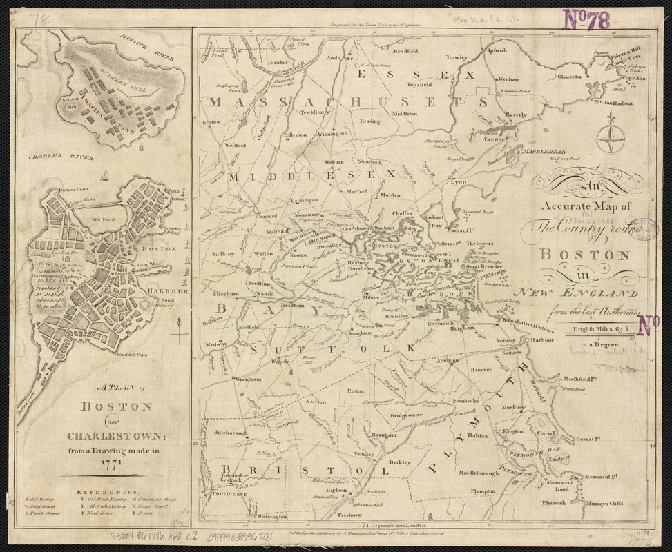
An accurate map of the country round Boston in New England from the best authorities
This map is also available in American Revolutionary Geographies Online (ARGO), a collections portal especially built for material relating to the American Revolutionary War Era. Visit ARGO to learn more about this item and explore the historical geography of North America in the late eighteenth century.
Item Information
- Title:
- An accurate map of the country round Boston in New England from the best authorities
- Date:
-
1776
- Format:
-
Maps/Atlases
- Location:
-
Boston Public Library
Norman B. Leventhal Map & Education Center - Collection (local):
-
Norman B. Leventhal Map & Education Center Collection
- Subjects:
-
Massachusetts--Maps--Early works to 1800
Boston (Mass.)--History--Revolution, 1775-1783--Maps--Early works to 1800
- Places:
-
MassachusettsSuffolk (county)Boston
- Extent:
- 1 map ; 32 x 29 cm.
- Terms of Use:
-
No known copyright restrictions.
No known restrictions on use.
- Publisher:
-
London :
A. Hamilton
- Scale:
-
Scale [ca. 1:360,000]
- Language:
-
English
- Notes:
-
Relief shown by hachures.
"Publish'd as the Act directs by A. Hamilton Junr. near St. John's Gate Jan. 16,1776."
"Engraved for the Town & Country Magazine."
Inset: A plan of Boston and Charlestown; from a drawing made in 1771.
- Identifier:
-
06_01_002587
- Call #:
-
G3764.B6 1776 .A22
- Barcode:
-
39999058996701


