Selected hurricanes affecting the southern United States 1954-1977
Item Information
- Title:
- Selected hurricanes affecting the southern United States 1954-1977
- Description:
-
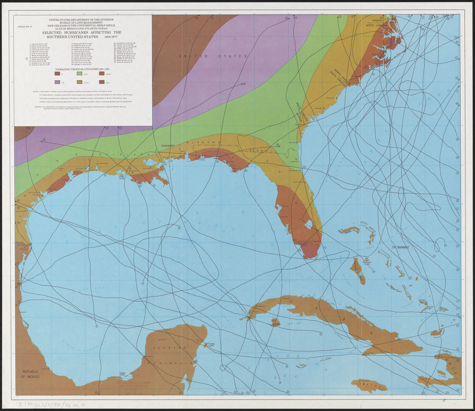
Regions and Seasons: By the 1960s, satellites were used to track hurricanes from the air. Issued as part of a government report, this map illustrates thirty-six hurricane tracks in the Gulf of Mexico over a twenty-year period. The different colors represent numbers of tropical cyclones that have impacted areas along the Gulf from 1901 to 1955. Florida’s west coast and the east coast of the Carolinas were heavily impacted by tropical storms, as evidenced by the dark rust color in those locations.
- Creator:
- United States. Bureau of Land Management. New Orleans Outer Continental Shelf Office,
- Cartographer:
- United States. Bureau of Land Management. New Orleans Outer Continental Shelf Office,
- Name on Item:
-
United States Department of the Interior, Bureau of Land Management, New Orleans Outer Continental Shelf Office, Gulf of Mexico and Atlantic Ocean
- Date:
-
[1978?]
- Format:
-
Maps/Atlases
- Location:
-
Boston Public Library
Norman B. Leventhal Map & Education Center - Collection (local):
-
Norman B. Leventhal Map & Education Center Collection
- Subjects:
-
Hurricanes--Southern States--Maps
Southern States--Maps
- Places:
-
Southern United States (area)
- Extent:
- 1 map : color ; 57 x 66 cm
- Terms of Use:
-
No known copyright restrictions.
No known restrictions on use.
- Publisher:
-
[New Orleans] :
New Orleans Outer Continental Shelf Office
- Scale:
-
Scale approximately 1:1,000,000
- Language:
-
English
- Notes:
-
Source: U.S. Dept. of Commerce, National Oceanic and Atmospheric Administration, National Weather Service, National Hurricane Center, Coral Gables, Florida.
Includes index to hurricanes.
- Notes (exhibitions):
-
Exhibited: "Regions and Seasons: Mapping Climate through History" organized by the Norman B. Leventhal Map Center at the Boston Public Library, 2017.
- Identifier:
-
06_01_015942
- Call #:
-
G3861.C86 1978 .U5
- Barcode:
-
39999085942033


