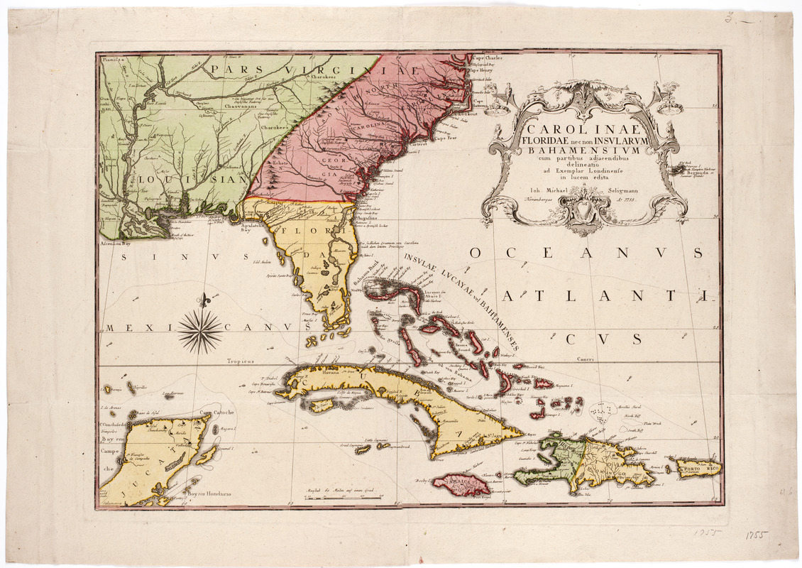
Carolinae Floridae nec non insularum Bahamensium : cum partibus adjacendibus delineatio ad Exemplar Londinense in lucem edita a Joh. Michael Seligmann Norimbergae Ao. 1755
This map is also available in American Revolutionary Geographies Online (ARGO), a collections portal especially built for material relating to the American Revolutionary War Era. Visit ARGO to learn more about this item and explore the historical geography of North America in the late eighteenth century.
Item Information
- Title:
- Carolinae Floridae nec non insularum Bahamensium : cum partibus adjacendibus delineatio ad Exemplar Londinense in lucem edita a Joh. Michael Seligmann Norimbergae Ao. 1755
- Description:
-
Subject: Map of the southern states, including Virginia, the Carolinas, Georgia, Florida and Louisiana. Also includes the islands of the West Indies: Bahamas, Cuba, Jamaica, Hispanola and Puerto Rico. A portion of the Yucatan Peninsula is seen at left, and the island of Bermuda is seen to the right of the cartouche.
- Donor:
- Farwell, John Whittemore, 1843-1929
- Publisher:
- Seligmann, Johann Michael, 1720-1762
- Date:
-
[1755]
- Format:
-
Maps/Atlases
- Location:
- American Antiquarian Society
- Collection (local):
-
American Antiquarian Society Collection
- Subjects:
-
Southern States--Maps
West Indies--Maps
- Places:
-
Southern United States (area)
West Indies
- Extent:
- 1 map : engraving, hand colored ; 43 x 59 cm., on sheet 52 x 74 cm.
- Terms of Use:
-
Public Domain/No known restrictions on use. Contact host institution to download image.
Contact host institution for more information.
- Publisher:
-
Nuremberg :
Johann Michaell Seligmann
- Scale:
-
Scale not given
- Language:
-
Latin
- Catalog Record:
-
http://catalog.mwa.org/vwebv/holdingsInfo?bibId=488493
- Notes:
-
Relief shown pictorially.
- Notes (date):
-
This date is inferred.


