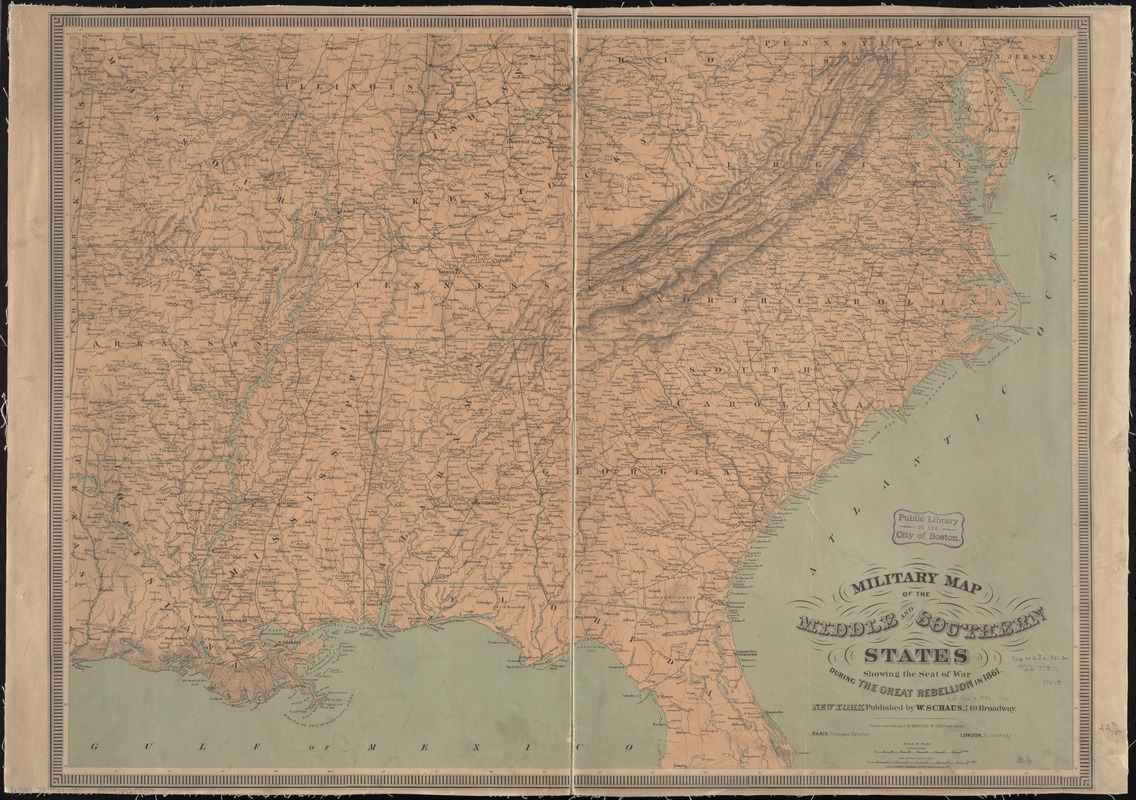
Military map of the middle and southern states showing the seat of war during the great rebellion in 1861
Item Information
- Title:
- Military map of the middle and southern states showing the seat of war during the great rebellion in 1861
- Creator:
- Schedler, J. (Joseph)
- Name on Item:
-
drawn and engr. by J. Schedler.
- Date:
-
[1860?–1869?]
- Format:
-
Maps/Atlases
- Location:
-
Boston Public Library
Norman B. Leventhal Map & Education Center - Collection (local):
-
Norman B. Leventhal Map & Education Center Collection
- Subjects:
-
Southern States--Maps
United States--History--Civil War, 1861-1865--Maps
- Places:
-
Southern United States (area)
- Extent:
- 1 map : col. ; 59 x 80 cm.
- Terms of Use:
-
No known copyright restrictions.
No known restrictions on use.
- Publisher:
-
New York; Paris; London :
W. Schaus; Francois Delarue; H. Graves & Co.
- Scale:
-
Scale [ca. 1:2,370,000]
- Language:
-
English
- Notes:
-
General map of the southeastern states showing roads, railroads, cities and towns, rivers, state boundaries, and relief by hachures.
Description derived from published bibliography.
- Identifier:
-
hdl:loc.gmd/g3701s.cw0017400
06_01_008753
- Call #:
-
G3861.S5 1861 .S34
- Barcode:
-
39999065656314
- LCCN:
-
99447052


