Map of the south western part of the United States : constructed and engraved to illustrate "The War with the South"
Item Information
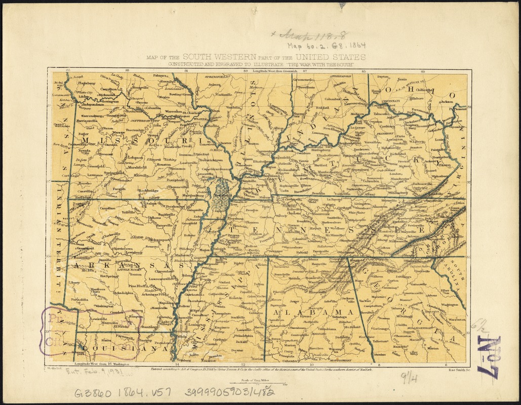
- Title:
- Map of the south western part of the United States : constructed and engraved to illustrate "The War with the South"
- Title (alt.):
-
Map of the southwestern part of the United States
- Creator:
- Virtue, Yorston & Co
- Name on Item:
-
J. Wells del. ; Rae Smith sc.
- Date:
-
1864
- Format:
-
Maps/Atlases
- Location:
-
Boston Public Library
Norman B. Leventhal Map & Education Center - Collection (local):
-
Norman B. Leventhal Map & Education Center Collection
- Subjects:
-
Southern States--Maps
- Places:
-
Southern United States (area)
- Extent:
- 1 map : col. ; 17 x 24 cm.
- Terms of Use:
-
No known copyright restrictions.
No known restrictions on use.
- Publisher:
-
[New York?] :
Virtue Yorston & Co.
- Scale:
-
Scale [ca. 1:5,300,000]
- Language:
-
English
- Notes:
-
Relief shown by hachures.
Shows Missouri, Arkansas, Kentucky, Tennessee, and portions of Kansas, Texas, Illinois, Indiana, Ohio, Virginia, Louisiana, Mississippi, Alabama, Georgia, North Carolina, and South Carolina.
- Identifier:
-
06_01_007446
- Call #:
-
G3860 1864 .V57
- Barcode:
-
39999059031482


