Toggle navigation
LMEC Home
Exhibitions
Georeferencing
Tools for Teachers
Collections
My Favorites
Sign Up / Log In
Search
Search the map portal
Map Collection
Map Collection
Map Sets
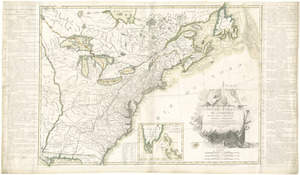
Search
Search
Search for
Search In
All Fields
Creator
Title
Subject
Place
Search All Digital Collections
Advanced Search
336 Results
My Search
Start Over
More Like
commonwealth:z603vs77g
Remove constraint More Like: commonwealth:z603vs77g
Filter your Search
Place
North and Central America
269
United States
196
New York
56
New Jersey
35
Suffolk (county)
32
Boston
30
Canada
30
North America
28
more
Place
»
Topic
New Jersey--Maps--Early works to 1800
30
North America--Maps--Early works to 1800
19
New York (N.Y.)--Maps--Early works to 1800
18
Boston (Mass.)--History--Revolution, 1775-1783--Maps--Early works to 1800
16
New York (State)--Maps--Early works to 1800
12
Pennsylvania--Maps--Early works to 1800
12
New Jersey--Administrative and political divisions--Maps--Early works to 1800
11
Vues d'optique
10
more
Topic
»
Date
Date range begin
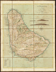
–
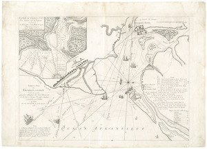
Date range end
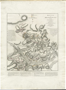
Current results range from
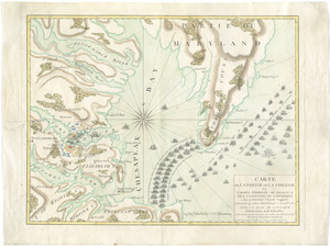
1672
to
1799
View distribution
Creator
Faden, William, 1749-1836
37
Jefferys, Thomas, -1771
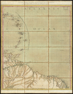
30
Le Rouge, Georges-Louis
23
Des Barres, Joseph F. W. (Joseph Frederick Wallet), 1722-1824
22
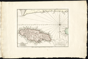
Sayer, Robert, 1725-1794
20
Korn, Christoph Heinrich, 1726-1783
11
Raspe, Gabriel Nicolaus, 1712-1785
11
Simcoe, John Graves, 1752-1806
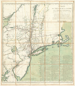
10
more
Creator
»
Format
Maps/Atlases
293
Prints
32
Manuscripts
25
Drawings/Illustrations
9
Books
2
Georeferenced
Yes
17
No
319
Collection
American Revolutionary War-Era Maps
329
Richard H. Brown Revolutionary War Map Collection at Mount Vernon
293
Norman B. Leventhal Map & Education Center Collection
19
New York Public Library Collection
17
Maritime Charts and Atlases
5
Urban Maps
5
Boston and New England Maps
4
New-York Historical Society Collection
2
more
Collection
»
Available to use
Creative Commons license
313
No known restrictions
20
Search Constraints
Sort by relevance
relevance
title
date (asc)
date (desc)
Number of results to display per page
100 per page
10
per page
20
per page
50
per page
100
per page
View results as:
grid view
map view
Search Results
1.
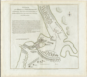
Attaque de l'armée des provinciaux dans Long Island du 27. Aoust 1776 : dessin de l'isle de New-York et des Etats
2.
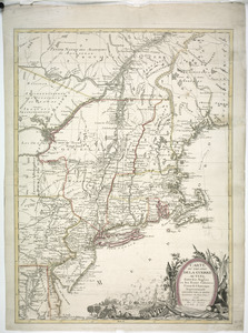
Connecticut and parts adjacent
3.
Connecticut and parts adjacent
4.
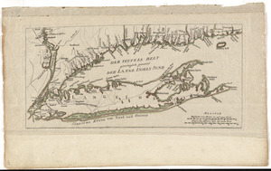
Der Teufels Belt gemeiniglich genannt der Lange Insels Sund
5.
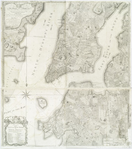
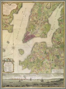
A plan of the city of New-York & its environs to Greenwich, on the North or Hudsons River, and to Crown Point, on the East or...
6.
A south east view of the city of New York, in North America = Vue de sud est de la ville de New York, dans l'Amerique...
7.
A south west view of the city of New York, in North America = Vue de sud ouest de la ville de New York, dans l'Amerique...
8.
To His Excellency Sr. Henry Moore, Bart., captain general and governour in chief in & over the province of New York & the...
9.
Position der Koenigl;Grosbrittanischen und derer vereinigten provinzial armée in New York und dem Jerseys in Nord America im...
10.
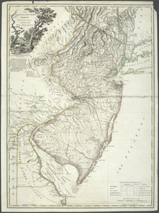
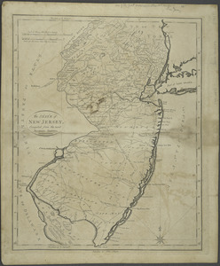
Province de New-Jersey divisée en est et ouest nomée vulgairement les Jerseys
11.
The province of New Jersey, divided into east and west, commonly called the Jerseys
12.
[A chart of New York Island & North River : East River, passage through Hell Gate, Flushing Bay, Hampstead Bay, Oyster,...
13.
A large draught of New England, New York and Long Island
14.
Sketch of the country illustrating the late engagement in Long Island
15.
Carte d'un partie de l'Amerique Septentrionale : ou est tracée notre route d'Halifax à New York, par Quebec, Montreal, le Lac...
16.
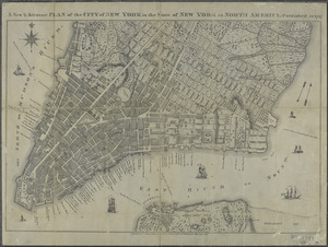
A new & accurate plan of the city of New York in the state of New York in North America
17.
A new & accurate plan of the city of New York in the state of New York in North America
18.
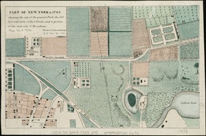
Part of New York in 1742 : showing the site of the present park, the collect and the little collect ponds, and a portion of the...
19.
Particular draughts and plans of some of the principal towns and harbours belonging to the English, French, and Spaniards, in...
20.
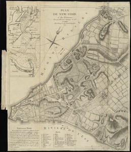
Plan de New-York et des environs
21.
A plan of the city and environs of New York in North America
22.
Plan of the city of New York in North America : surveyed in the years 1766 & 1767
23.
Plan of the city of New York in North America : surveyed in the years 1766 & 1767
24.
PLAN of the CITY of NEW YORK, in North America : Surveyed in the Years 1766 & 1767
25.
A plan of the city of New-York & its environs to Greenwich, on the North or Hudsons River, and to Crown Point, on the East or...
26.
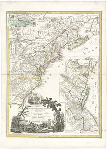
The provinces of New York and New Jersey : with part of Pensilvania, and the Province of Quebec
27.
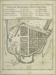
Ville de Manathe ou Nouvelle-Yorc
28.
Carte de la Pensylvanie et du Nouveau Jersey
29.
An exact map of New Jersey, Pensylvania [sic], New York, Maryland & Virginia, from the latest surveys
30.
Map no. I
31.
A map of the eastern part of the province of New York with part of New Jersey, & c
32.
A map of the eastern part of the province of New York with part of New Jersey, & c
33.
A map of the provinces of New-York and New Jersey, with a part of Pennsylvania and the Province of Quebec
34.
A mapp of New Jersey in America
35.
Mappa geographica Provinciæ Nova Eboraci ab Anglis New-York : dictæ ex ampliori delineatione ad exactas dimensiones concinnata...
36.
A New and accurate map of New Jersey : from the best authorities
37.
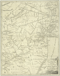
A New and accurate map of the present seat of war in North America : comprehending New Jersey, Philadelphia, Pensylvania,...
38.
A New and accurate map of the present seat of war in North America : comprehending New Jersey, Philadelphia, Pensylvania,...
39.
New Engelland, New York, New Yersey und Pensilvania
40.
A new map of Virginia, Mary-land and the improved parts of Penn-sylvania & New Jersey
41.
Part of east New Jarsey, New York, and Connecticut
42.
Paskaerte van de Zuÿdt en Noordt Revier in Nieu Nederlant streckende van Cabo Hinloopen tot Rechkewach
43.
La Pensilvania, la Nuova York, il Jersey Settentrio[na]le : con la parte occidentale del Connecticut, Massachusset-s-bay e...
44.
Pensylvania Nova Jersey et Nova York cum Regionibus ad Fluvium Delaware in America sitis
45.
Porti della Nuova York e Perthamboy
46.
Position du camp de l'armée combinée a Philipsburg du 6 juillet au 19 aoust
47.
The Province of New Jersey : divided into East and West, commonly called the Jerseys
48.
The Province of New Jersey : divided into East and West, commonly called the Jerseys
49.
The province of New Jersey, divided into east and west, commonly called the Jerseys
50.
The province of New Jersey, divided into east and west, commonly called the Jerseys
51.
The provinces of New York, and New Jersey; with part of Pensilvania, and the governments of Trois Rivières, and Montreal
52.
Seat of war in the environs of Philadeliphia
53.
Seat of war in the environs of Philadeliphia
54.
The State of New Jersey : compiled from the most accurate surveys
55.
[A map of part of Pennsylvania & Maryland intended to shew, at one view, the several places proposed for opening a...
56.
Abriss der stadt Gibraltar und der darinn befindlichen festen platze, nebst dem meerbusen von Algesiras
57.
An accurate map of His Majesty's province of New-Hampshire in New England : taken from actual surveys of all the inhabited...
58.
An accurate map of the country round Boston in New England from the best authorities
59.
Action at Spencer's ordinary : June 26th. 1781
60.
Affair at Quintin's Bridge : 18th March 1778
61.
Allgemeine charte von Nord America als den sitz des krieges zwischen den Konigl. Engl. truppen u:den provinzialen
62.
Ambuscade of the Indians at Kingsbridge : August 31st. 1778
63.
L'Amerique divisée en septentrionale et méridionale, subdivisée en ses principales parties, dressée sur les relations les...
64.
L'Amerique divisée en ses principaux États
65.
L'Amerique Septentrionale
66.
Amérique septentrionale avec les routes, distances en miles, limites et etablissements françois et anglois
67.
Amerique Septentrionale divisée en ses principales parties, ou sont distingués les vns des autres les estats suivant qu'il...
68.
Amérique Septentrionale dressée sur les relations les plus modernes des voyageurs et navigateurs, ou se remarquent les Etats...
69.
L'Amerique Septentrionale, ou se remarquent les Etats Unis
70.
Antigue : levée par Robert Baker, Arpenteur General de l'Isle ; traduit de l'Anglais
71.
The attack and defeat of the American fleet under Benedict Arnold, by the King's fleet commanded by Capt. Thos. Pringle, upon...
72.
Attack of the rebels upon Fort Penobscot in the province of New England in which their fleet was totally destroyed and their...
73.
La Barbade
74.
Barre et port de Charles-Town levé en 1776 : avec les attaques du Fort Sulivan du 28 juin 1776 par l'escadre anglaise...
75.
Battle of Brandywine in which the rebels were defeated, September the 11th. 1777, by the army under the command of General Sr....
76.
Baye de Chesapeake en 4 feuilles avec les bas fonds, passes, entrées, sondes et routes ou l'on donne les parties navigables...
77.
Baye et port de Boston
78.
Bequia ou Becouya, le plus septentrionale des Granadilles : levé en 1763
79.
[Boston Neck, with the British lines and John Hancock's house]
80.
Bowles's new and accurate map of Europe, divided into it's [sic] empires, kingdoms, states, republicks and principalities :...
81.
Bowles's new and accurate map of North America and the West Indies : exhibiting the extent and boundaries of the United States,...
82.
British camp at Trudruffrin from the 18th. to the 21st. of September 1777 : with the attack made by Major General Grey against...
83.
[Cambridge with Washington's headquarters]
84.
The Caribbee Islands and Guayana
85.
Carte de la partie de la Virginie ou l'armée combinée de France & des États-Unis de l'Amérique a fait prisonnière l'armée...
86.
Carte de l'affaire de Montmouth, ou le Général Washington commandon l'armée Americaine, et le Général Clinton l'armée...
87.
Carte de l'Amérique Septle. pour servir à l'intelligence de la guerre entre les Anglois et les insurgents
88.
Carte de l'isle d'Antigoa une de Isles Antilles
89.
Carte de l'isle de la Jamaique
90.
Carte des environs du Fort Pitt et de la nouvelle province Indiana : dediée a M. Franklin
91.
Carte des Etats-Unis d'Amérique, et du cours du Mississippi : rédigée d'après différentes cartes et relations Anglaises et...
92.
Carte des Etats-Unis de l'Amerique suivant le Traité de Paix de 1783
93.
Carte des possessions angloises dans l'Amerique Septentrionale pour servir d'intelligence à la guerre presente traduite de...
94.
Carte du Canada et des Etats-Unis de l'Amérique Septentrionale
95.
Carte du port et havre de Boston avec les côtes adjacentes, dans laquel on a tracée les camps et les retranchemens occupé,...
96.
Carte du théatre de la guerre actuel entre les Anglais et les Treize Colonies Unies de l'Amerique Septentrionale
97.
Carte du théatre de la guerre dans l'Amérique Septentrionale, pendant les années 1775, 76, 77, et 78 : où se trouvent les...
98.
Carte du theatre de la guerre presente en Amerique
99.
Carte d'une partie du Nord Amerique dans la quelle se trouvent les isles et les provinces suivantes : l'Isle de la Terre-Neuve...
100.
Carte generale des colonies angloises dans l'Amerique Septentrionale pour l'intelligence de la guerre presente : d'apres des...
‹ Prev
Next ›
1
2
3
4


![A plan of the city of New-York & its environs to Greenwich, on the North or Hudsons River, and to Crown Point, on the East or Sound River, shewing the several streets, publick buildings, docks, fort & battery, with the true form & course of the commanding grounds, with and without the town : survey'd in the winter, 1775 [i.e. 1766]](https://bpldcassets.blob.core.windows.net/derivatives/images/commonwealth:z603vs09b/image_thumbnail_300.jpg)


![A plan of the city of New-York & its environs to Greenwich, on the North or Hudsons River, and to Crown Point, on the East or Sound River, shewing the several streets, publick buildings, docks, fort & battery, with the true form & course of the commanding grounds, with and without the town : survey'd in the winter, 1775 [i.e. 1766]](https://bpldcassets.blob.core.windows.net/derivatives/images/commonwealth:6t053q479/image_thumbnail_300.jpg)


![An exact map of New Jersey, Pensylvania [sic], New York, Maryland & Virginia, from the latest surveys](https://bpldcassets.blob.core.windows.net/derivatives/images/commonwealth:z603vp67m/image_thumbnail_300.jpg)


![La Pensilvania, la Nuova York, il Jersey Settentrio[na]le](https://bpldcassets.blob.core.windows.net/derivatives/images/commonwealth:z603vq53g/image_thumbnail_300.jpg)


![[A map of part of Pennsylvania & Maryland intended to shew, at one view, the several places proposed for opening a communication between the waters of the Delaware & Chesopeak Bays]](https://bpldcassets.blob.core.windows.net/derivatives/images/commonwealth:z603vt12v/image_thumbnail_300.jpg)


![[Boston Neck, with the British lines and John Hancock's house]](https://bpldcassets.blob.core.windows.net/derivatives/images/commonwealth:dz010v61c/image_thumbnail_300.jpg)
![Bowles's new and accurate map of Europe, divided into it's [sic] empires, kingdoms, states, republicks and principalities](https://bpldcassets.blob.core.windows.net/derivatives/images/commonwealth:q524mt678/image_thumbnail_300.jpg)

![[Cambridge with Washington's headquarters]](https://bpldcassets.blob.core.windows.net/derivatives/images/commonwealth:dz010v63x/image_thumbnail_300.jpg)