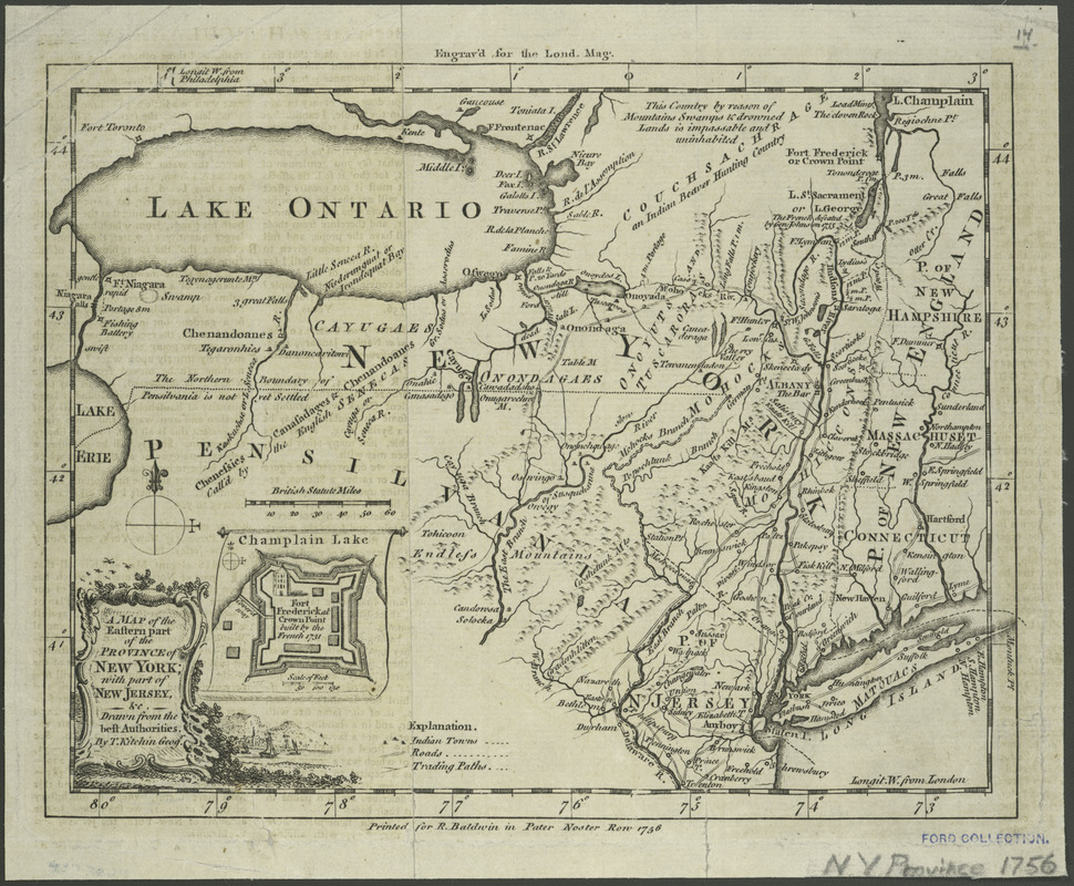
A map of the eastern part of the province of New York with part of New Jersey, & c
This map is also available in American Revolutionary Geographies Online (ARGO), a collections portal especially built for material relating to the American Revolutionary War Era. Visit ARGO to learn more about this item and explore the historical geography of North America in the late eighteenth century.
Item Information
- Title:
- A map of the eastern part of the province of New York with part of New Jersey, & c
- Creator:
- Kitchin, Thomas, 1719-1784
- Name on Item:
-
drawn from the best authorities, by T. Kitchin, geogr.
- Date:
-
1756
- Format:
-
Maps/Atlases
- Location:
- New York Public Library
- Collection (local):
-
Maps of New York City and State
- Subjects:
-
New York (State)--Maps--Early works to 1800
New Jersey--Maps--Early works to 1800
United States--History--French and Indian War, 1755-1763--Maps--Early works to 1800
Fort Frederic (N.Y.)
- Places:
-
New YorkEssex (county)Crown Point (cape)
New Jersey
- Extent:
- 1 map ; 17 x 22 cm.
- Terms of Use:
-
No known copyright restrictions.
This work is licensed for use under a Creative Commons Attribution Non-Commercial Share Alike License (CC BY-NC-SA).

- Publisher:
-
London :
R. Baldwin
- Scale:
-
Scale 1:2,538,360
- Language:
-
English
- Catalog Record:
-
https://digitalcollections.nypl.org/items/510d47da-ee20-a3d9-e040-e00a18064a99
- Notes:
-
Prime meridians: London and Philadelphia.
Inset: Fort Frederic at Crown Point, built by the French 1731. Scale 1:3600.
Engraved for the London magazine.


