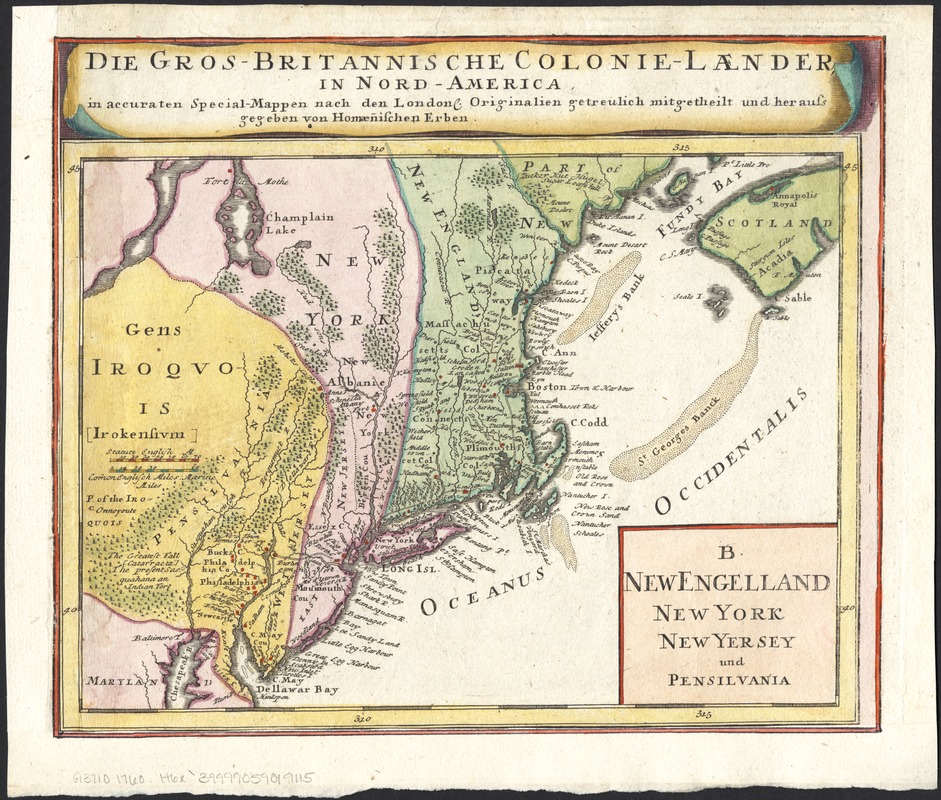
New Engelland, New York, New Yersey und Pensilvania
This map is also available in American Revolutionary Geographies Online (ARGO), a collections portal especially built for material relating to the American Revolutionary War Era. Visit ARGO to learn more about this item and explore the historical geography of North America in the late eighteenth century.
Item Information
- Title:
- New Engelland, New York, New Yersey und Pensilvania
- Title (alt.):
-
B New Engelland, New York, New Yersey und Pensilvania
Gros-britannische Colonie-Laender, in Nord America
- Creator:
- Homann Erben (Firm)
- Date:
-
[1760?]
- Format:
-
Maps/Atlases
- Location:
-
Boston Public Library
Norman B. Leventhal Map & Education Center - Collection (local):
-
Norman B. Leventhal Map & Education Center Collection
- Subjects:
-
New Jersey--Maps--Early works to 1800
New York (State)--Maps--Early works to 1800
Pennsylvania--Maps--Early works to 1800
New England--Maps--Early works to 1800
Northeastern States--Maps--Early works to 1800
- Places:
-
Pennsylvania
New England (area)
Northeastern United States (area)
New York
New Jersey
- Extent:
- 1 map : col. ; 19 x 26 cm.
- Terms of Use:
-
No known copyright restrictions.
No known restrictions on use.
- Publisher:
-
Nuremberg :
Homann Heirs
- Scale:
-
Scale ca. 1:3,700,000.
- Language:
-
German
Latin
English
- Notes:
-
One of four maps cut from larger map titled Dominia Anglorum in America septentrionali : specialibus mappis Londini primum a Mollio edita, nunc recusa ab Homannianis Hered.
In top margin: Gros-britannische Colonie-Laender, in Nord America / in accuraten Special-Mappen nach den London. Originalien getreullich mitgetheiil und heraussgegeben von Homaenishcen Erben.
Shows boundary of East and West Jersey as of or before 1702.
- Identifier:
-
06_01_006021
- Call #:
-
G3710 1700 .H6x
- Barcode:
-
39999059019115


