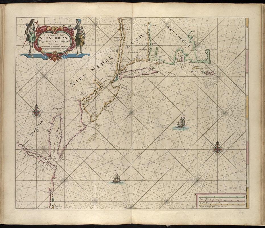
Pas caert van Nieu Nederland, Virginia en Nieu Engelant
Item Information
- Title:
- Pas caert van Nieu Nederland, Virginia en Nieu Engelant
- Creator:
- Doncker, Hendrick, 1626-1699
- Date:
-
[1660]
- Format:
-
Maps/Atlases
- Location:
-
Boston Public Library
Norman B. Leventhal Map & Education Center - Collection (local):
-
Norman B. Leventhal Map & Education Center Collection
- Subjects:
-
New England--Maps--Early works to 1800
New York (State)--Maps--Early works to 1800
Atlantic Coast (U.S.)--Maps--Early works to 1800
Northeastern States--Maps--Early works to 1800
- Places:
-
New England (area)
Northeastern United States (area)
New York
- Extent:
- 1 map : hand col. ; 45 x 54 cm.
- Terms of Use:
-
No known copyright restrictions.
No known restrictions on use.
- Publisher:
-
Amsterdam :
By Hendrik Doncker
- Scale:
-
Scale [ca. 1:2,040,000]
- Language:
-
Dutch
- Notes:
-
Depths shown by soundings.
From Hendrick Doncker's Zee-atlas ofte water-waereld, vertoonende alle de zee-kusten van het bekende deel des aerd-bedems, met een beschrijvinge der selve. Amsterdam: By Hendrick Doncker, Anno 1660 [i.e. 1665]
Title in decorative cartouche.
Hand colored.
Includes ill.
Cataloging, conservation, and digitization made possible in part by The National Endowment for the Humanities: Exploring the human endeavor.
Atlas scanned by Internet Archive http://archive.org/details/dezeeatlasofwate00donc
- Notes (date):
-
This date is inferred.
- Identifier:
-
06_01_007867
- Call #:
-
G1059 .D66 1665
- Barcode:
-
30000003765377


