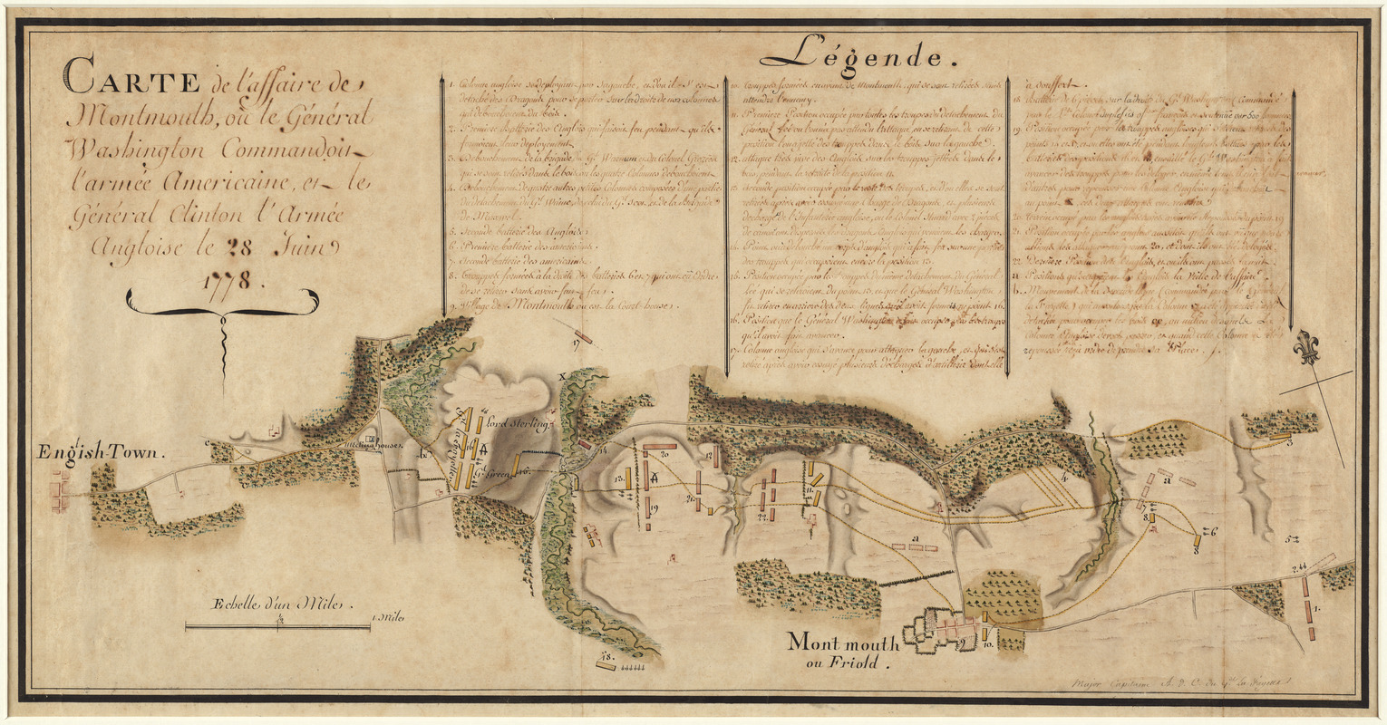
Carte de l'affaire de Montmouth, ou le Général Washington commandon l'armée Americaine, et le Général Clinton l'armée Angloise le 28 Juin 1778
This map is also available in American Revolutionary Geographies Online (ARGO), a collections portal especially built for material relating to the American Revolutionary War Era. Visit ARGO to learn more about this item and explore the historical geography of North America in the late eighteenth century.
Item Information
- Title:
- Carte de l'affaire de Montmouth, ou le Général Washington commandon l'armée Americaine, et le Général Clinton l'armée Angloise le 28 Juin 1778
- Description:
-
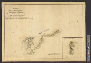
Michel Capitaine du Chesnoy, the Marquis de Lafayette?s map maker, drew this map following the Battle of Monmouth Court House in northeastern New Jersey. After confusion surrounding the Continental Army?s orders, the soldiers prevented the British troops from advancing. The battle occurred on a hot June day and hundreds of soldiers died of heatstroke. Women, who came to be referred to collectively as “Molly Pitcher,” supported the American troops by bringing water to cool the men and their guns. Although the battle ended inconclusively, it was a turning point for the professionalization of the American army as volunteer French and German military officers provided training.
- Creator:
- Capitaine du Chesnoy, Michel, 1746-1804
- Name on Item:
-
Major Capitaine A. d. C. du Gl. La Fayette.
- Date:
-
1778
- Format:
-
Maps/Atlases
Manuscripts
- Location:
- George Washington's Mount Vernon
- Collection (local):
-
Richard H. Brown Revolutionary War Map Collection at Mount Vernon
- Subjects:
-
Monmouth, Battle of, Freehold, N.J., 1778--Maps
Freehold (N.J.)--Maps
United States--History--Revolution, 1775-1783--Maps
- Places:
-
Monmouth (county)Freehold
- Extent:
- 1 manuscript map : hand color ; 37 x 74 cm
- Terms of Use:
-
No known copyright restrictions.
This work is licensed for use under a Creative Commons Attribution Non-Commercial Share Alike License (CC BY-NC-SA).

- Scale:
-
Scale 1:15,500
- Language:
-
French
- Catalog Record:
-
MVLA record
- Notes:
-
Relief shown by shading.
Oriented with north to the upper left.
Includes references.
- Notes (exhibitions):
-
Exhibited: "We Are One: Mapping America's Road from Revolution to Independence" organized by the Norman B. Leventhal Map Center at the Boston Public Library, 2015.
- Identifier:
-
06_01_014536