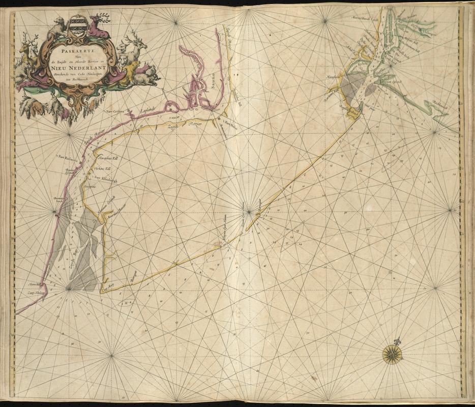
Paskaerte van de Zuÿdt en Noordt Revier in Nieu Nederlant streckende van Cabo Hinloopen tot Rechkewach
Item Information
- Title:
- Paskaerte van de Zuÿdt en Noordt Revier in Nieu Nederlant streckende van Cabo Hinloopen tot Rechkewach
- Creator:
- Goos, Pieter, ca. 1616-1675
- Date:
-
1672
- Format:
-
Maps/Atlases
- Location:
-
Boston Public Library
Norman B. Leventhal Map & Education Center - Collection (local):
-
Norman B. Leventhal Map & Education Center Collection
- Subjects:
-
Nautical charts--New Jersey--Early works to 1800
New Jersey--Maps--Early works to 1800
- Places:
-
New Jersey
- Extent:
- 1 map : hand col. ; 51 x 59 cm.
- Terms of Use:
-
No known copyright restrictions.
No known restrictions on use.
- Publisher:
-
t'Amsteldam :
By Pieter Goos
- Scale:
-
Scale ca. 1:2,600,000.
- Language:
-
Dutch
- Notes:
-
Relief shown by soundings.
Oriented with north toward the upper right.
"In effect this map is the first of present day New Jersey and is the most detailed map of the region to date."--Burden, P.D. The mapping of North America, p. 494.
Appears in the author's De zee-atlas ofte water-wereld. Amsterdam: Pieter Goos, 1672.
Cataloging, conservation, and digitization made possible in part by The National Endowment for the Humanities: Exploring the human endeavor.
Atlas scanned by Internet Archive http://archive.org/details/dezeeatlasoftewa00goos
- Identifier:
-
06_01_007925
- Call #:
-
G1059 .G66 1672
- Barcode:
-
30000003773584


