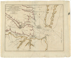
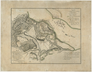
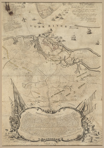
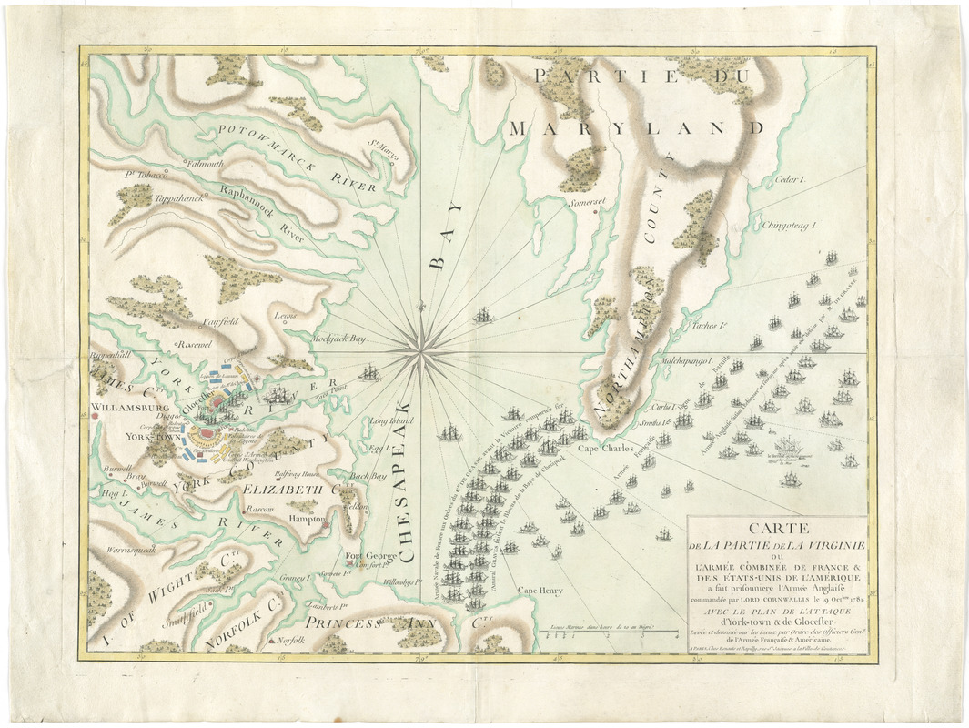
Carte de la partie de la Virginie ou l'armée combinée de France & des États-Unis de l'Amérique a fait prisonnière l'armée anglaise commandée par Lord Cornwallis le 19 octobre, 1781 : avec le plan de l'attaque d'York-town & de Glocester : levée et dessinée sur les lieux par ordre des officiers genx. de l'armée française & américaine
This map is also available in American Revolutionary Geographies Online (ARGO), a collections portal especially built for material relating to the American Revolutionary War Era. Visit ARGO to learn more about this item and explore the historical geography of North America in the late eighteenth century.
Item Information
- Title:
- Carte de la partie de la Virginie ou l'armée combinée de France & des États-Unis de l'Amérique a fait prisonnière l'armée anglaise commandée par Lord Cornwallis le 19 octobre, 1781 : avec le plan de l'attaque d'York-town & de Glocester : levée et dessinée sur les lieux par ordre des officiers genx. de l'armée française & américaine
- Description:
-
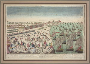
This French map features the American and French forces in Yorktown, Virginia, at the time of the British surrender on October 19, 1781. British commander Charles Cornwallis capitulated after Washington's successful siege of Yorktown. Continental troops surround the British forts (colored red), and the French navy forms a blockade in the Chesapeake Bay. French ships also line up across from British ships, one of which is on fire. This map, printed in Paris, emphasizes the significance of French military assistance for the Americans' victory. The map acknowledges America's success, but it also celebrates a French triumph over a longtime enemy.
- Contributor:
- Esnauts et Rapilly
- Date:
-
[1781?]
- Format:
-
Maps/Atlases
- Location:
- George Washington's Mount Vernon
- Collection (local):
-
Richard H. Brown Revolutionary War Map Collection at Mount Vernon
- Subjects:
-
Gloucester (Va.)--History--18th century--Maps--Early works to 1800
Yorktown (Va.)--History--Siege, 1781--Maps--Early works to 1800
Yorktown (Va.)--History--18th century--Maps--Early works to 1800
- Places:
-
Gloucester (county)Gloucester
York (county)Yorktown
- Extent:
- 1 map : hand col. ; 45 x 59 cm.
- Terms of Use:
-
No known copyright restrictions.
This work is licensed for use under a Creative Commons Attribution Non-Commercial Share Alike License (CC BY-NC-SA).

- Publisher:
-
Paris :
Esnauts et Rapilly
- Scale:
-
Scale [ca. 1:215,000]
- Language:
-
French
- Catalog Record:
-
MVLA record
- Notes:
-
Prime meridian: Paris.
Relief shown by hachures.
Shows troop and fleet positions.
This map can be viewed as a georeferenced overlay in an interactive application made especially for We Are One: Mapping America's Road from Revolution to Independence http://d2o8owo4k087al.cloudfront.net/index.html?mapId=77.
- Notes (exhibitions):
-
Exhibited: "We Are One: Mapping America's Road from Revolution to Independence" organized by the Norman B. Leventhal Map Center at the Boston Public Library, 2015.
- Identifier:
-
06_01_008202