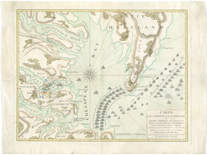
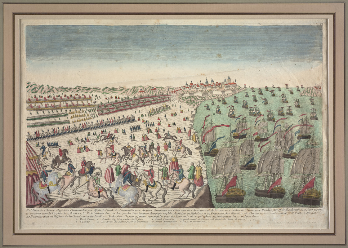
Reddition de l'armée Angloises commandée par Mylord Comte de Cornwallis aux armees combinées des Etats Unis de l'Amerique et de France aux ordres des Generaux Washington et de Rochambeau a Yorck Touwn et Glocester dans la Virginie : le 19 Octobre 1781
This map is also available in American Revolutionary Geographies Online (ARGO), a collections portal especially built for material relating to the American Revolutionary War Era. Visit ARGO to learn more about this item and explore the historical geography of North America in the late eighteenth century.
Item Information
- Title:
- Reddition de l'armée Angloises commandée par Mylord Comte de Cornwallis aux armees combinées des Etats Unis de l'Amerique et de France aux ordres des Generaux Washington et de Rochambeau a Yorck Touwn et Glocester dans la Virginie : le 19 Octobre 1781
- Description:
-
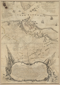
This print offers a French perspective of the British surrender at Yorktown. The image portrays Yorktown as a bustling city with European-style buildings with domes and towers. Dozens of ships, standards raised, sail in the river as soldiers stand in formation on the shore. Officers on horses celebrate as male and female civilians observe the scene. This print highlights the French military contributions to the American victory over the British. This lively scene aimed to resonate with Frenchmen celebrating the British defeat.
- Contributor:
- Mondhare (Firm)
- Date:
-
[1781?]
- Format:
-
Prints
- Genre:
-
Views
- Location:
- George Washington's Mount Vernon
- Collection (local):
-
Richard H. Brown Revolutionary War Map Collection at Mount Vernon
- Subjects:
-
Yorktown (Va.)--History--Siege, 1781--Pictorial works--Early works to 1800
Yorktown (Va.)--History--Siege, 1781--Maps--Early works to 1800
Yorktown (Va.)--History--18th century--Maps--Early works to 1800
- Places:
-
York (county)Yorktown
- Extent:
- 1 view : hand col. ; 32 x 52 cm.
- Terms of Use:
-
No known copyright restrictions.
This work is licensed for use under a Creative Commons Attribution Non-Commercial Share Alike License (CC BY-NC-SA).

- Publisher:
-
Paris :
Mondhare
- Scale:
-
Not drawn to scale
- Language:
-
French
- Catalog Record:
-
MVLA record
- Notes:
-
Includes references to points of interest.
In upper right: 26.
In French.
- Notes (exhibitions):
-
Exhibited: "We Are One: Mapping America's Road from Revolution to Independence" organized by the Norman B. Leventhal Map Center at the Boston Public Library, 2015.
- Identifier:
-
06_01_009566