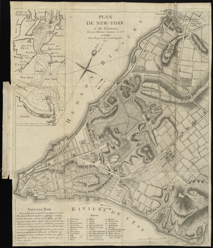
Plan de New-York et des environs
This map is also available in American Revolutionary Geographies Online (ARGO), a collections portal especially built for material relating to the American Revolutionary War Era. Visit ARGO to learn more about this item and explore the historical geography of North America in the late eighteenth century.
Item Information
- Title:
- Plan de New-York et des environs
- Creator:
- Montrésor, John, 1736-1799
- Name on Item:
-
levé par Montrésor, ingénieur en 1775.
- Date:
-
1777
- Format:
-
Maps/Atlases
- Location:
-
Boston Public Library
Norman B. Leventhal Map & Education Center - Collection (local):
-
Norman B. Leventhal Map & Education Center Collection
- Subjects:
-
New York (N.Y.)--Maps--Early works to 1800
- Places:
-
New YorkNew York
- Extent:
- 1 map ; 61 x 50 cm.
- Terms of Use:
-
No known copyright restrictions.
No known restrictions on use.
- Publisher:
-
Paris :
Chez le Rouge
- Scale:
-
Scale [ca. 1:6,500]
- Language:
-
French
- Notes:
-
Relief shown by hachures.
Oriented with north to the upper right.
Includes text and index to points of interest.
Inset: Port de New-York.
Bound in Le Rouge's Recueil des plans de l'Amerique Septentrionale.
- Identifier:
-
06_01_009938
- Call #:
-
G1105 .L47 1777
- Barcode:
-
30000003914071
- LCCN:
-
gm 71000988
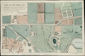


![A plan of the city of New-York & its environs to Greenwich, on the North or Hudsons River, and to Crown Point, on the East or Sound River, shewing the several streets, publick buildings, docks, fort & battery, with the true form & course of the commanding grounds, with and without the town : survey'd in the winter, 1775 [i.e. 1766]](https://bpldcassets.blob.core.windows.net/derivatives/images/commonwealth:6t053q479/image_thumbnail_300.jpg)
