Toggle navigation
LMEC Home
Exhibitions
Georeferencing
Tools for Teachers
Collections
My Favorites
Sign Up / Log In
Search
Search the map portal
Map Collection
Map Collection
Map Sets
Search
Search
Search for
Search In
All Fields
Creator
Title
Subject
Place
Search All Digital Collections
Advanced Search
8282 Results
My Search
Start Over
More Like
commonwealth:w9505s760
Remove constraint More Like: commonwealth:w9505s760
Filter your Search
Place
North and Central America
4,941
United States
3,640
Suffolk (county)
1,026
Boston
999
Europe
963
Canada
443
North America
301
France
269
more
Place
»
Topic
Boston (Mass.)--Maps
574
United States--Maps
270
North America--Maps--Early works to 1800
180
Real property--Massachusetts--Boston--Maps
174
Massachusetts--Maps
160
Landowners--Massachusetts--Boston--Maps
132
New England--Maps
99
Europe--Maps
78
more
Topic
»
Date
Date range begin
–
Date range end
Current results range from
1482
to
2023
View distribution
Creator
United States. Hydrographic Office
357
O.H. Bailey & Co
148
Des Barres, Joseph F. W. (Joseph Frederick Wallet), 1722-1824
123
United States. Post Office Dept
120
Ptolemy, 2nd cent
100
Walling, Henry Francis, 1825-1888
94
Jefferys, Thomas, -1771
90
Geological Survey (U.S.)
82
more
Creator
»
Format
Maps/Atlases
8,223
Manuscripts
219
Prints
51
Books
36
Objects/Artifacts
10
Drawings/Illustrations
8
Posters
4
Georeferenced
Yes
874
No
7,408
Collection
Norman B. Leventhal Map Center Collection
8,173
Boston and New England Maps
2,185
Urban Maps
1,925
Maritime Charts and Atlases
750
American Revolutionary War-Era Maps
718
Boston Redevelopment Authority Collection
86
New York Public Library Collection
46
Richard H. Brown Revolutionary War Map Collection at Mount Vernon
28
more
Collection
»
Available to use
No known restrictions
8,026
Creative Commons license
139
Search Constraints
Sort by relevance
relevance
title
date (asc)
date (desc)
Number of results to display per page
100 per page
10
per page
20
per page
50
per page
100
per page
View results as:
grid view
map view
Search Results
1.
British dominions in America, drawn from the latest and best authorities
2.
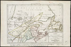
Carte d'une partie de l'Amérique Septentrionale pour servir à l'intelligence du mémoire sur les prétentions des Anglois au...
3.
A new map of the United States of North America with the British dominions on that continent &c
4.
A map of the British and French dominions in North America : with the roads, distances, limits, and extent of the settlements,...
5.
A New map of North America with the West India Islands : divided according to the preliminary articles of peace, signed at...
6.
Carte minéralogique, où l'on voit la nature des terreins du Canada et de la Louisiane
7.
A map of Canada and the north part of Louisiana with the adjacent countrys
8.
Map of the United States in North America : with the British, French and Spanish dominions adjoining, according to the treaty...
9.
The United States of America with the British possessions of Canada, Nova Scotia, New Brunswick and Newfoundland divided with...
10.
The United States of North America : with the British territories and those of Spain according to the treaty of 1784
11.
British colonies in North America : drawn from the best authorities
12.
Le Canada, ou Nouvelle France, &c : ce qui est le plus advance vers le Septentrion est tiré de diverses relations des Anglois,...
13.
A New and correct map of the British colonies in North America comprehending eastern Canada with the province of Quebec, New...
14.
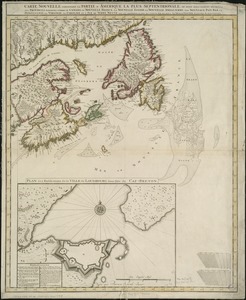
Pas-caert van Terra Nova, Nova Francia, Nieuw-Engeland en de groote rivier van Canada
15.
Carte nouvelle de l'Amérique Angloise contenant tout ce que les Anglois possédent sur le continent de l'Amérique...
16.
A map of the northern and middle states : comprehending the western territory & the British dominions in North America : from...
17.
Carte du Canada et des Etats-Unis de l'Amérique Septentrionale
18.
Virginia et Nova Francia
19.
L'Amerique Septentrionale, ou se remarquent les Etats Unis
20.
BOWLES'S NEW POCKET MAP OF THE UNITED STATES OF AMERICA : WITH THE BRITISH POSSESSIONS OF CANADA, NOVA SCOTIA, AND OF...
21.
A new and correct map of North America with the West India Islands : divided according to the last treaty of peace, concluded...
22.
A new and correct map of North America, with the West India islands, divided according to the preliminary articles of peace,...
23.
Carte de Canada, de la Nouvelle Ecosse et de l'Acadie : d'après les originaux Anglais
24.
Carte du Canada ou de la Nouvelle France et des decouvertes qui y ont été faites
25.
Carte nouvelle contenant la partie d'Amerique la plus septentrionale, ou sont exactement dêcrites les provinces suivantes...
26.
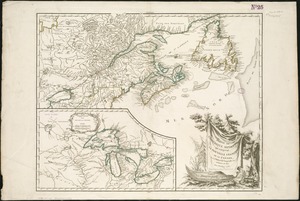
A new chart of the coast of New England, Nova Scotia, New France or Canada, with the islands of Newfoundld. Cape Breton St....
27.
Partie de l'Amérique septent? qui comprend la Nouvelle France ou le Canada
28.
Partie orientale de la Nouvelle France ou du Canada
29.
Partie orientale de la Nouvelle France ou du Canada
30.
Partie orientale du Canada, avec la Nouvelle Angleterre, l'Acadie, et la Terre-Neuve
31.
Paskaerte Zÿnde de Noordelijckfte Zeekuften van America van Groenland door de Straet Davis en de Straet Hudson tot Terra Neuf
32.
Théatre de la guerre en Amerique, avec les Isles Antilles : projetté et assujettie aux observations
33.
Théatre de la guerre en Amerique, avec les Isles Antilles : projetté et assujettie aux observations
34.
An accurate map of the United States of America, with part of the surrounding provinces agreeable to the Treaty of Peace of 1783
35.
Amplissimae regionis Mississipi seu provinciae Ludovicianae â R.P. Ludovico Hennepin Francisc. Miss. in America septentrionali...
36.
Amplissimae regionis Mississipi seu Provinciae Ludovicianae â R.P. Ludovico Hennepin Francisc Miss in America Septentrionali...
37.
Bowles's new one-sheet map of the independent states of Virginia, Maryland, Delaware, Pensylvania, New Jersey, New York,...
38.
Carte de la Louisiane cours du Mississipi et pais voisins : dediée à M. le Comte de Maurepas, ministre et secretaire d'etat...
39.
Carte de la Louisiane et du cours de Mississipi
40.
Carte du Mexique et des Etats Unis d'Amérique, partie meridionale
41.
Carte generale des treize Etats Unis, de l'Amerique septentrionale
42.
Charte über die XIII Vereinigte Staaten von Nord-America
43.
A map of Carolana and of the river Meschacebe &c
44.
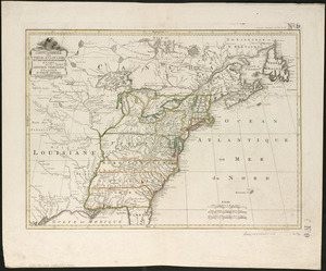
A Map of the British American plantations, extending from Boston in New England to Georgia : including all the back settlements...
45.
Map of the United States exhibiting the post-roads, the situations, connections & distances of the post-offices, stage roads,...
46.
Partie de l'Amérique septentrionale, qui comprend le cours de l'Ohio, la Nlle. Angleterre, la Nlle York, le New Jersey, la...
47.
States of America, drawn from the best authorities
48.
The United States of America with the British possessions of Canada, Nova Scotia, & of Newfoundland, divided with the French :...
49.
The United States of North America : with the British & Spanish territories according to the treaty
50.
An accurate map of North America : describing and distinguishing the British and Spanish dominions on this great continent :...
51.
An accurate map of North America : describing and distinguishing the British and Spanish dominions of this great continent;...
52.
An accurate map of North America : describing and distinguishing the British, Spanish and French dominions on this great...
53.
America : with those known parts in that unknowne worlde both people and manner of buildings discribed and inlarged
54.
America septentrionalis
55.
America Septentrionalis : concinnata juxta observationes Dnn Academiae Regalis Scientiarum et nonnullorum aliorum, et juxta...
56.
America Septentrionalis
57.
America Septentrionalis a Domino d'Anville in Galliis edita nunc in Anglia : Coloniis in interiorem Virginiam deductis nec non...
58.
America Settentrionale : colle nuove scoperte fin alle' anno 1688 divisa nelle sue partu secondo lo stato presente
59.
America sive novvs orbis respectv Evropaeorvm inferior globi terrestris pars
60.
Amérique Septentrionale
61.
Amérique Septentrionale
62.
Amérique Septentrionale : dressée sur les relations les plus modernes des voyageurs et navigateurs, et divisée suivant les...
63.
Amérique septentrionale
64.
L'Amerique septentrionale
65.
L'Amérique Septentrionale
66.
[Amerique septentrionale]
67.
Amérique septentrionale avec les routes, distances en miles, villages, et etablissements François et Anglois
68.
Amerique septentrionale divisée en ses principale parties
69.
Amerique septentrionale divisée en ses principales parties : ou sont distingués les uns des autres les etats suivant quils...
70.
L'Amérique Septentrionale divisée en ses principaux états
71.
Le Canada, ou Nouvelle France, la Floride, la Virginie, Pensilvanie, Caroline, Nouvelle Angleterre et Nouvelle Yorck, l'Isle de...
72.
Carte de la Louisiane et des pays voisins dédiée à M. Rouillé sécretaire d'état, ayant le Département de la marine
73.
Carte de la Nouuelle France et de la Louisiane nouuellement découuerte : dediée au Roy l'an 1683
74.
Carte de l'Amérique septentrionale, depuis la baye d'Hudson jusqu'au Mississipi : pour servir aux essais historiques et...
75.
Carte des possessions angloises & françoises du continent de l'Amérique septentrionale = Kaart van de Engelsche en Fransche...
76.
Carte des possessions des Anglois en Amerique, par rapport à leurs differends avec la France
77.
Carte detaillée des possessions angloises dans l'Amerique Septentrionale : construite d'après les dernieres relations et les...
78.
Carte du Mexique et de la Florida : des terres angloises et des Isles Antilles, du cours et des environs de la Riviere de...
79.
Carte générale du Canada, de la Louisiane, de la Floride, de la Caroline, de la Virginie, de la Nouvelle Angleterre etc
80.
Carte geographique de la Nouvelle Franse
81.
Chart of the Atlantic Ocean, with the British, French, & Spanish settlements in North America, and the West Indies : as also on...
82.
Chart of the Atlantic Ocean, with the British, French, & Spanish settlements in North America, and the West Indies : as also on...
83.
Le Colonie Unite dell' America Settentr'le di nuova projezione a ss. ee. li signori riformatori dello studio di Padova : con...
84.
Domina Anglorum in America Septentrionali specialibus mappis Londini primum a Mollio edita, nunc recusa ab Homannianis Hered =...
85.
The English empire in America, Newfound-land, Canada, Hudsons Bay, &c. in plano
86.
The English Empire in America, Newfound-land, Canada, Hudsons Bay &c. in plano
87.
Extract from a map of the British and French dominions in North America
88.
A general map of North America : in which is express'd the several new roads, forts, engagements, &c, taken from actual surveys...
89.
Generalkarte von Nord America samt den Westindischen inseln
90.
The isle of California : New Mexico : Louisiane : The river Misisipi, and the lakes of Canada
91.
A map of Louisiana and of the River Mississipi
92.
A map of New England, and Nova Scotia : with part of New York, Canada, and New Britain & the adjacent islands of New Found...
93.
A map of North America, & the West India Islands, with part of South America, Europe, Africa & the Atlantic Ocean with it's...
94.
A map of North America, with the European settlements & whatever else is remarkable in ye West Indies, from the latest and best...
95.
A map of the British and French dominions in North America : with the roads, distances, limits, and extent of the settlements,...
96.
A map of the British and French dominions in North America : with the roads, distances, limits, and extent of the settlements,...
97.
A map of the British and French dominions in North America, with the roads, distances, limits, and extent of the settlements
98.
A map of the British and French settlements in North America
99.
A map of the British colonies in North America : with the roads, distances, limits, and extent of the settlements, humbly...
100.
A map of the British Empire in America with the French and Spanish settlements adjacent thereto
‹ Prev
Next ›
1
2
3
4
5
…
82
83


![[Amerique septentrionale]](https://bpldcassets.blob.core.windows.net/derivatives/images/commonwealth:8336h2955/image_thumbnail_300.jpg)