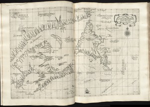
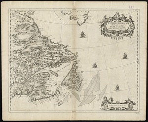
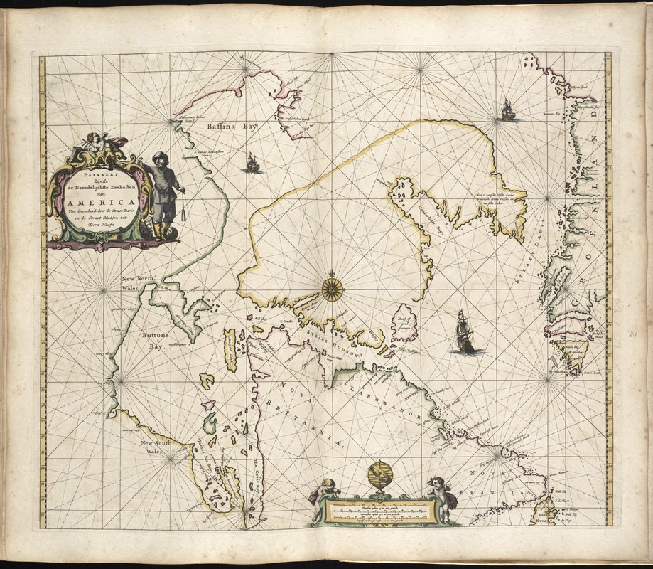
Paskaerte Zÿnde de Noordelijckfte Zeekuften van America van Groenland door de Straet Davis en de Straet Hudson tot Terra Neuf
Item Information
- Title:
- Paskaerte Zÿnde de Noordelijckfte Zeekuften van America van Groenland door de Straet Davis en de Straet Hudson tot Terra Neuf
- Creator:
- Goos, Pieter, ca. 1616-1675
- Name on Item:
-
auctore Petro Goos.
- Date:
-
1672
- Format:
-
Maps/Atlases
- Location:
-
Boston Public Library
Norman B. Leventhal Map & Education Center - Collection (local):
-
Norman B. Leventhal Map & Education Center Collection
- Subjects:
-
Atlantic Provinces--Maps--Early works to 1800
Canada--Maps--Early works to 1800
- Places:
-
CanadaNewfoundland and Labrador (province)
- Extent:
- 1 map : hand col. ; 45 x 53 cm.
- Terms of Use:
-
No known copyright restrictions.
No known restrictions on use.
- Publisher:
-
t'Amsteldam :
by Pieter Goos
- Scale:
-
Scale ca. 1:7,500,000.
- Language:
-
Dutch
- Notes:
-
Map of the northern coast of Canada.
Appears in the author's De zee-atlas ofte water-wereld. Amsterdam: Pieter Goos, 1672, plate [31].
Cataloging, conservation, and digitization made possible in part by The National Endowment for the Humanities: Exploring the human endeavor.
Atlas scanned by Internet Archive http://archive.org/details/dezeeatlasoftewa00goos
- Identifier:
-
06_01_007922
- Call #:
-
G1059 .G66 1672
- Barcode:
-
30000003772472