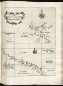
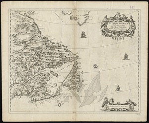
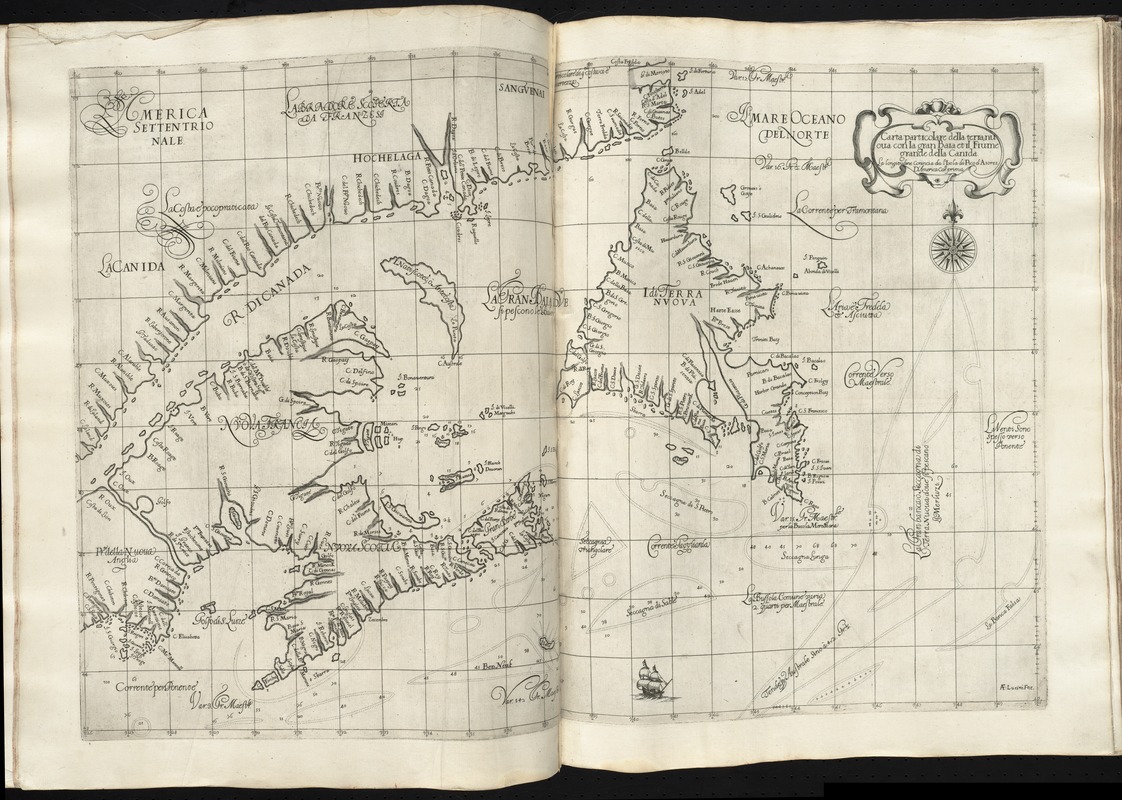
Carta particolare della terra nuoua con la Gran Baia et il Fiume Grande della Canida
Item Information
- Title:
- Carta particolare della terra nuoua con la Gran Baia et il Fiume Grande della Canida
- Title (alt.):
-
Carta particolare della terra nuova con la Gran Baia et il Fiume Grande della Canida
- Creator:
- Dudley, Robert, Sir, 1574-1649
- Engraver:
- Lucini, Antonio Francesco, b. 1605
- Name on Item:
-
A.F. Lucini fece.
- Date:
-
[1647]
- Format:
-
Maps/Atlases
- Location:
-
Boston Public Library
Norman B. Leventhal Map & Education Center - Collection (local):
-
Norman B. Leventhal Map & Education Center Collection
- Subjects:
-
Coasts--Atlantic Provinces--Maps--Early works to 1800
Coasts--Newfoundland and Labrador--Maps--Early works to 1800
Nautical charts--Early works to 1800
Newfoundland and Labrador--Maps--Early works to 1800
Atlantic Provinces--Maps--Early works to 1800
Saint Lawrence, Gulf of--Maps--Early works to 1800
- Places:
-
CanadaSaint Lawrence, Gulf of
- Extent:
- 1 map ; 49 x 74 cm.
- Terms of Use:
-
No known copyright restrictions.
No known restrictions on use.
- Publisher:
-
Firenze :
Francesco Onofri
- Scale:
-
Scale [ca. 1:2,600,000]
- Language:
-
Italian
- Notes:
-
Covers the Gulf of St. Lawrence and part of the Atlantic Provinces, showing coastal towns, harbors, prevailing winds, ocean currents, and magnetic deviations of the compass.
Depths shown by soundings.
Prime meridian: Pico.
In Dudley's Dell'arcano del mare, 1646-1647.
Cataloging, conservation, and digitization made possible in part by The National Endowment for the Humanities: Exploring the human endeavor.
- Notes (date):
-
This date is inferred.
- Identifier:
-
06_01_010149
- Call #:
-
G1059 .D84 1647
- Barcode:
-
30000003234594