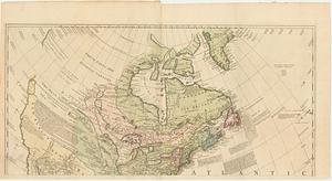
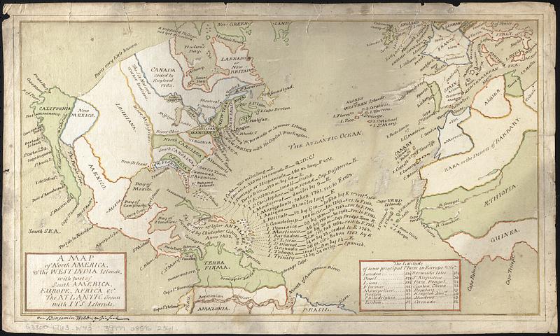
A map of North America, & the West India Islands, with part of South America, Europe, Africa & the Atlantic Ocean with it's islands
Item Information
- Title:
- A map of North America, & the West India Islands, with part of South America, Europe, Africa & the Atlantic Ocean with it's islands
- Description:
-
Manuscript map in pen, ink and wash color depicting political boundaries and possessions after the 1763 Treaty of Paris. Drawn by Benjamin Webb, a merchant and sometime schoolmaster active in London, England and later Basel, Switzerland in the mid- to late 18th century.
- Cartographer:
- Webb, Benjamin, active 1760-1784
- Contributor:
- Ptolemy, active 2nd century
- Name on Item:
-
von Benjamin Webb, gezeichnet
- Date:
-
[ca. 1763]
- Format:
-
Maps/Atlases
- Genre:
-
Manuscript maps
- Location:
-
Boston Public Library
Norman B. Leventhal Map & Education Center - Collection (local):
-
Norman B. Leventhal Map & Education Center Collection
- Subjects:
-
North America--Maps--Early works to 1800
West Indies--Maps--Early works to 1800
Europe, Western--Maps--Early works to 1800
Africa, Northwest--Maps--Early works to 1800
- Places:
-
North America (area)
Southern Europe (area)
West Africa (area)
West Indies
- Extent:
- 1 manuscript map ; hand colored ; 25 x 44 cm
- Terms of Use:
-
No known copyright restrictions.
No known restrictions on use.
- Scale:
-
Not drawn to scale
- Language:
-
English
- Notes:
-
Includes table of The latitude of some principal place in Europe &c.
Some islands in the West Indies also labeled with length of the island, length of coastline, island dimensions, or changes from the 1763 Treaty of Paris.
Likely based on German sources.
- Identifier:
-
06_01_017682
- Call #:
-
G3300 1763 .W43
- Barcode:
-
39999085962361