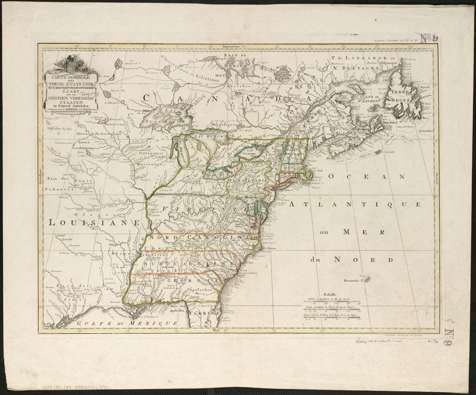
Carte generale des treize Etats Unis, de l'Amerique septentrionale
This map is also available in American Revolutionary Geographies Online (ARGO), a collections portal especially built for material relating to the American Revolutionary War Era. Visit ARGO to learn more about this item and explore the historical geography of North America in the late eighteenth century.
Item Information
- Title:
- Carte generale des treize Etats Unis, de l'Amerique septentrionale
- Title (alt.):
-
Kaart van de dertien Verénigde Staaten, in Noord Amerika
- Date:
-
[1782?]
- Format:
-
Maps/Atlases
- Location:
-
Boston Public Library
Norman B. Leventhal Map & Education Center - Collection (local):
-
Norman B. Leventhal Map & Education Center Collection
- Subjects:
-
United States--Maps--Early works to 1800
- Places:
-
United States
- Extent:
- 1 map : hand col. ; 40 x 55 cm.
- Terms of Use:
-
No known copyright restrictions.
No known restrictions on use.
- Publisher:
-
Amsterdam :
Chez C. Mortier & J. Covens, et Fils
- Scale:
-
Scale [ca. 1:7,000,000]
- Language:
-
French
- Notes:
-
Relief shown pictorially.
Appears in Cóvens et Mortier's Nieuwe atlas, inhoudende de vier gedeeltens der waereld. [1740-1817].
- Identifier:
-
06_01_006214
- Call #:
-
G3700 1782 .C37
- Barcode:
-
39999059021392


