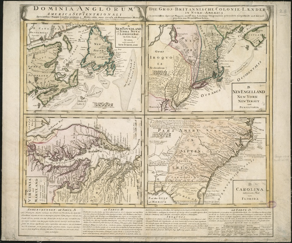
Domina Anglorum in America Septentrionali specialibus mappis Londini primum a Mollio edita, nunc recusa ab Homannianis Hered = Die Gros-Britannische colonie-laender, in Nord-America, in accuraten special-mappennach den Londone originalien getreulich mitgetheilt und heraus gegeben von Homaenischen Erben
This map is also available in American Revolutionary Geographies Online (ARGO), a collections portal especially built for material relating to the American Revolutionary War Era. Visit ARGO to learn more about this item and explore the historical geography of North America in the late eighteenth century.
Item Information
- Title:
- Domina Anglorum in America Septentrionali specialibus mappis Londini primum a Mollio edita, nunc recusa ab Homannianis Hered = Die Gros-Britannische colonie-laender, in Nord-America, in accuraten special-mappennach den Londone originalien getreulich mitgetheilt und heraus gegeben von Homaenischen Erben
- Creator:
- Homann Erben (Firm)
- Date:
-
[1759?]
- Format:
-
Maps/Atlases
- Location:
-
Boston Public Library
Norman B. Leventhal Map & Education Center - Collection (local):
-
Norman B. Leventhal Map & Education Center Collection
- Subjects:
-
North America--Maps--Early works to 1800
- Places:
-
North America (area)
- Extent:
- 4 maps on 1 sheet : col. ; each 19 x 26 cm, sheet 52 x 63 cm.
- Terms of Use:
-
No known copyright restrictions.
No known restrictions on use.
- Publisher:
-
[Norimbergae] :
Homann Erben
- Scale:
-
Scales differ.
- Language:
-
Latin
German
- Table of Contents:
-
A. Newfoundland, od. Terra Nova S. Laurentii Bay, die Fisch-Bank, Acadia, nebst einem Theil New Schotland
B. Ne Engelland New York New Yersey und Pensilvania
C. Virginia und Maryland
D. Carolina nebsteinem Theil von Florida.
- Notes:
-
Relief shown pictorially.
Includes explanatory text.
- Identifier:
-
06_01_006090
- Call #:
-
G3300 1759 .H6x
- Barcode:
-
39999059019552


