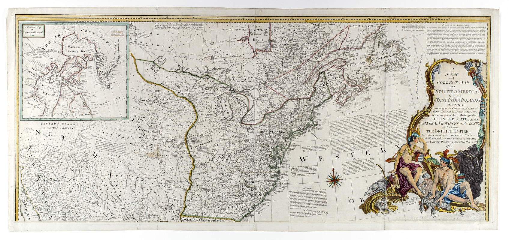
A new and correct map of North America, with the West India islands, divided according to the preliminary articles of peace, signed at Versailles, 20 Jan. 1783, wherein are particularly distinguished the United States, & the several provinces and colonies, which compose the British empire : laid down according to the latest surveys, and corrected from the original materials, of Goverr. Pownall, membr. of Parliamt. 1783

This map is also available in American Revolutionary Geographies Online (ARGO), a collections portal especially built for material relating to the American Revolutionary War Era. Visit ARGO to learn more about this item and explore the historical geography of North America in the late eighteenth century.
Item Information
- Title:
- A new and correct map of North America, with the West India islands, divided according to the preliminary articles of peace, signed at Versailles, 20 Jan. 1783, wherein are particularly distinguished the United States, & the several provinces and colonies, which compose the British empire : laid down according to the latest surveys, and corrected from the original materials, of Goverr. Pownall, membr. of Parliamt. 1783
- Cartographer:
- Bowen, Emanuel, 1693 or 1694-1767
- Publisher:
- Robert Sayer and John Bennett (Firm)
- Date:
-
[1783]
- Format:
-
Maps/Atlases
- Location:
- New-York Historical Society
- Collection (local):
-
New-York Historical Society Collection
- Subjects:
-
North America--Maps--Early works to 1800
United States--Maps--Early works to 1800
Mexico--Maps--Early works to 1800
- Places:
-
North America (area)
Mexico
- Extent:
- 1 map in 2 sheets : outline color ; 103 x 118.4 cm
- Terms of Use:
-
No known copyright restrictions.
No known restrictions on use.
- Publisher:
-
London :
Printed for Robt. Sayer and Jno. Bennett, no. 53 Fleet Street
- Scale:
-
Scale 1:5,500,000
- Language:
-
English
- Catalog Record:
-
https://library.nyu.edu/persistent/lcn/nyu_aleph004280591?institution=NYU&persistent
- Notes:
-
New state of 1779 issue showing 1783 boundaries and with changes to the title but retaining the 1779 date in imprint.
The map includes articles 4, 5, 7, 9, 17, 18, and 20 of the Treaty of Versailles.
Insets: Particular map of Baffin and Hudson's Bay--Passage by land to California discover'd by Father Eusebius Francis Kino ...
- Notes (date):
-
This date is inferred.
- Notes (citation):
-
Stevens and Tree. Comparative cartography, no. 49h
- Identifier:
-
93230d_MapNorthAmerWIndies1783_L4_3_2


