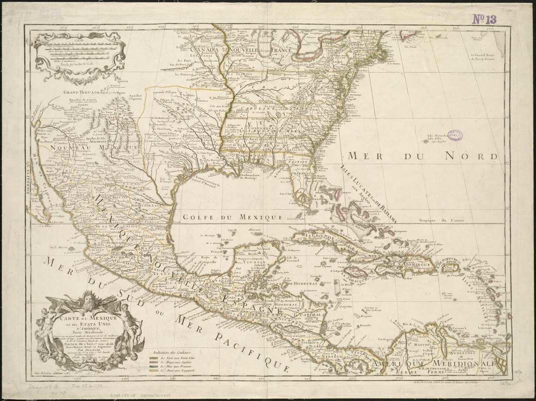
Carte du Mexique et des Etats Unis d'Amérique, partie meridionale
This map is also available in American Revolutionary Geographies Online (ARGO), a collections portal especially built for material relating to the American Revolutionary War Era. Visit ARGO to learn more about this item and explore the historical geography of North America in the late eighteenth century.
Item Information
- Title:
- Carte du Mexique et des Etats Unis d'Amérique, partie meridionale
- Creator:
- L'Isle, Guillaume de, 1675-1726
- Name on Item:
-
dressée sur un grand nombre de mémoires, et sur les meilleures cartes du pays, assujetie aux observations astronomiques de Mrs. de l'Académie Royale des Sciences par Guil. de L'Isle ... revuë et augmentée par Dezauche successeur des Srs. De l'Isle et Phil. Buache.
- Date:
-
1783
- Format:
-
Maps/Atlases
- Location:
-
Boston Public Library
Norman B. Leventhal Map & Education Center - Collection (local):
-
Norman B. Leventhal Map & Education Center Collection
- Subjects:
-
Mexico--Maps--Early works to 1800
West Indies--Maps--Early works to 1800
United States--Maps--Early works to 1800
- Places:
-
United States
Mexico
West Indies
- Extent:
- 1 map : outline col. ; 48 x 65 cm.
- Terms of Use:
-
No known copyright restrictions.
No known restrictions on use.
- Publisher:
-
A Paris :
[Dezauche]
- Scale:
-
Scale 1:9,000,000.
- Language:
-
French
- Notes:
-
Relief shown pictorially.
Engraved by: C. Simonneau.
Below neat line at right: Ph. Buache ... avec privilege du roi.
Below cartouche: Avec privilege du roi, 1783.
Reissue of original L'Isle plate of 1703 with Buache and Dezauche imprint, change of title, and other alterations, including boundaries of United States.
Color key added at bottom to identify boundaries of respective nations or their colonies.
Cataloging, conservation, and digitization made possible in part by The National Endowment for the Humanities: Exploring the human endeavor.
- Identifier:
-
06_01_006069
- Call #:
-
G3300 1783 .L5
- Barcode:
-
39999059019347


