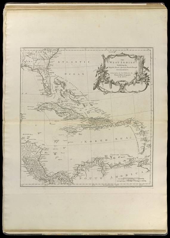
The West Indies exhibiting the English, French, Spanish, Dutch & Danish settlements

This map is also available in American Revolutionary Geographies Online (ARGO), a collections portal especially built for material relating to the American Revolutionary War Era. Visit ARGO to learn more about this item and explore the historical geography of North America in the late eighteenth century.
Item Information
- Title:
- The West Indies exhibiting the English, French, Spanish, Dutch & Danish settlements
- Publisher:
- Sayer, Robert, 1725-1794
- Cartographer:
- Jefferys, Thomas, -1771
- Name on Item:
-
collected from the best authorities, by Thomas Jefferys, geographer to the King
- Date:
-
[1768]
- Format:
-
Maps/Atlases
- Location:
-
Boston Public Library
Norman B. Leventhal Map & Education Center - Collection (local):
-
Norman B. Leventhal Map & Education Center Collection
- Subjects:
-
Caribbean Area--Maps--Early works to 1800
West Indies--Maps--Early works to 1800
Mexico--Maps--Early works to 1800
Central America--Maps--Early works to 1800
- Places:
-
Mexico
Mesoamerica (area)
Caribbean Sea
West Indies
- Extent:
- 1 map on 2 sheets ; 47 x 87 cm. on sheets 76 x 56 cm.
- Terms of Use:
-
No known copyright restrictions.
No known restrictions on use.
- Publisher:
-
[London] :
Published according to the act by R. Sayer ... & T. Jefferys
- Scale:
-
Scale [ca. 1:6,500,000]
- Language:
-
English
- Notes:
-
Shows southern United States, Mexico, Central America, northern South America, and West Indies.
Relief shown pictorially.
Prime meridians: London and Ferro.
Appears in Jefferys' General topography of North America and the West Indies. London: Printed for Robert Sayer, ... and Thomas Jefferys, 1768.
- Notes (date):
-
This date is inferred.
- Notes (citation):
-
LC Maps of North America, 1750-1789, 1689
Phillips, P. List of maps of America, p. 1056
- Identifier:
-
4000137_0082r
4000137_0083r
- Call #:
-
G1105 .J4 1768
- Barcode:
-
30000003255930


![[Mexico and Central America]](https://bpldcassets.blob.core.windows.net/derivatives/images/commonwealth:cj82m4685/image_thumbnail_300.jpg)