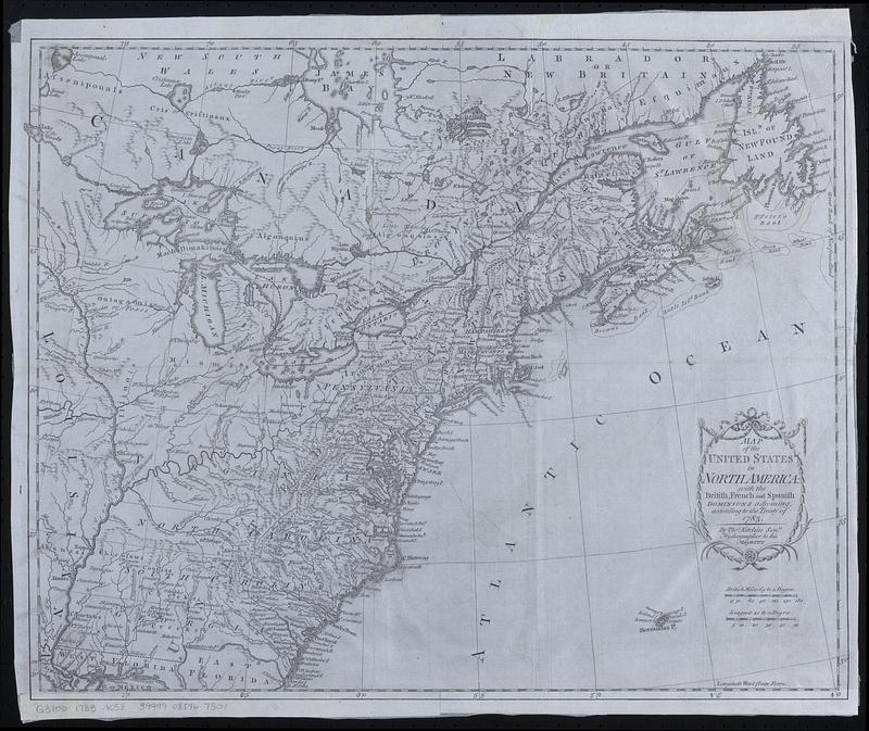
Map of the United States in North America : with the British, French and Spanish dominions adjoining, according to the treaty of 1783
This map is also available in American Revolutionary Geographies Online (ARGO), a collections portal especially built for material relating to the American Revolutionary War Era. Visit ARGO to learn more about this item and explore the historical geography of North America in the late eighteenth century.
Item Information
- Title:
- Map of the United States in North America : with the British, French and Spanish dominions adjoining, according to the treaty of 1783
- Cartographer:
- Kitchin, Thomas, 1719-1784
- Name on Item:
-
by Thos. Kitchin senr., hydrographer to His Majesty
- Date:
-
[1783?]
- Format:
-
Maps/Atlases
- Location:
-
Boston Public Library
Norman B. Leventhal Map & Education Center - Collection (local):
-
Norman B. Leventhal Map & Education Center Collection
- Subjects:
-
United States--Maps--Early works to 1800
East (U.S.)--Maps--Early works to 1800
Canada--Maps--Early works to 1800
- Places:
-
United States
- Extent:
- 1 map ; 40 x 50 cm
- Terms of Use:
-
No known copyright restrictions.
No known restrictions on use.
- Place of origin:
-
[London]
- Scale:
-
Scale approximately 1:6,500,000
- Language:
-
English
- Notes:
-
Relief shown pictorially.
Prime meridian: Ferro.
Decorative title cartouche.
Map of the United States extending to the Mississippi River, showing forts, Indian villages and fishing banks.
Later state without Cadell's imprint.
- Notes (citation):
-
McCorkle, B.B. New England in early printed maps, 1513 to 1800, 783.11
- Identifier:
-
06_01_018436
- Call #:
-
G3700 1783 .K58
- Barcode:
-
39999085967501


