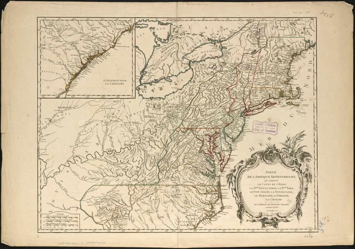
Partie de l'Amérique septentrionale, qui comprend le cours de l'Ohio, la Nlle. Angleterre, la Nlle York, le New Jersey, la Pensylvanie, le Maryland, la Virginie, la Caroline
This map is also available in American Revolutionary Geographies Online (ARGO), a collections portal especially built for material relating to the American Revolutionary War Era. Visit ARGO to learn more about this item and explore the historical geography of North America in the late eighteenth century.
Item Information
- Title:
- Partie de l'Amérique septentrionale, qui comprend le cours de l'Ohio, la Nlle. Angleterre, la Nlle York, le New Jersey, la Pensylvanie, le Maryland, la Virginie, la Caroline
- Creator:
- Robert de Vaugondy, Gilles, 1688-1766
- Name on Item:
-
par le Sr. Robert de Vaugondy ; M.C. Haussard, fecit.
- Date:
-
[1755]
- Format:
-
Maps/Atlases
- Location:
-
Boston Public Library
Norman B. Leventhal Map & Education Center - Collection (local):
-
Norman B. Leventhal Map & Education Center Collection
- Subjects:
-
United States--Maps--Early works to 1800
Ohio River Valley--Maps--Early works to 1800
- Places:
-
Ohio River
- Extent:
- 1 map : col. ; 48 x 62 cm.
- Terms of Use:
-
No known copyright restrictions.
No known restrictions on use.
- Publisher:
-
Paris :
s.n.
- Scale:
-
Scale ca. 1:3,000,000.
- Language:
-
French
- Notes:
-
Relief shown pictorially.
Hand colored.
Covers the area from the Great Lakes to South Carolina and from the Atlantic coast to the Mississippi River.
Shows provinces, counties, towns and cities, riviers, Indian villages and tribal territory, forts, numerous place-names, and relief.
Appears in the author's Atlas universal. 1757 [i.e. 1758].
Inste: "Supplément pour la Caroline."
- Notes (date):
-
This date is inferred.
- Identifier:
-
06_01_006251
- Call #:
-
G3700 1755 .R63
- Barcode:
-
39999059021715


