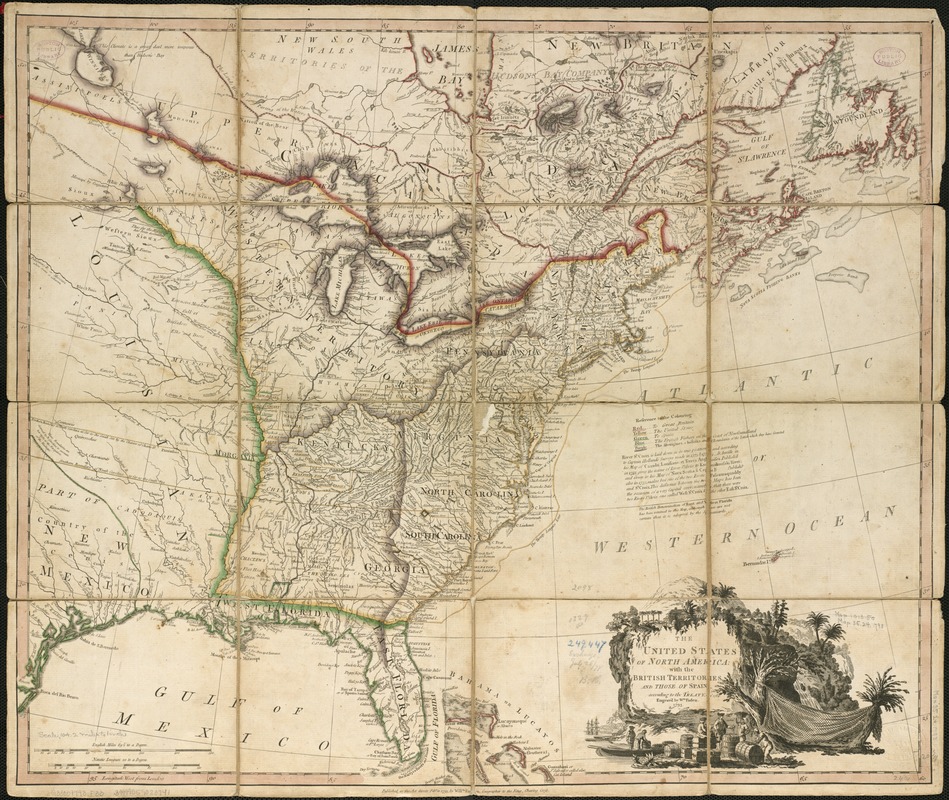
The United States of North America : with the British territories and those of Spain according to the treaty of 1784
This map is also available in American Revolutionary Geographies Online (ARGO), a collections portal especially built for material relating to the American Revolutionary War Era. Visit ARGO to learn more about this item and explore the historical geography of North America in the late eighteenth century.
Item Information
- Title:
- The United States of North America : with the British territories and those of Spain according to the treaty of 1784
- Creator:
- Faden, William, 1749-1836
- Name on Item:
-
engrav'd by Wm. Faden.
- Date:
-
1793
- Format:
-
Maps/Atlases
- Location:
-
Boston Public Library
Norman B. Leventhal Map & Education Center - Collection (local):
-
Norman B. Leventhal Map & Education Center Collection
- Subjects:
-
United States--Maps--Early works to 1800
Canada--Maps--Early works to 1800
Great Britain--Territories and possessions--Maps--Early works to 1800
Spain--Territories and possessions--Maps--Early works to 1800
- Places:
-
United States
Canada
- Extent:
- 1 map : col. ; 52 x 64 cm.
- Terms of Use:
-
No known copyright restrictions.
No known restrictions on use.
- Publisher:
-
[London] :
Willm. Faden
- Scale:
-
Scale [ca. 1:7,000,000].
- Language:
-
English
- Notes:
-
Relief shown pictorially.
Prime meridian: London.
Includes references to coloring, and texts about the River St. Croix and Florida.
Cataloging, conservation, and digitization made possible in part by The National Endowment for the Humanities: Exploring the human endeavor.
- Identifier:
-
06_01_006150
- Call #:
-
G3300 1793 .F33
- Barcode:
-
39999059020741


