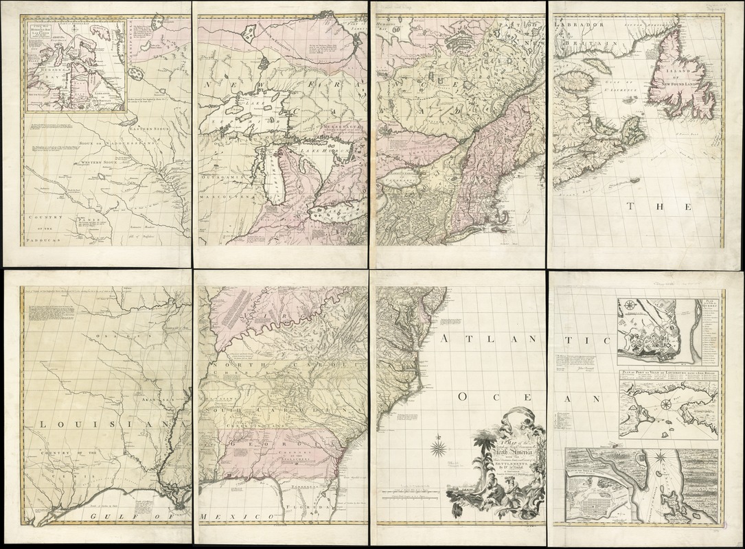
A map of the British and French dominions in North America, with the roads, distances, limits, and extent of the settlements
This map is also available in American Revolutionary Geographies Online (ARGO), a collections portal especially built for material relating to the American Revolutionary War Era. Visit ARGO to learn more about this item and explore the historical geography of North America in the late eighteenth century.
Item Information
- Title:
- A map of the British and French dominions in North America, with the roads, distances, limits, and extent of the settlements
- Creator:
- Mitchell, John, 1711-1768
- Name on Item:
-
by Dr. Jno. Mitchell at Amsterdam.
- Date:
-
[1755?]
- Format:
-
Maps/Atlases
- Location:
-
Boston Public Library
Norman B. Leventhal Map & Education Center - Collection (local):
-
Norman B. Leventhal Map & Education Center Collection
- Subjects:
-
North America--Maps--Early works to 1800
- Places:
-
North America (area)
- Extent:
- 1 map on 2 sheets : col. ; 135 x 190 cm., sheets 68 x 190 cm.
- Terms of Use:
-
No known copyright restrictions.
No known restrictions on use.
- Publisher:
-
Amsterdam :
Printed for I. Covens and C. Mortier
- Edition:
- First Dutch ed.
- Scale:
-
Scale [ca. 1:2,000,000].
- Language:
-
English
- Notes:
-
Relief shown pictorially.
First Dutch edition.
Includes text and ill.
Insets: Plan of the town of Halifax in Nova Scotia -- Plan du port et ville de Louisbourg dans l'Isle Royale -- Plan de la ville de Quebec -- A new map of Hudsons Bay and Labrador from the late surveys of those coasts.
Cataloging, conservation, and digitization made possible in part by The National Endowment for the Humanities: Exploring the human endeavor.
- Identifier:
-
06_01_006094
- Call #:
-
G3300 1755 .M574
- Barcode:
-
39999065649533
- LCCN:
-
96688050


