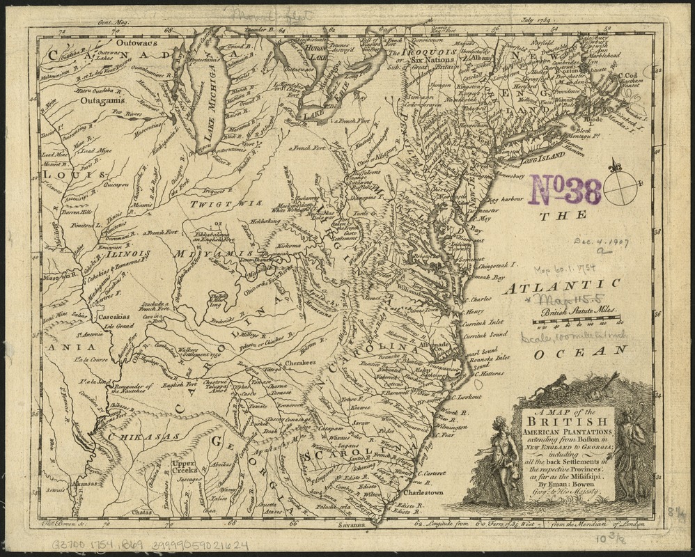
A Map of the British American plantations, extending from Boston in New England to Georgia : including all the back settlements in the respective provinces, as far as the Mississipi
This map is also available in American Revolutionary Geographies Online (ARGO), a collections portal especially built for material relating to the American Revolutionary War Era. Visit ARGO to learn more about this item and explore the historical geography of North America in the late eighteenth century.
Item Information
- Title:
- A Map of the British American plantations, extending from Boston in New England to Georgia : including all the back settlements in the respective provinces, as far as the Mississipi
- Creator:
- Bowen, Emanuel, d. 1767
- Name on Item:
-
by Eman. Bowen ; Tho. Bowen sc.
- Date:
-
[1754]
- Format:
-
Maps/Atlases
- Location:
-
Boston Public Library
Norman B. Leventhal Map & Education Center - Collection (local):
-
Norman B. Leventhal Map & Education Center Collection
- Subjects:
-
Great Britain--Colonies--America--Maps--Early works to 1800
United States--Maps--Early works to 1800
- Places:
-
United States
- Extent:
- 1 map ; 22 x 28 cm.
- Terms of Use:
-
No known copyright restrictions.
No known restrictions on use.
- Publisher:
-
London :
s.n.
- Scale:
-
Scale [1:6,350,000].
- Language:
-
English
- Notes:
-
Relief shown pictorially.
"Gent. Mag. July 1754."
Ferro and London meridians.
Eastern United States divided into provinces.
- Notes (date):
-
This date is inferred.
- Identifier:
-
06_01_006230
- Call #:
-
G3700 1754 .B69
- Barcode:
-
39999059021624


