Toggle navigation
LMEC Home
Exhibitions
Georeferencing
Tools for Teachers
Collections
My Favorites
Sign Up / Log In
Search
Search the map portal
Map Collection
Map Collection
Map Sets
Search
Search
Search for
Search In
All Fields
Creator
Title
Subject
Place
Search All Digital Collections
Advanced Search
345 Results
My Search
Start Over
More Like
commonwealth:q524mv18j
Remove constraint More Like: commonwealth:q524mv18j
Filter your Search
Place
North and Central America
246
United States
208
Canada
38
North America
38
New York
31
Suffolk (county)
31
Boston
29
Charleston (county)
10
more
Place
»
Topic
United States--Maps--Early works to 1800
60
North America--Maps--Early works to 1800
29
Boston (Mass.)--History--Revolution, 1775-1783--Maps--Early works to 1800
16
Canada--Maps--Early works to 1800
14
United States--History--Revolution, 1775-1783--Maps--Early works to 1800
12
Vues d'optique
10
Gibraltar--History--Siege, 1779-1783--Maps--Early works to 1800
9
New York (N.Y.)--Pictorial works--Early works to 1800
9
more
Topic
»
Date
Date range begin
–
Date range end
Current results range from
1707
to
1830
View distribution
Creator
Faden, William, 1749-1836
36
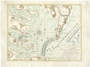
Jefferys, Thomas, -1771
30
Le Rouge, Georges-Louis
23
Des Barres, Joseph F. W. (Joseph Frederick Wallet), 1722-1824
21
Sayer, Robert, 1725-1794
20
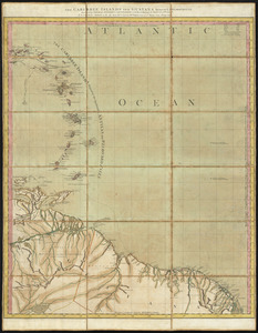
Korn, Christoph Heinrich, 1726-1783
11
Raspe, Gabriel Nicolaus, 1712-1785
11
Robert Sayer and John Bennett (Firm)
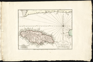
11
more
Creator
»
Format
Maps/Atlases
302
Prints
32
Manuscripts
23
Drawings/Illustrations
9
Books
2
Georeferenced
Yes
15
No
330
Collection
American Revolutionary War-Era Maps
334
Richard H. Brown Revolutionary War Map Collection at Mount Vernon
293
Norman B. Leventhal Map Center Collection
29
New York Public Library Collection
15
Boston and New England Maps
4
New-York Historical Society Collection
4
Mapping Boston Collection
2
Maritime Charts and Atlases
2
more
Collection
»
Available to use
Creative Commons license
312
No known restrictions
31
Search Constraints
Sort by relevance
relevance
title
date (asc)
date (desc)
Number of results to display per page
100 per page
10
per page
20
per page
50
per page
100
per page
View results as:
grid view
map view
Search Results
1.
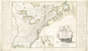
L'Amerique Septentrionale, ou se remarquent les Etats Unis
2.
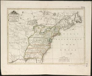
Carte du Canada et des Etats-Unis de l'Amérique Septentrionale
3.
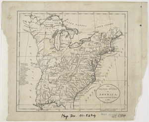
Carte generale des treize Etats Unis, de l'Amerique septentrionale = Kaart van de dertien Verénigde Staaten, in Noord Amerika
4.
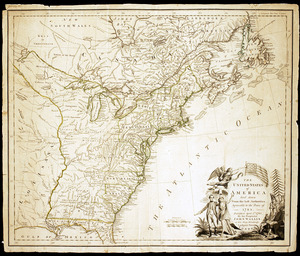
A general map of the middle British colonies, in America : viz Virginia, Màriland, Dèlaware, Pensilvania, New-Jersey,...
5.
A map of the United States of N. America
6.
Partie septentrionale des possessions angloise en Amérique : pour servire d'intelligence à la guerre présente entre les...
7.
The United States of America laid down from the best authorities, agreeable to the Peace of 1783
8.
The United States of America with the British possessions of Canada, Nova Scotia, & of Newfoundland, divided with the French :...
9.
An accurate map of the English colonies in North America, bordering on the river Ohio
10.
An accurate map of the United States of America : according to the Treaty of Peace of 1783
11.
An accurate map of the United States of America, with part of the surrounding provinces agreeable to the Treaty of Peace of 1783
12.
Amplissimae regionis Mississipi seu provinciae Ludovicianae â R.P. Ludovico Hennepin Francisc. Miss. in America septentrionali...
13.
Amplissimae regionis Mississipi seu Provinciae Ludovicianae â R.P. Ludovico Hennepin Francisc Miss in America Septentrionali...
14.
Bowles's new one-sheet map of the independent states of Virginia, Maryland, Delaware, Pensylvania, New Jersey, New York,...
15.
BOWLES'S NEW POCKET MAP OF THE UNITED STATES OF AMERICA : WITH THE BRITISH POSSESSIONS OF CANADA, NOVA SCOTIA, AND OF...
16.
British dominions in America, drawn from the latest and best authorities
17.
Carta della Nuova Inghilterra, Nuova Iork, e Pensilvania
18.
Carte de la Louisiane cours du Mississipi et pais voisins : dediée à M. le Comte de Maurepas, ministre et secretaire d'etat...
19.
Carte de la Louisiane et du cours de Mississipi
20.
Carte de la Louisiane et du cours du Mississipi avec les colonies anglaises
21.
Carte du Mexique et des Etats Unis d'Amérique, partie meridionale
22.
Carte du theatre de la guerre presente en Amerique
23.
Carte du theatre de la guerre presente en Amerique
24.
Carte d'une partie de l'Amérique Septentrionale pour servir à l'intelligence du mémoire sur les prétentions des Anglois au...
25.
Carte generale des colonies angloises dans l'Amerique Septentrionale pour l'intelligence de la guerre presente : d'apres des...
26.
Carte générale des Etats Unis de l'Amérique Septentrionale : renfermant aussi quelques provinces Angloises adjacentes
27.
Carte génerale des Etats-Unis de l'Amérique Septentrionale : divisée en ses 17 provinces
28.
Carte generale des treize Etats Unis, de l'Amerique septentrionale
29.
Carte minéralogique, où l'on voit la nature des terreins du Canada et de la Louisiane
30.
Carte nouvelle de l'Amérique Angloise contenant tout ce que les Anglois possédent sur le continent de l'Amérique...
31.
Carte réduite du nord des Etat-Unis avec l'intérieur du pays : pour servir à l'intelligence de cette histoire ; copieé par...
32.
Charte über die XIII Vereinigte Staaten von Nord-America
33.
A general map of the middle British colonies, in America : viz Virginia, Màriland, Dèlaware, Pensilvania, New-Jersey, New-York,...
34.
Map for the interior travels through America : delineating the march of the army
35.
A map of Canada and the north part of Louisiana with the adjacent countrys
36.
A map of Carolana and of the river Meschacebe &c
37.
A Map of the British American plantations, extending from Boston in New England to Georgia : including all the back settlements...
38.
A map of the British and French dominions in North America : with the roads, distances, limits, and extent of the settlements,...
39.
A map of the northern and middle states : comprehending the western territory & the British dominions in North America : from...
40.
Map of the United States exhibiting the post-roads, the situations, connections & distances of the post-offices, stage roads,...
41.
Map of the United States in North America : with the British, French and Spanish dominions adjoining, according to the treaty...
42.
A map of the United States of America, as settled by the peace of 1783
43.
A map of the United States of North America : drawn from a number of critical researches
44.
A new and correct map of North America : in which the places of the principal engagements during the present war are accurately...
45.
A new and correct map of North America : in which the places of the principal engagements during the present war are accurately...
46.
A new and correct map of North America with the West India Islands : divided according to the last treaty of peace, concluded...
47.
A new and correct map of North America, with the West India islands, divided according to the preliminary articles of peace,...
48.
A new map of North America
49.
A New map of North America with the West India Islands : divided according to the preliminary articles of peace, signed at...
50.
A new map of the United States of North America with the British dominions on that continent &c
51.
Partie de l'Amérique septentrionale, qui comprend le cours de l'Ohio, la Nlle. Angleterre, la Nlle York, le New Jersey, la...
52.
States of America, drawn from the best authorities
53.
The United States of America, according to the Treaty of Peace of 1784
54.
The United States of America laid down from the best authorities, agreeable to the Peace of 1783
55.
The United States of America with the British possessions of Canada, Nova Scotia, & of Newfoundland, divided with the French :...
56.
The United States of America with the British possessions of Canada, Nova Scotia, New Brunswick and Newfoundland divided with...
57.
The United States of North America : with the British & Spanish territories according to the treaty
58.
The United States of North America : with the British territories and those of Spain according to the treaty of 1784
59.
The United States of North America, with the British & Spanish territories according to the treaty
60.
The United States of North America, with the British & Spanish territories according to the treaty
61.
[A map of part of Pennsylvania & Maryland intended to shew, at one view, the several places proposed for opening a...
62.
Abriss der stadt Gibraltar und der darinn befindlichen festen platze, nebst dem meerbusen von Algesiras
63.
An accurate map of His Majesty's province of New-Hampshire in New England : taken from actual surveys of all the inhabited...
64.
An accurate map of Staten Island : with that part of New York, Long Island and the Jerseys, which is the rendesvous of the two...
65.
An accurate map of the country round Boston in New England from the best authorities
66.
Action at Spencer's ordinary : June 26th. 1781
67.
Affair at Quintin's Bridge : 18th March 1778
68.
Allgemeine charte von Nord America als den sitz des krieges zwischen den Konigl. Engl. truppen u:den provinzialen
69.
Ambuscade of the Indians at Kingsbridge : August 31st. 1778
70.
L'Amerique divisée en septentrionale et méridionale, subdivisée en ses principales parties, dressée sur les relations les...
71.
L'Amerique divisée en ses principaux États
72.
L'Amerique Septentrionale
73.
Amérique septentrionale avec les routes, distances en miles, limites et etablissements françois et anglois
74.
Amerique Septentrionale divisée en ses principales parties, ou sont distingués les vns des autres les estats suivant qu'il...
75.
Amérique Septentrionale dressée sur les relations les plus modernes des voyageurs et navigateurs, ou se remarquent les Etats...
76.
Antigue : levée par Robert Baker, Arpenteur General de l'Isle ; traduit de l'Anglais
77.
The attack and defeat of the American fleet under Benedict Arnold, by the King's fleet commanded by Capt. Thos. Pringle, upon...
78.
Attack of the rebels upon Fort Penobscot in the province of New England in which their fleet was totally destroyed and their...
79.
Attaque de l'armée des provinciaux dans Long Island du 27. Aoust 1776 : dessin de l'isle de New-York et des Etats
80.
La Barbade
81.
Barre et port de Charles-Town levé en 1776 : avec les attaques du Fort Sulivan du 28 juin 1776 par l'escadre anglaise...
82.
Battle of Brandywine in which the rebels were defeated, September the 11th. 1777, by the army under the command of General Sr....
83.
Baye de Chesapeake en 4 feuilles avec les bas fonds, passes, entrées, sondes et routes ou l'on donne les parties navigables...
84.
Baye et port de Boston
85.
Bequia ou Becouya, le plus septentrionale des Granadilles : levé en 1763
86.
[Boston Neck, with the British lines and John Hancock's house]
87.
Bowles's new and accurate map of Europe, divided into it's [sic] empires, kingdoms, states, republicks and principalities :...
88.
Bowles's new and accurate map of North America and the West Indies : exhibiting the extent and boundaries of the United States,...
89.
British camp at Trudruffrin from the 18th. to the 21st. of September 1777 : with the attack made by Major General Grey against...
90.
[Cambridge with Washington's headquarters]
91.
The Caribbee Islands and Guayana
92.
Carte de la partie de la Virginie ou l'armée combinée de France & des États-Unis de l'Amérique a fait prisonnière l'armée...
93.
Carte de l'affaire de Montmouth, ou le Général Washington commandon l'armée Americaine, et le Général Clinton l'armée...
94.
Carte de l'Amérique Septle. pour servir à l'intelligence de la guerre entre les Anglois et les insurgents
95.
Carte de l'isle d'Antigoa une de Isles Antilles
96.
Carte de l'isle de la Jamaique
97.
Carte des environs du Fort Pitt et de la nouvelle province Indiana : dediée a M. Franklin
98.
Carte des Etats-Unis d'Amérique, et du cours du Mississippi : rédigée d'après différentes cartes et relations Anglaises et...
99.
Carte des Etats-Unis de l'Amerique suivant le Traité de Paix de 1783
100.
Carte des possessions angloises dans l'Amerique Septentrionale pour servir d'intelligence à la guerre presente traduite de...
‹ Prev
Next ›
1
2
3
4


![[A map of part of Pennsylvania & Maryland intended to shew, at one view, the several places proposed for opening a communication between the waters of the Delaware & Chesopeak Bays]](https://bpldcassets.blob.core.windows.net/derivatives/images/commonwealth:z603vt12v/image_thumbnail_300.jpg)


![[Boston Neck, with the British lines and John Hancock's house]](https://bpldcassets.blob.core.windows.net/derivatives/images/commonwealth:dz010v61c/image_thumbnail_300.jpg)
![Bowles's new and accurate map of Europe, divided into it's [sic] empires, kingdoms, states, republicks and principalities](https://bpldcassets.blob.core.windows.net/derivatives/images/commonwealth:q524mt678/image_thumbnail_300.jpg)

![[Cambridge with Washington's headquarters]](https://bpldcassets.blob.core.windows.net/derivatives/images/commonwealth:dz010v63x/image_thumbnail_300.jpg)