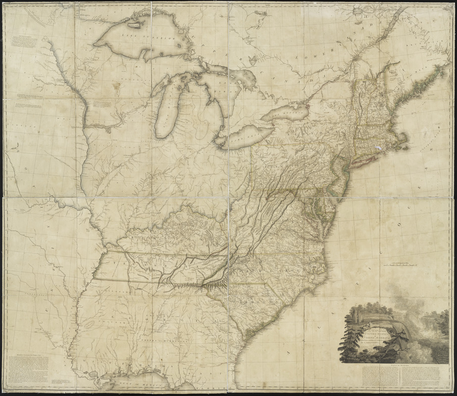
A map of the United States of North America : drawn from a number of critical researches
This map is also available in American Revolutionary Geographies Online (ARGO), a collections portal especially built for material relating to the American Revolutionary War Era. Visit ARGO to learn more about this item and explore the historical geography of North America in the late eighteenth century.
Item Information
- Title:
- A map of the United States of North America : drawn from a number of critical researches
- Creator:
- Arrowsmith, Aaron, 1750-1823
- Name on Item:
-
by A. Arrowsmith.
- Date:
-
1796
- Format:
-
Maps/Atlases
- Location:
- New York Public Library
- Collection (local):
-
Maps of North America
- Subjects:
-
United States--Maps--Early works to 1800
Alabama--History--To 1819--Maps
Mississippi--History--To 1803--Maps
- Places:
-
- Extent:
- 1 map : hand col. ; 123 x 141 cm.
- Terms of Use:
-
No known copyright restrictions.
This work is licensed for use under a Creative Commons Attribution Non-Commercial Share Alike License (CC BY-NC-SA).

- Publisher:
-
London :
Published ... by Arrowsmith, Charles Street, No. 10 Soho Square
- Scale:
-
Scale [ca. 1:1,750,000]
- Language:
-
English
- Catalog Record:
-
https://digitalcollections.nypl.org/items/510d47da-efa4-a3d9-e040-e00a18064a99
- Notes:
-
Relief shown pictorially.
"As the Act directs."
Library's copy is incomplete, only covering the area from Galveston Bay to the eastern boundary of Tennessee and from the northern boundary of Kentucky to northern Florida.


