Toggle navigation
LMEC Home
Exhibitions
Georeferencing
Tools for Teachers
Collections
My Favorites
Sign Up / Log In
Search
Search the map portal
Map Collection
Map Collection
Map Sets
Search
Search
Search for
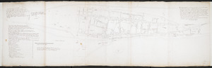
Search In
All Fields
Creator
Title
Subject
Place
Search All Digital Collections
Advanced Search
390 Results
My Search
Start Over
More Like
commonwealth:hx11z600p
Remove constraint More Like: commonwealth:hx11z600p
Filter your Search
Place
North and Central America
349
United States
229
Canada
105
Essex (county)
24
Louisbourg
22
Saint Lawrence River
19
Charleston (county)
17
Suffolk (county)
17
more
Place
»
Topic
United States--History--French and Indian War, 1754-1763--Maps, Manuscript--Early works to 1800
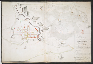
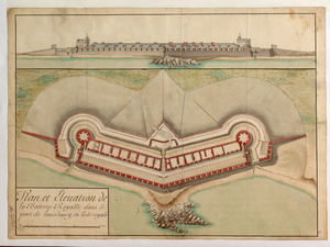
58
Louisbourg (N.S.)--Maps, Manuscript--Early works to 1800
18
Fort Edward (N.Y.)--Maps, Manuscript--Early works to 1800
16
Fort Ticonderoga (N.Y.)--Maps, Manuscript--Early works to 1800
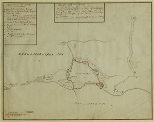
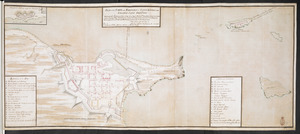
15
Saint Lawrence River--Maps, Manuscript--Early works to 1800
15
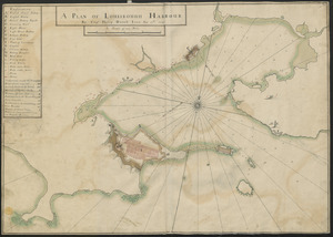
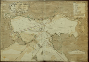
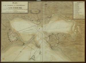
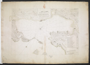
Louisbourg (N.S.)--History--Siege, 1745--Maps, Manuscript--Early works to 1800
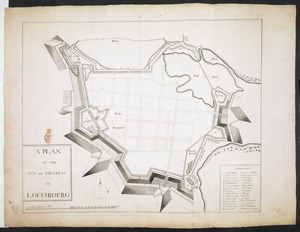
14
Fortification--New York (State)--Fort Edward--Maps, Manuscript--Early works to 1800
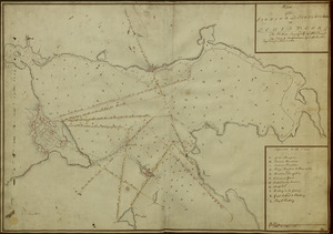
13
Fortification--New York (State)--Maps, Manuscript--Early works to 1800
13
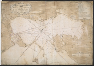
more
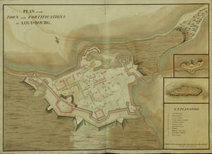
Topic
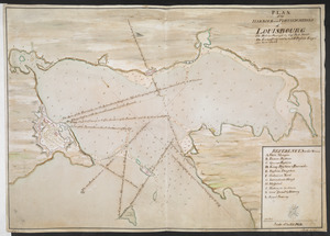
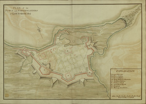
»
Date
Date range begin
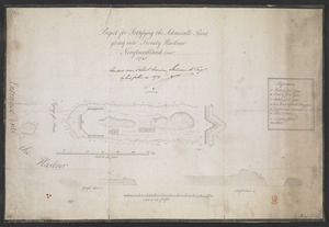
–
Date range end
Current results range from
1664
to
1816
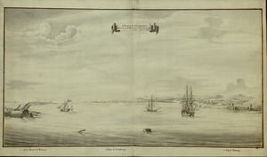
View distribution
Creator
Royal United Services Institute for Defence and Security Studies
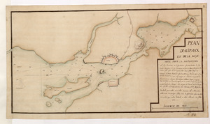
160
George, III, King of Great Britain, 1738-1820
151
George, IV, King of Great Britain, 1762-1830
150
Amherst, Jeffery Amherst, Baron, 1717-1797
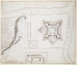
128
Skinner, Monier
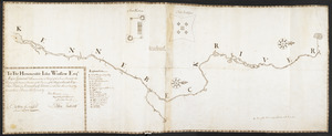
28
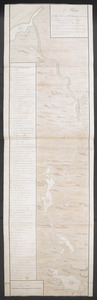
Skinner, William, 1700-1780
28
Brasier, William
16
Bastide, John Henry, approximately 1700-1770
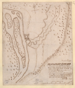
15
more
Creator
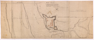
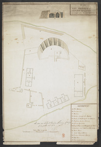
»
Format
Maps/Atlases
373
Manuscripts
151
Drawings/Illustrations
15
Georeferenced
Yes
7
No
383
Collection
British Library Collection
376
American Revolutionary War-Era Maps
363
Boston and New England Maps
22
Norman B. Leventhal Map Center Collection
10
Maritime Charts and Atlases
7
Urban Maps
4
Harvard Map Collection
2
Library of Congress Collection
1
more
Collection
»
Available to use
Creative Commons license
380
No known restrictions
10
Search Constraints
Sort by date (asc)
relevance
title
date (asc)
date (desc)
Number of results to display per page
100 per page
10
per page
20
per page
50
per page
100
per page
View results as:
grid view
map view
Search Results
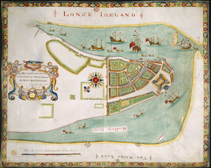
1.
A DESCRIPTION OF THE TOWNE OF MANNADOS OR NEW AMSTERDAM as it was in September 1661 lying in Latitude 40 de: and 40,: Anno...
2.
A chart of the province of New England, with the soundings on the coast; drawn about 1670, on a scale of 1 2/3 English league...
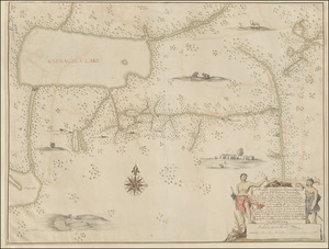
3.
[A map of the east coast of America from Newfoundland to the Bay of Honduras]
4.
A= draught of Boston Harbor
5.
A Mappe of Colonel Römers Voyage to ye: 5 Indian nations going from New Yorck to Albany thence west to ye 3 Macquas Castle and...
6.
A new Mappe of a part of Hutsons or the North River, Rareton River which have there aiet lett in to the Sea by Sandy hoocke,...
7.
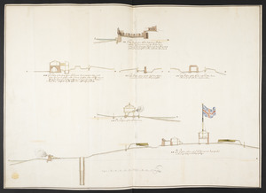
Fort William & Mary on Piscataqua River in the Province of New Hampshire on the Continent of America
8.
[Fort William and Mary on Piscataqua River]
9.
The Icqnographical draft of Castle Island where upon is built Her Maj.ties Castle and by Her Maj.ties Special Command named...
10.
The Profil belonging to the Iconographycal Draft of the Fort William & Mary on Piscataqua River in America
11.
The Respective Profiles belonging to the great Iconografical Draughts of Castle Island in the Bay of Boston
12.
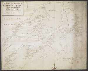
A CHART of the COAST OF NEWFOUND-LAND NEW SCOTLAND NEW ENGLAND &c. 1711
13.
An Exact Draught of Bostone harbour, with a Survey of most of the Islands about it
14.
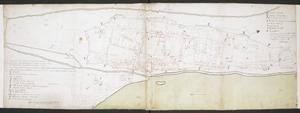
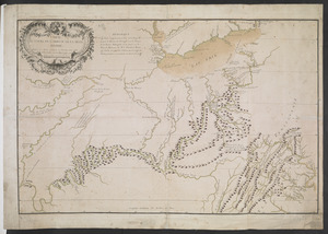
[Map showing the boundary line between the provinces of Massachusetts Bay and Connecticut by Woodward and Saffery in 1642 and...
15.
Plan de la ville de Montreal en Canada levé en l'annee 1713
16.
This discription and [?] of the South Line of the Massachusetts Province which divides between the said Province and the Colony...
17.
Plan de la ville de Montreal en Canada levé en l'année 1713 et enceinte a Este rectifiée
18.
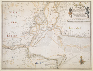
[A map of part of New York, comprehending the country between New York and Quebec, the river Connecticut, &c., to shew "the way...
19.
[A map of part of New York, comprehending the country between New York and Quebec, the river Connecticut, &c., to shew "the way...
20.
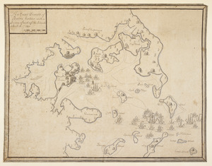
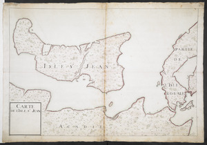
CARTE DE L'ISLE ST JEAN
21.
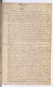
Explanation of the Plans
22.
Plan du fort de Chouéghen de la Riviere Et de terrain aux Environs au Sud du Lac Ontario
23.
Plan No: 1 : [Eastern New Hampshire and Massachusetts]
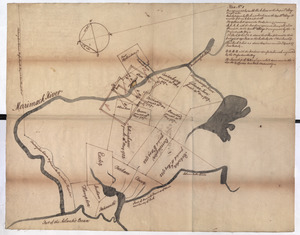
24.
Plan No: 2 : [Eastern New Hampshire and Massachusetts]
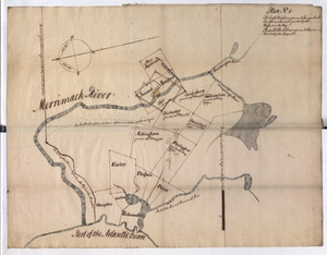
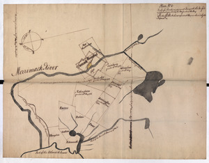
25.
Plan No: 2 : [Eastern New Hampshire and Massachusetts]
26.
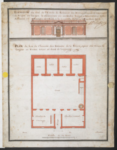
PLAN du Rex de Chausee des Batiments de la Prison, ayant dix Toises de largeur et Treize toises et demi de longeur
27.
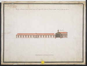
Façade, Elevation, Coupe et Profil, pris sur la ligne a.b. du plan de l'hopital projetté a Faire a la Nouvelle Orleans
28.
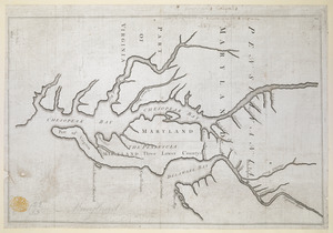
Proposed Maryland / Pennsylvania Boundary
29.
A Copy of the Plan returned by his Maj:tys Com:rs for setling the Boundarys between the Provinces of New Hampshire and the...
30.
A new mapp of Carolina
31.
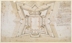
1.r Plan du fort proposé dans l'Ille de S.t Simon pour la deffence de l'Entree du Havre de Jenkins Sownd
32.
1.r Plan du fort proposé dans l'Ille de S.t Simon pour la deffence de l'Entree du Havre de Jenkins Sownd
33.
2.e Plan d'une Batterie & d'une Redoute avec un Corps de Garde construit en forme de Redoute a Machecoulis pour y Servir de...
34.
[A sketch map of the proposed battery (?) on Jekyll Island (?)]
35.
[Map and profiles of proposed (?) fortifications on Jekyll Island (?)]
36.
[Map of Saint Simons and Jekyll Islands with fortifications]
37.
[Map of the proposed fort and adjacent redoubt on Saint Simons Island]
38.
Plan dun Fort convenable en quelque endroit ce que soit dune Cote maritime Auquel on a changé la figure reguliere du 1.r...
39.
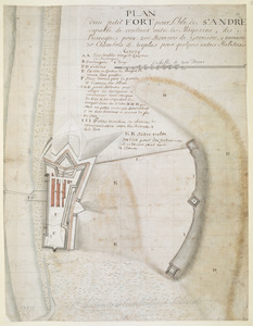
PLAN dun petit FORT pour l'Isle de S.t ANDRE capable de contenir outre les Magazins, des Barraques pour 200 Hommes de Garrison,...
40.
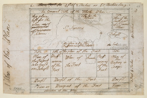
A Plan of the Plan
41.
A SMALL MAP of the SEA COAST of NEW ENGLAND Together with the out Lines of Several of the Provinces Lying theron. 1738
42.
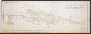
Carte du Lac Champlain depuis le Fort de Chambly Jusques au desus du Fort S.t Frederic, dans la Nouvelle France
43.
[Map of Saint Simons and Jekyll Islands]
44.
A New Plan of ye Great Town of BOSTON in New England in AMERICA with the many Additionall Buildings & New Streets to the Year,...
45.
A PLAN of the Rivers and Boundary Lines referr'd to in ye Proceedings & Judgment of ye Commissioners for adjusting the Bounds...
46.
[A manuscript map of Isle Royalle]
47.
[Acadie, Isle Saint Jean and part of Isle Royale with the Baye Francoise]
48.
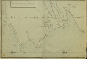
A CHART of the South East Part of l'Isle Royal, or Cape Bretton taken from the best Surveys, and the Observations of the most...
49.
[Entrance to the Harbour of S.t Johns Newfoundland]
50.
A Map of the Sea Coasts of NEW ENGLAND According to the actual Survey made thereof BY CAP.T CYPRIAN SOUTHACK As also the...
51.
Plans des isles, rades, et ports de plusieurs lieux de l'Amérique : tirés de la Carte angloise de Mr. Popple publiée en 1733...
52.
A Map Of the River MERRIMACK from the Atlantick Ocean to Pantuckett Falls describing bounds between His Maj:tys Province of New...
53.
Superficial Sketch of an advantagious Fortification for LOUISBOURG
54.
[Map of the coast of Florida from Fort William to Musketae River] [north sheet]
55.
[Map of the coast of Florida from Fort William to Musketae River] [south sheet]
56.
A new plan of ye great town of Boston in New England in America with the many additionall buildings & new streets to the year 1743
57.
A Survey of the Coast from FORT WILLIAM near S.t Iuans River to Mosquito River
58.
Plan of Part of Black River & Part of Otter Creek with the Distances by Computation
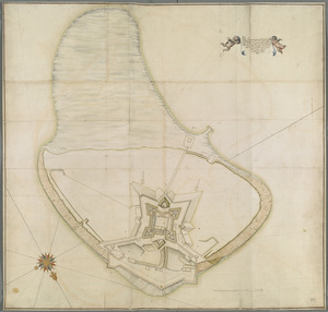
59.
[An outline plan of the harbour and fortifications of Louisbourg]
60.
[Map showing Saint John's Harbour and a proposed fort]
61.
PLAN of FORT FREDERICK at NEWFOUND-LAND as it is now with the new Additions
62.
A PLAN OF LOUISBOUGH HARBOUR
63.
A PLAN OF THE CITY and FORTRESS OF LOUISBOURG
64.
Plan of the City and Fortress of LOUISBOURG Surrendered to his Britanick Majesty by Capitulation the 17 June 1745. to Lieut....
65.
A PLAN OF THE HARBOUR AND FORTIFICATIONS OF LOUISBOURG
66.
A PLAN OF THE HARBOUR AND FORTIFICATIONS OF LOUISBOURG
67.
Plan of the HARBOUR and FORTIFICATIONS OF LOUISBOURG
68.
A PLAN OF THE HARBOUR AND FORTIFICATIONS OF LOUISBOURG : The Harbour Survey'd by Cap.t Phi; Durrell The Fortifications by Cap.t...
69.
PLAN of the HARBOUR and FORTIFICATIONS of LOUISBOURG : The Harbour Survey'd by Capt Phill Durell the Town & Fortifications by...
70.
PLAN of the TOWN and FORTIFICATIONS of LOUISBOURG
71.
PLAN of the TOWN and FORTIFICATIONS of LOUISBOURG
72.
PLAN of the TOWN and FORTRESS of LOUISBOURG on the ISLAND CAPE BRETON : Surrender'd ye 16th June 1745 after a Seige of 12 days...
73.
Project for Fortifying the Admiralls Point going into Trinity Harbour Newfoundland Octob.r 1745
74.
Particular draughts and plans of some of the principal towns and harbours belonging to the English, French, and Spaniards, in...
75.
A PLAN & SURVEY of the Town and Harbour of LOUISBOURG : the harbour by Cap Darell & the Town & Batteries by Cap Bastide Engineer
76.
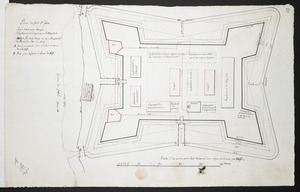
Plan du fort S.t Jean
77.
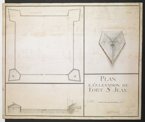
PLAN E L'ELEVATION DU FORT S.T JEAN
78.
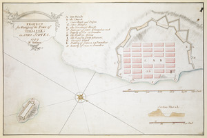
PROJECT for Fortifying the Town of HALLIFAX ; in NOVA SCOTIA
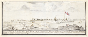
79.
A Prospect of LOUISBOURG taken from ye NE Harbour
80.
A Map of the Country Adjacent to the North Boundary Line of of the Colony of Rhode Island as the same was Run by Commissioners...
81.
[Map showing the location of Fort de la Presentation]
82.
PLAN D'ALIPHAX ET DE LA BAYE
83.
PLAN DE L'INTENDANCE DE QUE'BEC : Cette Maison Sert aussi de Palais; Elle est Située hors de la Ville, dans le Faubourg de...
84.
PLAN of the HARBOUR and Rivers of PORT LE JOYE in the Island of S.t Iohn
85.
[Map showing neck of land between 'Baye francaise' and 'Baye verte']
86.
Plan et Elevation de la Batterie Royalle, dans le port de louisbourg, en l'isle royale
87.
MAP of the Western parts of the COLONY of VIRGINIA, as far as the Mississipi
88.
A PLAN of FORT De Quesne
89.
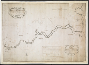
A Plan Of the River of Chibenaccadie from its Source To its Discharge into the Bay of Mines Surveyed in August 1754 : The...
90.
To The Honourable Iohn Winslow Esqr. Major General & Commander in Chief of the Forces Raisd for the Defence of the Eastern...
91.
CARTE DU COURS DE L'OHIO OU DE LA BELLE RIVIERE : Depuis sa Source jusqu'a sa Jonction avec celle d'Ouabache, avec les pays les...
92.
Charles-town, capitale de la Caroline
93.
[Chart of the Saint Lawrence River from Anticosti to Quebec]
94.
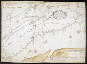
A CHART OF THE SEA COASTS OF THE PENINSULA OF NOVA SCOTIA
95.
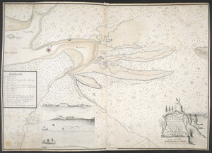
A DRAUGHT of the ISTHMUS which joyns Nova Scotia to the Continent with the Situation of the ENGLISH and FRENCH FORTS & the...
96.
Fort Edward
97.
[Map showing Fort William Henry, Fort Carillon, Fort St Frederic, and the upper reaches of the Connecticut River]
98.
A PLAN of FORT CUMBERLAND on Will's CREEK & POTOMACK River with a View of the Store Houses belonging to the OHIO COMPANY on the...
99.
PLAN of FORT EDWARD
100.
PLAN of Fort Edward
‹ Prev
Next ›
1
2
3
4

![[A map of the east coast of America from Newfoundland to the Bay of Honduras]](https://bpldcassets.blob.core.windows.net/derivatives/images/commonwealth:hx11z584h/image_thumbnail_300.jpg)

![[Fort William and Mary on Piscataqua River]](https://bpldcassets.blob.core.windows.net/derivatives/images/commonwealth:6108vv71t/image_thumbnail_300.jpg)
![[Map showing the boundary line between the provinces of Massachusetts Bay and Connecticut by Woodward and Saffery in 1642 and as run in 1713]](https://bpldcassets.blob.core.windows.net/derivatives/images/commonwealth:hx11z5641/image_thumbnail_300.jpg)
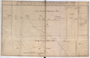
![This discription and [?] of the South Line of the Massachusetts Province which divides between the said Province and the Colony of Connecticut was made and Taken the Twenty Sixth day of October 1713 In Presence of Col. Samuel Partridge, Col. John Pynchon and [?] William Dudley Commissioners for the Massachusetts, and William Pithkin and William Whiting Esqrs for Connecticut wherein is discribed and Set down the Sain Line from Woodward and Saffery Station [?] to Connecticut River with the Several Towns farms and grants adjacent and Lying near the Same](https://bpldcassets.blob.core.windows.net/derivatives/images/commonwealth:hx11z566k/image_thumbnail_300.jpg)
![[A map of part of New York, comprehending the country between New York and Quebec, the river Connecticut, &c., to shew "the way from Albany to Canada ..... part by land and part by water;" drawn about 1720, on a scale of 31 miles to an inch]](https://bpldcassets.blob.core.windows.net/derivatives/images/commonwealth:6108vw070/image_thumbnail_300.jpg)
![[A map of part of New York, comprehending the country between New York and Quebec, the river Connecticut, &c., to shew "the way from Albany to Canada ..... part by land and part by water;" drawn about 1720, on a scale of 31 miles to an inch]](https://bpldcassets.blob.core.windows.net/derivatives/images/commonwealth:6108vw09j/image_thumbnail_300.jpg)


![[A sketch map of the proposed battery (?) on Jekyll Island (?)]](https://bpldcassets.blob.core.windows.net/derivatives/images/commonwealth:hx11z460q/image_thumbnail_300.jpg)
![[Map and profiles of proposed (?) fortifications on Jekyll Island (?)]](https://bpldcassets.blob.core.windows.net/derivatives/images/commonwealth:hx11z458p/image_thumbnail_300.jpg)
![[Map of Saint Simons and Jekyll Islands with fortifications]](https://bpldcassets.blob.core.windows.net/derivatives/images/commonwealth:hx11z4564/image_thumbnail_300.jpg)
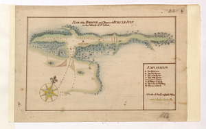
![[Map of the proposed fort and adjacent redoubt on Saint Simons Island]](https://bpldcassets.blob.core.windows.net/derivatives/images/commonwealth:hx11z468x/image_thumbnail_300.jpg)

![[Map of Saint Simons and Jekyll Islands]](https://bpldcassets.blob.core.windows.net/derivatives/images/commonwealth:hx11z454k/image_thumbnail_300.jpg)


![[A manuscript map of Isle Royalle]](https://bpldcassets.blob.core.windows.net/derivatives/images/commonwealth:hx11z507d/image_thumbnail_300.jpg)
![[Acadie, Isle Saint Jean and part of Isle Royale with the Baye Francoise]](https://bpldcassets.blob.core.windows.net/derivatives/images/commonwealth:hx11z490f/image_thumbnail_300.jpg)
![[Entrance to the Harbour of S.t Johns Newfoundland]](https://bpldcassets.blob.core.windows.net/derivatives/images/commonwealth:6108vv35z/image_thumbnail_300.jpg)


![[Map of the coast of Florida from Fort William to Musketae River] [north sheet]](https://bpldcassets.blob.core.windows.net/derivatives/images/commonwealth:hx11z4742/image_thumbnail_300.jpg)
![[Map of the coast of Florida from Fort William to Musketae River] [south sheet]](https://bpldcassets.blob.core.windows.net/derivatives/images/commonwealth:hx11z476m/image_thumbnail_300.jpg)

![[An outline plan of the harbour and fortifications of Louisbourg]](https://bpldcassets.blob.core.windows.net/derivatives/images/commonwealth:hx11z5128/image_thumbnail_300.jpg)
![[Map showing Saint John's Harbour and a proposed fort]](https://bpldcassets.blob.core.windows.net/derivatives/images/commonwealth:6108vw12v/image_thumbnail_300.jpg)

![[Map showing the location of Fort de la Presentation]](https://bpldcassets.blob.core.windows.net/derivatives/images/commonwealth:hx11z0993/image_thumbnail_300.jpg)

![[Map showing neck of land between 'Baye francaise' and 'Baye verte']](https://bpldcassets.blob.core.windows.net/derivatives/images/commonwealth:hx11z035j/image_thumbnail_300.jpg)


![[Chart of the Saint Lawrence River from Anticosti to Quebec]](https://bpldcassets.blob.core.windows.net/derivatives/images/commonwealth:hx11z079m/image_thumbnail_300.jpg)

![[Map showing Fort William Henry, Fort Carillon, Fort St Frederic, and the upper reaches of the Connecticut River]](https://bpldcassets.blob.core.windows.net/derivatives/images/commonwealth:hx11z1735/image_thumbnail_300.jpg)