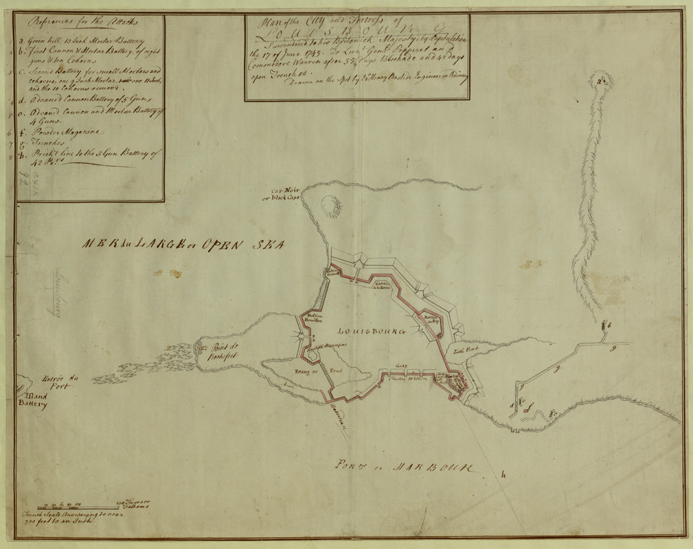
Plan of the City and Fortress of LOUISBOURG Surrendered to his Britanick Majesty by Capitulation the 17 June 1745. to Lieut. Genl. Pepperel and Commodore Warren after 55 Days Blockade and 42 days open Trenches
This map is also available in American Revolutionary Geographies Online (ARGO), a collections portal especially built for material relating to the American Revolutionary War Era. Visit ARGO to learn more about this item and explore the historical geography of North America in the late eighteenth century.
Item Information
- Title:
- Plan of the City and Fortress of LOUISBOURG Surrendered to his Britanick Majesty by Capitulation the 17 June 1745. to Lieut. Genl. Pepperel and Commodore Warren after 55 Days Blockade and 42 days open Trenches
- Cartographer:
- Bastide, John Henry, approximately 1700-1770
- Former owner:
- George, III, King of Great Britain, 1738-1820
- Donor:
- George, IV, King of Great Britain, 1762-1830
- Contributor:
- Pepperrell, William, Sir, 1696-1759
- Contributor:
- Warren, Peter, Sir, 1703-1752
- Name on Item:
-
Drawn on the spot by J°n. Henry Bastide Engineer in Ordinary.
- Date:
-
1745
- Format:
-
Maps/Atlases
Manuscripts
- Location:
- British Library
- Collection (local):
-
British Library Collection
- Subjects:
-
Louisbourg (N.S.)--History--Siege, 1745--Maps, Manuscript--Early works to 1800
Louisbourg (N.S.)--Maps, Manuscript--Early works to 1800
- Places:
-
CanadaLouisbourg
- Extent:
- 1 map : manuscript pen and ink ; 44 x 56 cm
- Terms of Use:
-
No known copyright restrictions.
This work is licensed for use under a Creative Commons Attribution Non-Commercial Share Alike License (CC BY-NC-SA).

- Scale:
-
Scale approximately 1:5,800
- Language:
-
English
- Catalog Record:
-
http://explore.bl.uk/BLVU1:LSCOP-ALL:BLL01004987919
- Notes:
-
Relief is shown pictorially on the map.
"References for the Attacks" appear as a lettered key (a-h) and upper left.
The scale appears in a surround at lower left where 2 5/8 inch is equal to 200 toises or Fathoms. A note adds "French scale Answering to near 500 feet to an Inch".
Shows batteries, trenches and magazines.
Titled 'A drawn plan of the City and Fortress of Louisbourg, by I. H. Bastide, Engr.' in the Catalogue of Maps, Prints, Drawings, etc., forming the geographical and topographical collection attached to the Library of his late Majesty King George the third, etc., London, 1829.
Titled 'A plan of the city and fortress of Louisbourg, "surrendered to H.B.M. by capitulation, the 17th June, 1745; to Lt.-Gen. Pepperel and Commodore Warren, after 55 days' blockade and 42 days open trenches; drawn on the spot by John Henry Bastide, engineer in ordinary," on a scale of 80 toises to an inch: 1 f. 10 in. x 1 f. 5 in.' in the Catalogue of the manuscript maps, charts, and plans , and of the topographical drawings in the British Museum.

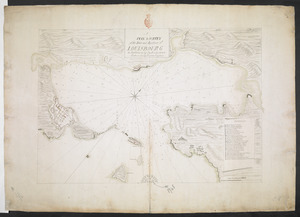
![[An outline plan of the harbour and fortifications of Louisbourg]](https://bpldcassets.blob.core.windows.net/derivatives/images/commonwealth:hx11z5128/image_thumbnail_300.jpg)
 IIIF Manifest