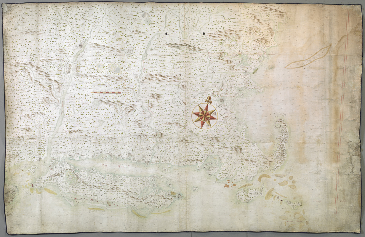
A chart of the province of New England, with the soundings on the coast; drawn about 1670, on a scale of 1 2/3 English league to an inch
This map is also available in American Revolutionary Geographies Online (ARGO), a collections portal especially built for material relating to the American Revolutionary War Era. Visit ARGO to learn more about this item and explore the historical geography of North America in the late eighteenth century.
Item Information
- Title:
- A chart of the province of New England, with the soundings on the coast; drawn about 1670, on a scale of 1 2/3 English league to an inch
- Title (alt.):
-
A map of New England from Sandy Point in the south to the Saco River in the north
New England and part of New York, including Long Island
- Cartographer:
- Scott, John 1632-1704
- Former owner:
- Sloane, Hans, Sir, 1660-1753
- Date:
-
[ca. 1670]
- Format:
-
Maps/Atlases
- Location:
- British Library
- Collection (local):
-
British Library Collection
- Subjects:
-
New England--Maps--Early works to 1800
- Places:
-
New England (area)
- Extent:
- 1 map : manuscript pen and ink with watercolour ; 113 x 173 cm
- Terms of Use:
-
No known copyright restrictions.
This work is licensed for use under a Creative Commons Attribution Non-Commercial Share Alike License (CC BY-NC-SA).

- Scale:
-
Scale approximately 1:11,000,000
- Language:
-
English
- Catalog Record:
-
http://explore.bl.uk/BLVU1:LSCOP-ALL:BLL01004987792
- Notes:
-
Towns and terrain shown pictorially.
Shows plantations.
- Notes (citation):
-
Allen, D. Long Island maps and their makers, 13-16
Mowrer, L. The indomitable John Scott, 101
Barstow, B. Setauket, alias Brookhaven, 137


