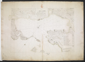
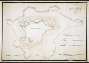
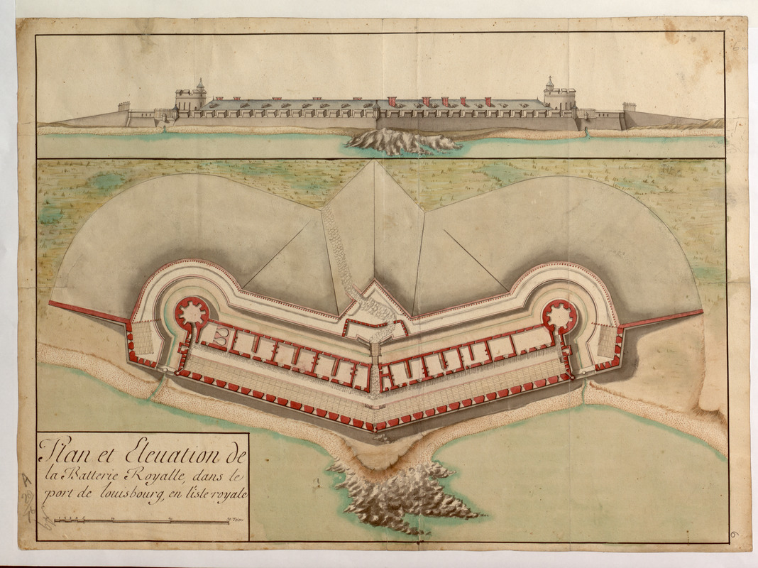
Plan et Elevation de la Batterie Royalle, dans le port de louisbourg, en l'isle royale
This map is also available in American Revolutionary Geographies Online (ARGO), a collections portal especially built for material relating to the American Revolutionary War Era. Visit ARGO to learn more about this item and explore the historical geography of North America in the late eighteenth century.
Item Information
- Title:
- Plan et Elevation de la Batterie Royalle, dans le port de louisbourg, en l'isle royale
- Former owner:
- Amherst, Jeffery Amherst, Baron, 1717-1797
- Former owner:
- Royal United Services Institute for Defence and Security Studies
- Date:
-
[ca. 1751]
- Format:
-
Maps/Atlases
- Location:
- British Library
- Collection (local):
-
British Library Collection
- Subjects:
-
Fortification--Nova Scotia--Halifax--Maps, Manuscript--Early works to 1800
Military art and science--Nova Scotia--Louisbourg--Maps, Manuscript--Early works to 1800
Louisbourg (N.S.)--Maps, Manuscript--Early works to 1800
- Places:
-
CanadaHalifax
CanadaLouisbourg
- Extent:
- 1 map : manuscript pen and ink with watercolour ; 40 x 55 cm
- Terms of Use:
-
No known copyright restrictions.
This work is licensed for use under a Creative Commons Attribution Non-Commercial Share Alike License (CC BY-NC-SA).

- Publisher:
-
[Louisbourg?] :
[producer not identified]
- Scale:
-
Scale approximately 1:430
- Language:
-
French
- Catalog Record:
-
http://searcharchives.bl.uk/IAMS_VU2:IAMS040-001999732
- Notes:
-
Date from comparison with "Plan et Elevation de la Batterie Royale dans le Port de Louisbourg" held by Archives nationales d'outre-mer and dated 1751 to verso (see FR CAOM OLC11B39/59). Previous British Library cataloguing dated this map before 1745. See also "Plan de la Batterie Royalle dans le port de Louisbourg de 39 Canon de 36 et de 2 Mortiers", signed by "Veritier" and dated about 1726 by the Archives nationales d'outre-mer (see FR CAOM 03DFC249B).
Relief is shown pictorially.
Shows an elevation of the Fortress of Louisbourg with the map beneath.
Shows the title at lower left including a scale of 30 toises.
Copy at Add Ms 57,702.6. Bound in R.U.S.I. Vol LXVII. Shows manuscript addition of "6" in pencil at lower right. Shows manuscript addition in pencil of "A 28/76" in pencil at lower left. Shows manuscript addition of "A 9" in pencil in margin at lower left. Evidence of old folds. Green circular label to verso showing "20". White label to verso showing "DRAWER 28 SECTION 1". Blue label to verso shows "A 28/76". Illegible watermark to paper.
- Notes (date):
-
9999