Toggle navigation
LMEC Home
Exhibitions
Georeferencing
Tools for Teachers
Collections
My Favorites
Sign Up / Log In
Search
Search the map portal
Map Collection
Map Collection
Map Sets
Search
Search
Search for
Search In
All Fields
Creator
Title
Subject
Place
Search All Digital Collections
Advanced Search
8181 Results
My Search
Start Over
More Like
commonwealth:1z40pb172
Remove constraint More Like: commonwealth:1z40pb172
Filter your Search
Place
North and Central America
4,930
United States
3,753
Suffolk (county)
1,026
Boston
999
Europe
963
Canada
431
Massachusetts
294
France
269
more
Place
»
Topic
Boston (Mass.)--Maps
574
United States--Maps
270
Real property--Massachusetts--Boston--Maps
174
Massachusetts--Maps
160
Landowners--Massachusetts--Boston--Maps
132
North America--Maps--Early works to 1800
103
New England--Maps
101
Europe--Maps
78
more
Topic
»
Date
Date range begin
–
Date range end
Current results range from
1482
to
2023
View distribution
Creator
United States. Hydrographic Office
357
O.H. Bailey & Co
148
Des Barres, Joseph F. W. (Joseph Frederick Wallet), 1722-1824
123
United States. Post Office Dept
120
Ptolemy, 2nd cent
100
Walling, Henry Francis, 1825-1888
94
Jefferys, Thomas, -1771
84
Geological Survey (U.S.)
83
more
Creator
»
Format
Maps/Atlases
8,122
Manuscripts
218
Prints
51
Books
36
Objects/Artifacts
9
Drawings/Illustrations
8
Posters
4
Georeferenced
Yes
869
No
7,312
Collection
Norman B. Leventhal Map Center Collection
8,163
Boston and New England Maps
2,184
Urban Maps
1,925
Maritime Charts and Atlases
750
American Revolutionary War-Era Maps
632
Boston Redevelopment Authority Collection
86
American Antiquarian Society Collection
8
William L. Clements Library Collection
6
more
Collection
»
Available to use
No known restrictions
8,022
Creative Commons license
47
Search Constraints
Sort by relevance
relevance
title
date (asc)
date (desc)
Number of results to display per page
100 per page
10
per page
20
per page
50
per page
100
per page
View results as:
grid view
map view
Search Results
1.
Clemens' map of Pennsylvania
2.
Clemens' silent teacher, dissected map of the United States and of each state in counties
3.
Map of the United States
4.
Tackabury's map of United States
5.
Bangor & Aroostook Railroad and connections : including northern Maine hunting and fishing region
6.
Fishing & hunting resorts of Maine, northern New Hampshire, and part of Canada and the provinces, Rangeley & Moosehead Lakes as...
7.
Lumberman's map of northern Maine
8.
Maine
9.
Maine
10.
A map & chart of the bays harbours post roads and settlements in Passamaquoddy & Machias with the large island of Grand Manan
11.
Map of Maine, New Hampshire, and Vermont : compiled from the latest authorities
12.
Map of Maine, New Hampshire and Vermont, from the most authentic sources
13.
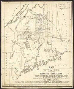
Map of the disputed territory [Maine] : reduced from the original of Messrs. Featherstonehaugh & Mudge, British commissioners
14.
Map of the district of Maine from the latest and best authorities
15.
Map of the district of Maine, Massachusetts : compiled from actual surveys made by order of the General Court and under the...
16.
A map of the Maine coast from York Harbor to Saco Bay : reminiscent & actual
17.
Map of the seat of war, showing disputed territory, and the boundary lines claimed by Maine & Great Britain and that proposed...
18.
Map of the state of Maine
19.
A map of the state of Maine
20.
Map of the state of Maine : exhibiting the disputed territory in connexion with the adjacent British provinces of N. Brunswick...
21.
Map of the state of Maine with the province of New Brunswick
22.
The National Publishing Company's 1900 census map of Maine : showing all counties, towns, railroads, cities, villages, post...
23.
New commercial, sportsmen's and route survey of Maine : showing all postoffices, railroads, electric roads, principal highways,...
24.
A new map of Maine
25.
North America : British provinces of New Brunswick, Nova Scotia, & part of Canada : compiled from recent surveys and adjusted...
26.
Post route map of the State of Maine showing post offices with the intermediate distances and mail routes in operation on the...
27.
Post route map of the State of Maine showing post offices with the intermediate distances and mail routes in operation on the...
28.
Post route map of the state of Maine showing post offices with the intermediate distances on mail routes in operation on the...
29.
Post route map of the state of Maine showing post offices with the intermediate distances on mail routes in operation on the...
30.
Province of Maine
31.
The province of Maine, from the best authorities
32.
Rand McNally official 1924 auto trails map Maine ; Rand McNally official 1924 auto trails map New Hampshire, Vermont
33.
Route and pictorial map of Maine
34.
State of Maine
35.
State of Maine
36.
An accurate map, of the District of Maine : being part of the commonwealth of Massachusetts
37.
An accurate map, of the district of Maine being part of the commonwealth of Massachusetts : compiled pursuant to an act of the...
38.
The coast from St. Johns, New Brunswick, to Goldsborough Bay, Maine
39.
The coast of Maine from modern Portland to Desert Island
40.
The district of Main from the latest surveys
41.
[Map of the area along the Saint Croix River in Maine and New Brunswick]
42.
Map of the District of Maine Massachusetts : compiled from actual surveys made by order of the General Court, and under the...
43.
Map of the northern part of New England : compiled for Pres't. Dwight's travels
44.
New Hampshire, Vermont, &c
45.
A new map of the District of Maine : taken from the original map compiled by Osgood Carleton Esqr. : From the actual surveys...
46.
A new map of the district of Maine taken from the original map compiled by Osgood Carleton esqr. from the actual surveys that...
47.
A plan of a rout from Fort Pownall on the river Penobscot in New England to Quebec and from Quebec to Fort Pownall : taken by...
48.
The Province of Maine, from the best authorities 1795
49.
Sketch of different passes into Canada from our lower provinces
50.
State of Maine
51.
This plan of Kennebeck & Sagadahock Rivers & country adjacent
52.
This plan represents par of the Bay of Passamoquoddy : the rivers Scoodic and Passamaquoddy which empty into said bay being an...
53.
This plan represents within the red lines twenty two townships of land situate between the million acres located on the River...
54.
Topographical map of the province of New Hampshire, including Montresor's survey of the St. Lawrence and the Kennebec route to...
55.
The 100th anniversary map of Abraham Lincoln's visit to Massachusetts, September 11-23, 1848
56.
1630 shoreline
57.
1879. Progress map of the U.S. Geographical Surveys west of the 100th Meridian : prepared under the direction of 1st Lieut....
58.
1903 Map of Salem and surrounding places
59.
19th annual convention of the National Association of Real Estate Boards : at Tulsa, June 7 to June 11 in 1926
60.
2005 significant U.S. hurricane strikes
61.
The 2100 project : an atlas for the Green New Deal
62.
227 Harzgerode
63.
305 Glatz
64.
38,000,000 escaped -- 10,000,000 died
65.
4 Kinten
66.
660 Wakulah St., Roxbury
67.
[A chart of Boston Bay and vicinity]
68.
[A chart of New York Island & North River : East River, passage through Hell Gate, Flushing Bay, Hampstead Bay, Oyster,...
69.
The A.A.A. key road map of continental Europe
70.
Aaron Bohrod's America, its history
71.
ABC pathfinder railway guide map : eastern division
72.
Abolition of Slavery, 1863
73.
Aboriginal map of North America, denoting the boundaries and the locations of various Indian tribes
74.
Acapulco, México
75.
Accurata delineatio Castrorum Suecicorum, ut et Haffniae, Regni Daniae Metropolis
76.
Accurata delineatio oppugnatae a faederatis, Caesareis, Polonicis, Danicis, et Brandeburgicis copijs sub-ductu Seren: Electoris...
77.
Accurata delineatio regionis circa Nieburgum Fioniæ cum prælio ibi commisso inter Danorum et fæderatorum exercitum ab una et...
78.
Accurata Scaniae, Blekingiae et Hallandiae descriptio
79.
An accurate map of Cuba, and the adjacent islands
80.
An accurate map of Dorset Shire divided into hundreds
81.
An accurate map of Dorset Shire, divided into its hundreds
82.
An accurate map of England and Wales with the principal roads from the best authorities
83.
An accurate map of England and Wales with the principal roads from the best authorities
84.
An accurate map of Europe from the best authorities
85.
An accurate map of Hindostan or India, from the best authorities
86.
An accurate map of His Majesty's province of New-Hampshire in New England : taken from actual surveys of all the inhabited...
87.
An Accurate map of New Hampshire in New England, from a late survey
88.
An Accurate map of New York in North America, from a late survey
89.
An accurate map of North America : describing and distinguishing the British and Spanish dominions on this great continent :...
90.
An accurate map of North America : describing and distinguishing the British and Spanish dominions of this great continent;...
91.
An accurate map of North America : describing and distinguishing the British, Spanish and French dominions on this great...
92.
An accurate map of North and South Carolina with their Indian frontiers, shewing in a distinct manner all the mountains,...
93.
An accurate map of Rhode Island, part of Connecticut and Massachusets, shewing Admiral Arbuthnot's station in blocking up...
94.
An accurate map of the coast of Cape de Verde
95.
An accurate map of the Commonwealth of Massachusetts exclusive of the district of Maine : compiled pursuant to an Act of the...
96.
An accurate map of the country round Boston in New England from the best authorities
97.
An accurate map of the county of Essex, divided into its hundreds
98.
An accurate map of the district of Maine being part of the Commonwealth of Massachusetts : compiled pursuant to an act of the...
99.
An accurate map of the United States of America, with part of the surrounding provinces agreeable to the Treaty of Peace of 1783
100.
Accuratissima Brasiliae tabula
‹ Prev
Next ›
1
2
3
4
5
…
81
82


![Map of the disputed territory [Maine]](https://bpldcassets.blob.core.windows.net/derivatives/images/commonwealth:7h14b025h/image_thumbnail_300.jpg)


![[Map of the area along the Saint Croix River in Maine and New Brunswick]](https://bpldcassets.blob.core.windows.net/derivatives/images/commonwealth:6108vt00n/image_thumbnail_300.jpg)


![[A chart of Boston Bay and vicinity]](https://bpldcassets.blob.core.windows.net/derivatives/images/commonwealth:cj82m2976/image_thumbnail_300.jpg)


