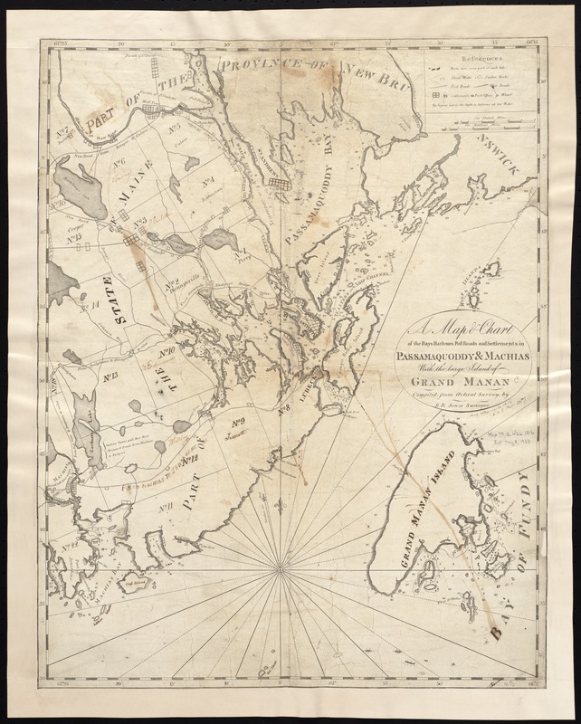
A map & chart of the bays harbours post roads and settlements in Passamaquoddy & Machias with the large island of Grand Manan
Item Information
- Title:
- A map & chart of the bays harbours post roads and settlements in Passamaquoddy & Machias with the large island of Grand Manan
- Creator:
- Jones, B. R. (Benjamin Richards), fl. 1804-1810
- Name on Item:
-
compiled from actual survey by B.R. Jones.
- Date:
-
[1816?]
- Format:
-
Maps/Atlases
- Location:
-
Boston Public Library
Norman B. Leventhal Map & Education Center - Collection (local):
-
Norman B. Leventhal Map & Education Center Collection
- Subjects:
-
Coasts--Maine--Maps
Coasts--New Brunswick--Maps
Maine--Maps
Passamaquoddy Bay (N.B. and Me.)--Maps
Grand Manan Island (N.B.)--Maps
- Places:
-
Maine
CanadaProvince of New Brunswick (province)
Passamaquoddy (bay)
- Extent:
- 1 map ; 52 x 41 cm.
- Terms of Use:
-
No known copyright restrictions.
No known restrictions on use.
- Publisher:
-
S.l :
s.n.
- Scale:
-
Scale ca. 1:146,000.
- Language:
-
English
- Notes:
-
Depths shown by soundings.
Shows town boundaries and gives distances.
- Identifier:
-
06_01_004059
- Call #:
-
G3732.C6 1816 .J66x
- Barcode:
-
39999059022465


