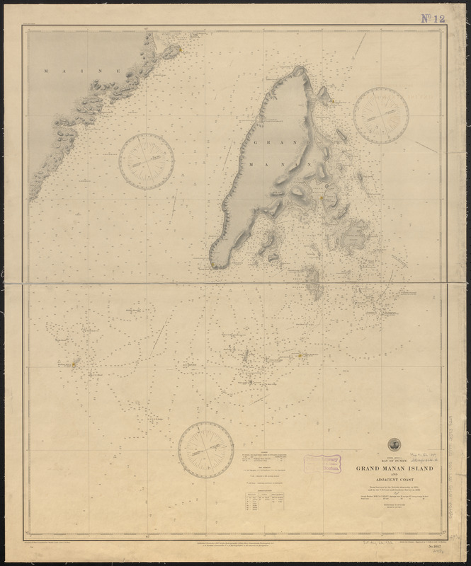
North America, Bay of Fundy, Grand Manan Island and adjacent coast : from surveys by the British Admiralty in 1855, and by the U.S. Coast and Geodetic Survey in 1886
Item Information
- Title:
- North America, Bay of Fundy, Grand Manan Island and adjacent coast : from surveys by the British Admiralty in 1855, and by the U.S. Coast and Geodetic Survey in 1886
- Title (alt.):
-
Grand Manan Island and adjacent coast
- Issuing body:
- United States. Hydrographic Office
- Engraver:
- Birch, C. E. (Charles E.)
- Draftsman:
- Dessez, L. (Leon)
- Engraver:
- Waddey, J. A. (John A.)
- Name on Item:
-
drawn by L. Dessez ; engraved by C.E. Birch and J.A. Waddey
- Date:
-
1887
- Format:
-
Maps/Atlases
- Location:
-
Boston Public Library
Norman B. Leventhal Map & Education Center - Collection (local):
-
Norman B. Leventhal Map & Education Center Collection
- Subjects:
-
Coasts--Maine--Maps
Coasts--New Brunswick--Grand Manan Island--Maps
Nautical charts--New Brunswick--Grand Manan Island
Grand Manan Island (N.B.)--Maps
- Places:
-
CanadaProvince of New Brunswick (province)Grand Manan (island)
- Extent:
- 1 map : hand colored ; 76 x 62 cm
- Terms of Use:
-
No known copyright restrictions.
No known restrictions on use.
- Publisher:
-
Washington, D.C. :
Hydrographic Office
- Scale:
-
Scale approximately 1:73,300
- Language:
-
English
- Notes:
-
Relief shown by shading and spot heights. Depths shown by soundings and isolines.
- Identifier:
-
06_01_015698
- Call #:
-
G9096.P5 svar .U55
- Barcode:
-
39999085939229


