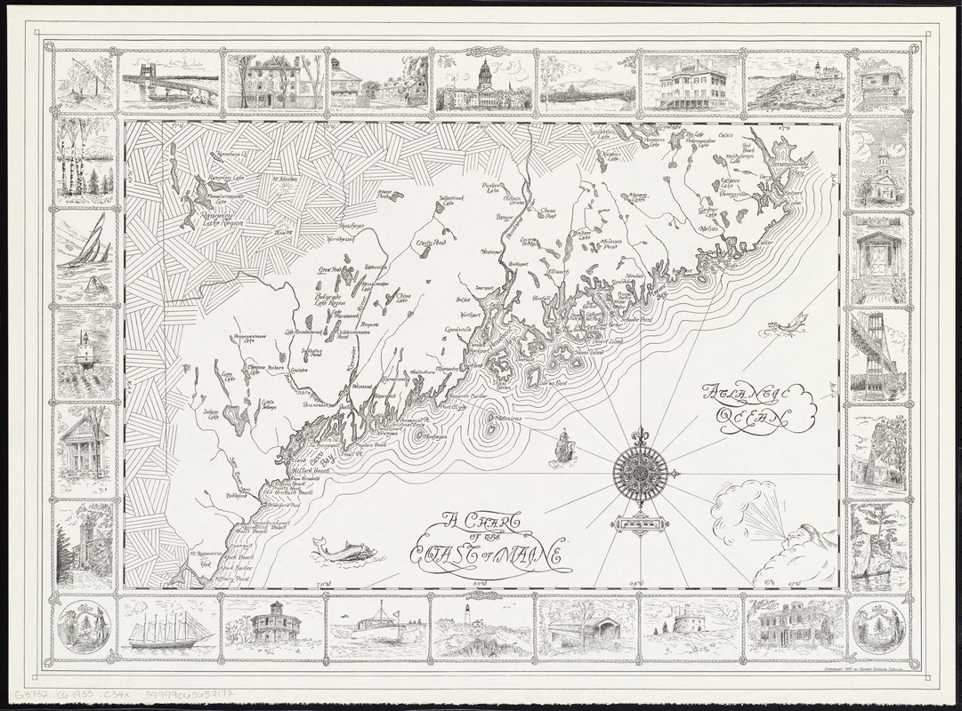
A chart of the coast of Maine
Item Information
- Title:
- A chart of the coast of Maine
- Creator:
- Chellis, Robert Dunning.
- Date:
-
1933
- Format:
-
Maps/Atlases
- Location:
-
Boston Public Library
Norman B. Leventhal Map & Education Center - Collection (local):
-
Norman B. Leventhal Map & Education Center Collection
- Subjects:
-
Nautical charts--Maine
Coasts--Maine--Maps
Atlantic Coast (Me.)--Maps
- Places:
-
Maine
- Extent:
- 1 map ; 37 x 57 cm. + 1 sheet (28 cm).
- Terms of Use:
-
No known copyright restrictions.
No known restrictions on use.
- Publisher:
-
Weston, Mass :
Robert Dunning Chellis
- Scale:
-
Scale [ca. 1:633,600]
- Language:
-
English
- Notes:
-
Includes illustrations of fish, a ship, and a wind head.
Map bordered by 28 illustrations in rope frames.
Accompanying sheet: List of border illustrations to accompany a chart of the coast of Maine.
Map and original plate gift of Robert Dunning Chellis, 2012.
- Identifier:
-
06_01_008348
- Call #:
-
G3732.C6 1933 .C34x
- Barcode:
-
39999065652172


