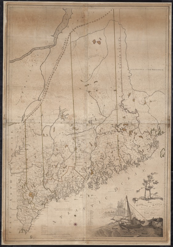
Map of the district of Maine, Massachusetts : compiled from actual surveys made by order of the General Court and under the inspection of agents of their appointment
Item Information
- Title:
- Map of the district of Maine, Massachusetts : compiled from actual surveys made by order of the General Court and under the inspection of agents of their appointment
- Creator:
- Carleton, Osgood, 1742-1816
- Name on Item:
-
by Osgood Carleton ; drawn by G. Graham ; Engra'd. by J. Callender & S. Hill.
- Date:
-
1802
- Format:
-
Maps/Atlases
- Location:
-
Boston Public Library
Norman B. Leventhal Map & Education Center - Collection (local):
-
Norman B. Leventhal Map & Education Center Collection
- Subjects:
-
Maine--Maps
- Places:
-
Maine
- Extent:
- 1 map : col. ; 131 x 90 cm.
- Terms of Use:
-
No known copyright restrictions.
No known restrictions on use.
- Publisher:
-
Boston :
B. & J. Loring
- Scale:
-
Scale [ca. 1:390,000].
- Language:
-
English
- Notes:
-
Shows town boundaries, buildings, roads, and distances of each town from Boston and the shire town.
Relief shown by hachures.
- Identifier:
-
06_01_004062
- Call #:
-
G3730 1802 .C37
- Barcode:
-
39999065671677


