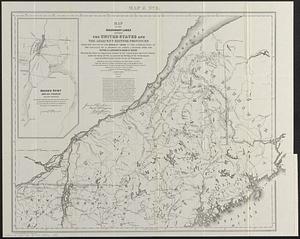
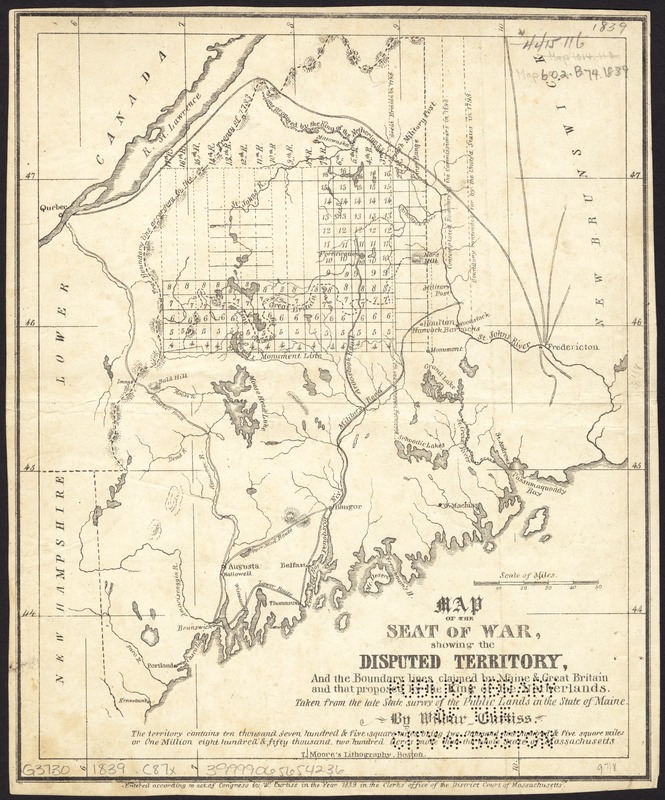
Map of the seat of war, showing disputed territory, and the boundary lines claimed by Maine & Great Britain and that proposed by the King of the Netherlands
Item Information
- Title:
- Map of the seat of war, showing disputed territory, and the boundary lines claimed by Maine & Great Britain and that proposed by the King of the Netherlands
- Creator:
- Curtiss, Wilbur.
- Name on Item:
-
taken from the late State survey of the Public Lands in the State of Maine by Wilbur Curtiss.
- Date:
-
1839
- Format:
-
Maps/Atlases
- Location:
-
Boston Public Library
Norman B. Leventhal Map & Education Center - Collection (local):
-
Norman B. Leventhal Map & Education Center Collection
- Subjects:
-
Maine--Maps
Northeast boundary of the United States--Maps
United States--Boundaries--Canada--Maps
Canada--Boundaries--United States--Maps
- Places:
-
Maine
- Extent:
- 1 map ; 24 x 20 cm.
- Terms of Use:
-
No known copyright restrictions.
No known restrictions on use.
- Publisher:
-
Massachusetts :
Wr. Curtiss
- Scale:
-
Scale [ca. 1:1,950,000]
- Language:
-
English
- Notes:
-
Relief shown by hachures.
- Identifier:
-
06_01_008623
- Call #:
-
G3730 1839 .C87x
- Barcode:
-
39999065654236
![Map of the disputed territory [Maine]](https://bpldcassets.blob.core.windows.net/derivatives/images/commonwealth:7h14b025h/image_thumbnail_300.jpg)