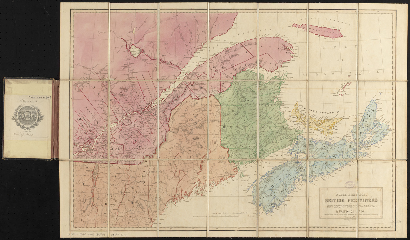
North America : British provinces of New Brunswick, Nova Scotia, & part of Canada : compiled from recent surveys and adjusted to the latest astronomical observations
Item Information
- Title:
- North America : British provinces of New Brunswick, Nova Scotia, & part of Canada : compiled from recent surveys and adjusted to the latest astronomical observations
- Title (alt.):
-
British provinces of New Brunswick, Nova Scotia, & part of Canada
Nelson's new map of the British provinces in North America
New map of the British provinces in North America
- Publisher:
- Nelson, V. H.
- Date:
-
[ca. 1840–1849]
- Format:
-
Maps/Atlases
- Location:
-
Boston Public Library
Norman B. Leventhal Map & Education Center - Collection (local):
-
Norman B. Leventhal Map & Education Center Collection
- Subjects:
-
Maritime Provinces--Maps
Nova Scotia--Maps
Prince Edward Island--Maps
New Brunswick--Maps
Québec (Province)--Maps
Maine--Maps
- Places:
-
Maine
CanadaNova Scotia (province)
- Extent:
- 1 map : color, sectioned and mounted on cloth ; 44 x 65 cm, folded in cover 17 x 12 cm
- Terms of Use:
-
No known copyright restrictions.
No known restrictions on use.
- Publisher:
-
London :
V.H. Nelson
- Scale:
-
Scale approximately 1:1,800,000
- Language:
-
English
- Notes:
-
Relief shown by hachures.
Identifies settled boundary between Maine and Canada and shows British and US claims.
Sectioned, pasted to linen, and folded into brown publisher's boards entitled: Nelson's new map of the British provinces in North America.
- Identifier:
-
06_01_016336
- Call #:
-
G3415 1840 .N45
- Barcode:
-
39999085946141


