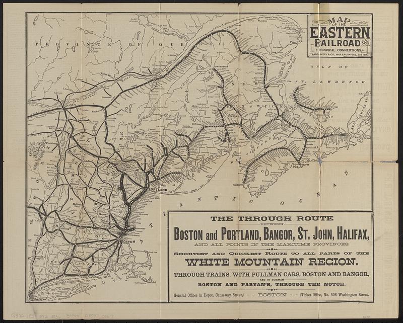
Map of the Eastern Railroad and principal connections

Item Information
- Title:
- Map of the Eastern Railroad and principal connections
- Title (alt.):
-
Eastern Railroad only through sea coast line to the White Mountains, Maine & eastern provinces
- Cartographer:
- Rand, Avery & Co.
- Contributor:
- Eastern Railroad Company
- Date:
-
1882
- Format:
-
Maps/Atlases
- Location:
-
Boston Public Library
Norman B. Leventhal Map & Education Center - Collection (local):
-
Norman B. Leventhal Map & Education Center Collection
- Subjects:
-
New England--Maps
Maritime Provinces--Maps
Québec (Province)--Maps
Railroads--New England--Maps
Railroads--Maritime Provinces--Maps
Railroads--Québec (Province)--Maps
Eastern Railroad Company
- Places:
-
CanadaMaritime Provinces (area)
New England (area)
- Extent:
- 1 map ; 36 x 43 cm, folded to 20 x 10 cm
- Terms of Use:
-
No known copyright restrictions.
No known restrictions on use.
- Publisher:
-
Boston :
Rand, Avery & Co.
- Scale:
-
Scale approximately 1:2,300,000
- Language:
-
English
- Notes:
-
Relief shown by hachures.
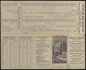
Includes text.
Time-tables, rates, and text on verso.
"Jan. 2, 1882."
- Identifier:
-
06_01_018757
- Call #:
-
G3721.P3 1882 .R36
- Barcode:
-
39999085970067