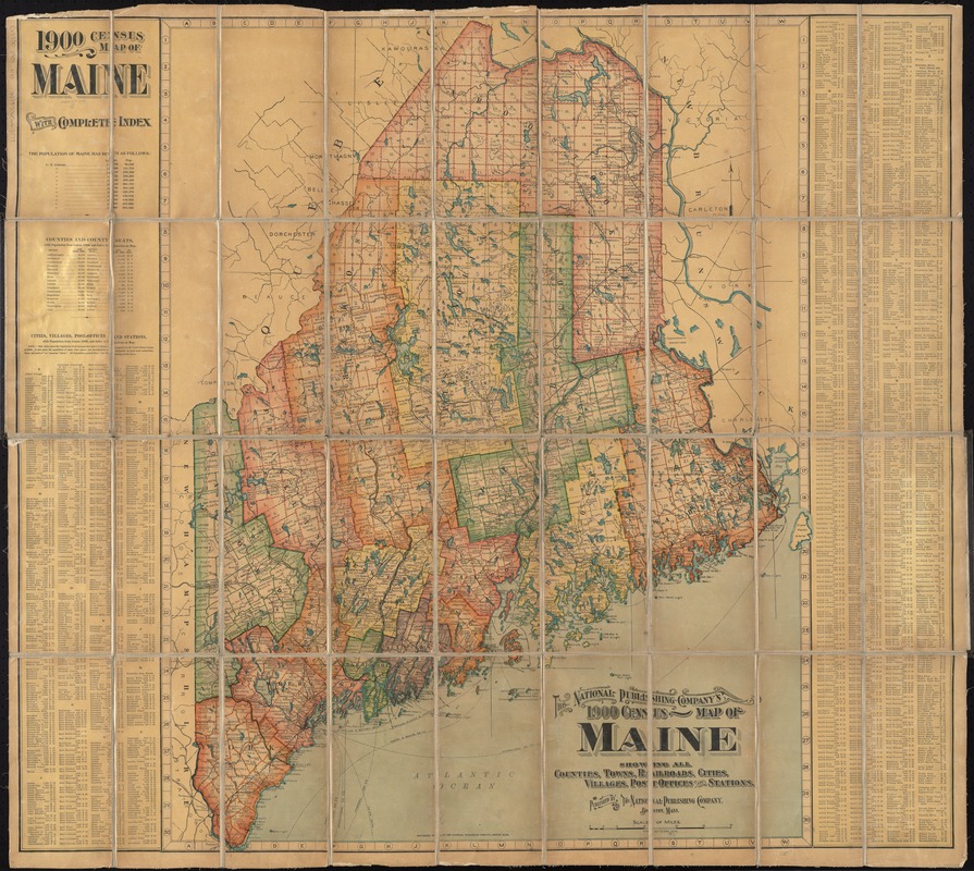
The National Publishing Company's 1900 census map of Maine : showing all counties, towns, railroads, cities, villages, post offices and stations
Item Information
- Title:
- The National Publishing Company's 1900 census map of Maine : showing all counties, towns, railroads, cities, villages, post offices and stations
- Title (alt.):
-
1900 census map of Maine with complete index
- Creator:
- National Publishing Company (Boston, Mass.)
- Date:
-
[ca. 1901]
- Format:
-
Maps/Atlases
- Location:
-
Boston Public Library
Norman B. Leventhal Map & Education Center - Collection (local):
-
Norman B. Leventhal Map & Education Center Collection
- Subjects:
-
Maine--Maps
- Places:
-
Maine
- Extent:
- 1 map : col., dissected and mounted on linen ; 87 x 68 cm.
- Terms of Use:
-
No known copyright restrictions.
No known restrictions on use.
- Publisher:
-
Boston :
The Company
- Scale:
-
Scale [1:580,240]. 9 miles to 1 in.
- Language:
-
English
- Notes:
-
Includes population figures and index.
On verso: Map of the United States and its new possessions.
Map of the United States on verso covered by linen.
- Identifier:
-
06_01_009750
- Call #:
-
G3730 1901 .N38
- Barcode:
-
39999065663179


