Toggle navigation
LMEC Home
Exhibitions
Georeferencing
Tools for Teachers
Collections
My Favorites
Sign Up / Log In
Search
Search the map portal
Map Collection
Map Collection
Map Sets
Search
Search
Search for
Search In
All Fields
Creator
Title
Subject
Place
Search All Digital Collections
Advanced Search
13385 Results
Filter your Search
Place
North and Central America
9,353
United States
7,286
Suffolk (county)
1,664
Boston
1,621
Europe
1,035
Canada
949
Massachusetts
875
New York
534
more
Place
»
Topic
Boston (Mass.)--Maps
741
City planning--Massachusetts--Boston--Maps
418
United States--History--Revolution, 1775-1783--Maps
329
United States--Maps
315
Urban renewal--Massachusetts--Boston--Maps
254
Real property--Massachusetts--Boston--Maps
252
Massachusetts--Maps
219
Insurance surveys
197
more
Topic
»
Date
Date range begin
–
Date range end
Current results range from
1482
to
2023
View distribution
Creator
United States. Hydrographic Office
595
Boston Redevelopment Authority
403
Des Barres, Joseph F. W. (Joseph Frederick Wallet), 1722-1824
247
Royal United Services Institute for Defence and Security Studies
160
Jefferys, Thomas, -1771
154
George, III, King of Great Britain, 1738-1820
152
George, IV, King of Great Britain, 1762-1830
151
O.H. Bailey & Co
148
more
Creator
»
Format
Maps/Atlases
13,205
Manuscripts
985
Prints
102
Books
49
Drawings/Illustrations
44
Photographs
15
Objects/Artifacts
13
Documents
7
more
Format
»
Georeferenced
Yes
979
No
12,406
Collection
Norman B. Leventhal Map Center Collection
8,891
American Revolutionary War-Era Maps
3,305
Boston and New England Maps
2,804
Urban Maps
2,397
Maritime Charts and Atlases
1,150
William L. Clements Library Collection
910
Library of Congress Collection
618
Boston Redevelopment Authority Collection
475
more
Collection
»
Available to use
No known restrictions
9,952
Creative Commons license
1,677
Search Constraints
Sort by relevance
relevance
title
date (asc)
date (desc)
Number of results to display per page
100 per page
10
per page
20
per page
50
per page
100
per page
View results as:
grid view
map view
Search Results
2101.
A chart of the Atlantic Ocean : its islands and the adjacent continents: In which the British Dominions in Europe and America,...
2102.
Chart of the Atlantic Ocean, with the British, French, & Spanish settlements in North America, and the West Indies : as also on...
2103.
Chart of the Atlantic Ocean, with the British, French, & Spanish settlements in North America, and the West Indies : as also on...
2104.
Chart of the Atlantic Ocean, with the British, French, & Spanish settlements in North America, and the West Indies : as also on...
2105.
A chart of the Atlantick Ocean describing the Coast of Africa from Cape Teffalana to Cape Formosa
2106.
A chart of the banks and part of the coast of Newfoundland including the islands of Sable and Cape Breton
2107.
A chart of the banks and part of the coast of Newfoundland including the islands of Sable and Cape Breton
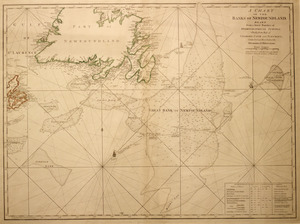
2108.
A chart of the Banks of Newfoundland
2109.
A chart of the Banks of Newfoundland
2110.
A chart of the Banks of Newfoundland, drawn from a great number of hydrographical surveys, chiefly from those of Chabert, Cook...
2111.
Chart of the Banks of Newfoundland, drawn from a great number of hydrographical surveys, these charts are followed, according...
2112.
Chart of the banks of Newfoundland, drawn from a great number of hydrographical surveys, these charts are followed, according...
2113.
A chart of the bay and harbour of Pensacola in the Province of West Florida
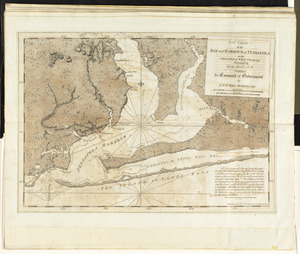
2114.
Chart of the Bay of Bengal, including plans of the principal harbours
2115.
Chart of the Bay of Fundy from Machias Bay to 64°35' west longitude
2116.
A chart of the British Channel and the Bay of Biscay, with a part of the North Sea, and the entrance of St. George's Channel
2117.
A chart of the Cape Verd Islands
2118.
A chart of the Caribe Islands
2119.
A chart of the Caribe islands
2120.
Chart of the coast of America from Albermarle Sound to Cape Lookout
2121.
Chart of the coast of America from Cape Fear to Cape Look Out
2122.
Chart of the coast of America from Cape Fear to Helens Sound
2123.
Chart of the coast of America from Cape Hateras to Cape Roman
2124.
Chart of the coast of America from Cape Hateras to Cape Roman
2125.
Chart of the coast of America from Cape Hateras to Cape Roman
2126.
Chart of the coast of America from Cape Hateras to Cape Roman
2127.
Chart of the coast of America from Cape Henry to Albermarle Sound
2128.
A chart of the coast of America from New found Land to Cape Cod
2129.
Chart of the coast of America from St. Hellens Sound [to] St. Johns River
2130.
Chart of the coast of America from the Nd. of St. Augustin to Ayes Inlet
2131.
A chart of the coast of America from Wood Island to Good Harbour from Hollands surveys
2132.
A chart of the Coast of America from Wood Island to Good Harbour from Hollands surveys
2133.
A chart of the Coast of America from Wood Island to Good Harbour from Hollands surveys
2134.
Chart of the coast of America thro' the Gulph of Florida
2135.
Chart of the coast of America through the Gulph of Florida to the entrance of the Gulph of Mexico
2136.
A chart of the coast of Barbaria with the western, Canaria, & Cape de Verd, isles
2137.
Chart of the coast of China and of the Japan islands : including the Marianes and part of the Philippines
2138.
Chart of the coast of China, from the Canton River, to the Yang Tze Keang
2139.
[Chart of the coast of Georgia]
2140.
[Chart of the coast of Georgia]
2141.
Chart of the coast of Honduras and Nicaragua
2142.
A chart of the coast of Maine
2143.
Chart of the coast of New England
2144.
A chart of the coast of New England, from Beverly to Scituate harbour, including the ports of Boston and Salem
2145.
A chart of the coast of New England from the South Shoal to Cape Sable including Georges Bay from Holland & actual surveys
2146.
A chart of the coast of New England from the South Shoal to Cape Sable including Georges Bay from Holland & actual surveys
2147.
A chart of the coast of New York, New Jersey, Pensilvania, Maryland, Virginia, North Carolina, &c
2148.
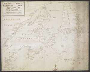
A CHART of the COAST OF NEWFOUND-LAND NEW SCOTLAND NEW ENGLAND &c. 1711
2149.
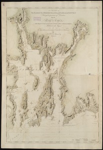
[Chart of the coast of Quebec from the Riviere St. Jean to Grand Hermine Bay]
2150.
A chart of the discoveries made by the late Capt. Cook, & other European navigators, in the great Pacific Ocean between Asia...
2151.
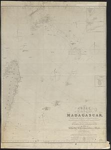
Chart of the east coast of Madagascar, including the Mauritius, Seychelle islands &c. between the latitudes of 2°30' & 26°30'...
2152.
Chart of the east coast of the Yucatan
2153.
Chart of the entrance of Hudson's River, from Sandy Hook to New York, with the banks, depths of water, sailing-marks, & ca
2154.
[Chart of the gulf and river of St. Lawrence]
2155.
A chart of the gulf stream
2156.
[Chart of the Gulf Stream]
2157.
A chart of the harbour of Boston
2158.
A chart of the harbour of Boston
2159.
A chart of the harbour of Boston
2160.
A chart of the harbour of Boston
2161.
A chart of the Harbour of Boston, with the soundings, sailing-marks and other directions
2162.
A chart of the Harbour of Boston, with the soundings, sailing-marks, and other directions
2163.
A chart of the Harbour of Boston, with the soundings, sailing-marks, and other directions
2164.
A chart of the harbour of Halifax in Nova Scotia : with Jebucto Bay and Cape Sambro also the islands, ledges of rocks, shoals &...
2165.
A chart of the harbour of Rhode Island and Narraganset Bay
2166.
A chart of the harbour of Rhode Island and Narraganset Bay
2167.
A chart of the harbour of Rhode Island and Narraganset Bay surveyed in pursuance of directions from the Lords of Trade to His...
2168.
A chart of the harbour of Rhode Island and Narraganset Bay surveyed in pursuance of directions from the Lords of Trade to his...
2169.
A chart of the harbour of Rhode Island and Narraganset Bay surveyed in pursuance of directions from the Lords of Trade to his...
2170.
Chart of the harbours of Salem, Marblehead, Beverly and Manchester : from a survey taken in the years 1804, 5 & 6
2171.
Chart of the harbours of Salem, Marblehead, Beverly, and Manchester : from a survey taken in the years 1804, 5 & 6
2172.
A chart of the history of printing in Europe
2173.
A chart of the iland of Hispaniola : with the Windward passage from Iamaica betwene ye east end of Cuba & the west end of...
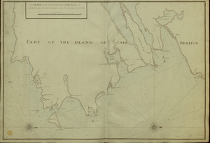
2174.
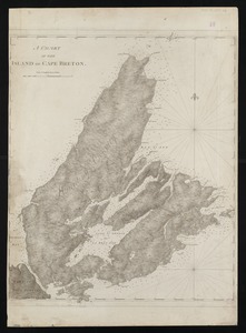
A chart of the island of Cape Breton
2175.
A chart of the Mediterranean Sea, with part of the Atlantic Ocean and Adriatic Sea, with the islands of Minorca, Majorca,...
2176.
Chart of the Mississippi River from the Ohio River to Gulf of Mexico : constructed and engraved to illustrate "The War with the...
2177.
A chart of the N.E. coast of Cape Breton Island, from St. Ann Bay to Cape Morien
2178.
Chart of the north east coast of New Caledonia and part of the New Hebrides
2179.
A Chart of the north part of America, describing the sea coast of Groenland, Dawies Streights, Baffins Bay, Hudsons Streights,...
2180.
A chart of the North-American coast, for the navigation between Halifax and Philadelphia
2181.
Chart of the Northern Passage between Asia & America
2182.
A chart of the peninsula of Nova Scotia
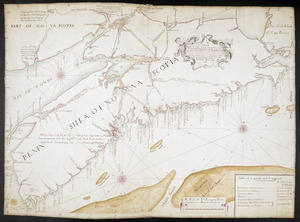
2183.
A Chart of The Peninsula of Nova Scotia 1765
2184.
Chart of the Philippine Islands, from the Spanish chart 1808 : the adjacent islands are added from the latest surveys
2185.
A chart of the province of New England, with the soundings on the coast; drawn about 1670, on a scale of 1 2/3 English league...
2186.
[Chart of the Saint Lawrence River]
2187.
[Chart of the Saint Lawrence River from Anticosti to Quebec]
2188.
Chart of the sea coast from latitude 27⁰00ʹ00ʺ to 27⁰20ʹ00ʺ, with Little Inlet & River into Hillsborough River ; Chart of the...
2189.
Chart of the sea coast from lattde. 26⁰20ʹ00ʺ to 26⁰ & 40ʹ00ʺ with the head of Sharkshead River ; Chart of New Inlet ; Chart of...
2190.
A chart of the sea coast of Brazil from Cape St. Augustine to the straights of Magellan, & in the South Sea, from the latitud...
2191.
A chart of the sea coast of New Found Land, New Scotland, New England, New York, New Jersey, with Virginia and Maryland
2192.
A chart of the sea coast of New Foundland, New Scotland, New England, New York, New Jersey, with Virginia and Maryland
2193.
A chart of the sea coast of New Foundland, New Scotland, New York, New Jersey, with Virginia and Maryland and New England
2194.
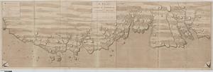
A CHART OF THE SEA COASTS OF THE PENINSULA OF NOVA SCOTIA
2195.
A chart of the sea-coast of Newfoundland between St. Laurence and Point May survey'd by order of Hugh Palliser esqr. commodore...
2196.
A CHART of the South East Part of l'Isle Royal, or Cape Bretton taken from the best Surveys, and the Observations of the most...
2197.
Chart of the South End of East Florida and Martiers
2198.
Chart of the South Pacific Ocean, from the American Expg. Expedition, Admiralty and Depot de la Marine
2199.
A chart of the South Sea
2200.
A chart of the Streights of Bell Isle
‹ Prev
Next ›
1
2
…
18
19
20
21
22
23
24
25
26
…
133
134


![Chart of the coast of America from St. Hellens Sound [to] St. Johns River](https://bpldcassets.blob.core.windows.net/derivatives/images/commonwealth:cj82m727j/image_thumbnail_300.jpg)


![[Chart of the coast of Georgia]](https://bpldcassets.blob.core.windows.net/derivatives/images/commonwealth:z603vv33t/image_thumbnail_300.jpg)
![[Chart of the coast of Georgia]](https://bpldcassets.blob.core.windows.net/derivatives/images/commonwealth:z603vv35c/image_thumbnail_300.jpg)


![[Chart of the coast of Quebec from the Riviere St. Jean to Grand Hermine Bay]](https://bpldcassets.blob.core.windows.net/derivatives/images/commonwealth:7h149v50v/image_thumbnail_300.jpg)

![[Chart of the gulf and river of St. Lawrence]](https://bpldcassets.blob.core.windows.net/derivatives/images/commonwealth:7h149v39v/image_thumbnail_300.jpg)

![[Chart of the Gulf Stream]](https://bpldcassets.blob.core.windows.net/derivatives/images/commonwealth:z603vr47j/image_thumbnail_300.jpg)


![[Chart of the Saint Lawrence River]](https://bpldcassets.blob.core.windows.net/derivatives/images/commonwealth:hx11z0594/image_thumbnail_300.jpg)
![[Chart of the Saint Lawrence River from Anticosti to Quebec]](https://bpldcassets.blob.core.windows.net/derivatives/images/commonwealth:hx11z079m/image_thumbnail_300.jpg)
![Chart of the sea coast from latitude 27⁰00ʹ00ʺ to 27⁰20ʹ00ʺ, with Little Inlet & River into Hillsborough River ; Chart of the sea coast from latitude 26⁰40ʹ00ʺ to [27⁰]00ʹ00ʺ, the Leech Shoal & Hillsborough River](https://bpldcassets.blob.core.windows.net/derivatives/images/commonwealth:q524nd97p/image_thumbnail_300.jpg)