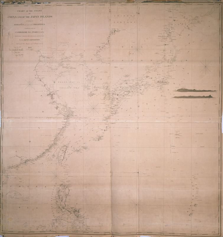
Chart of the coast of China and of the Japan islands : including the Marianes and part of the Philippines
Item Information
- Title:
- Chart of the coast of China and of the Japan islands : including the Marianes and part of the Philippines
- Description:
-
Published by the U.S. Navy, this map of the coast of China and Japan was the direct result of Commodore Matthew C. Perry's ground-breaking diplomatic journey to Asia in 1853 -1854. Among the goals of the expedition was the completion of coastal surveys of China, Japan, and other nations in this region. The missing Korean coastline provides evidence that Perry did not travel as far north as Korea.
- Creator:
- Maury, William L.
- Name on Item:
-
compiled by order of Commodore M.C. Perry, U.S.N., from the latest authorities with additions and corrections by the U.S. Japan Expedition, by Lieuts. W.L. Maury and S. Bent, U.S.N.
- Date:
-
1855
- Format:
-
Maps/Atlases
- Location:
-
Boston Public Library
Norman B. Leventhal Map & Education Center - Collection (local):
-
Norman B. Leventhal Map & Education Center Collection
- Subjects:
-
China--Maps
Japan--Maps
Pacific Coast (Asia)--Maps
- Places:
-
China
Japan
- Extent:
- 1 map ; 107 x 112 cm.
- Terms of Use:
-
No known copyright restrictions.
No known restrictions on use.
- Publisher:
-
Washington, D.C :
U.S.N.
- Scale:
-
Scale [ca. 1:3,800,000].
- Language:
-
English
- Notes:
-
Depths shown by soundings.
Includes two elevations.
"Drawn by Edw. Sels. Engr. by Selmar Siev[?]" [Last name indecipherable].
Exhibited in “Faces and Places,” at the Boston Public Library, Boston, MA, October 2003 - September 2004. MB (BRL)
- Identifier:
-
05_04_000046
- Call #:
-
G7822.C6 1855 .M3
- Barcode:
-
39999052507165