Yeojido

Item Information
- Title:
- Yeojido
- Title (alt.):
-
輿地圖
Korean atlas
- Date:
-
[1800–1899]
- Format:
-
Maps/Atlases
- Genre:
-
Manuscript maps
- Location:
- MacLean Collection Map Library
- Collection (local):
-
MacLean Collection Map Library
- Subjects:
-
Korea--Maps
China--Maps
Japan--Maps
- Places:
-
North Korea
South Korea
China
Japan
- Extent:
- 1 atlas (12 manuscript maps) : hand color ; maps 29 x 40 cm
- Terms of Use:
-
Public Domain/No known restrictions on use. Contact host institution to download image.
Contact host institution for more information.
- Place of origin:
-
Korea
- Language:
-
Korean
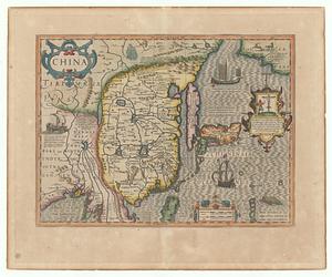
- Table of Contents:
-
[1] World map (K. cheonhado 天下圖)
[2] Map of China
[3] Map of Japan
[4] Map of Korea
[5] Map of Gyeonggi province
[6] Map of Chungcheong province
[7] Map of Jeolla province
[8] Map of Gyeongsang province
[9] Map of Gangwon province
[10] Map of Hwanghae province
[11] Map of Pyongan province
[12] Map of Hamgyong.
- Notes (date):
-
This date is inferred.
- Notes (language):
-
In Korean.
- Identifier:
-
MC29648
- Call #:
-
29648