A chart of the sea coast of New Foundland, New Scotland, New York, New Jersey, with Virginia and Maryland and New England
Item Information
- Title:
- A chart of the sea coast of New Foundland, New Scotland, New York, New Jersey, with Virginia and Maryland and New England
- Description:
-
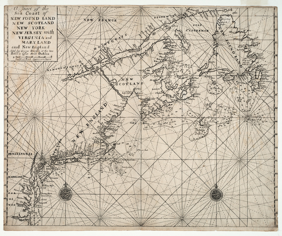
The 1749 pirated Dublin edition of "The English Pilot, The Fourth Book" included two relatively rare charts showing the New England coast. Although the charts in the Dublin edition resemble those in the London edition of "The English Pilot", they were entirely re-engraved. The chart displayed here shows the entire northeastern coast line from the Chesapeake Bay north to the Gulf of Saint Lawrence and Newfoundland. The other chart, which was drawn at a larger scale, focuses on just the New England coast line from the Hudson River to the Penobscot River.
- Creator:
- Grierson, George, d. 1753
- Name on Item:
-
sold by George Grierson at the two bibles in Essex Street Dublin
- Date:
-
1749
- Format:
-
Maps/Atlases
- Location:
- Private Collection
- Collection (local):
-
Mapping Boston Collection
- Subjects:
-
Nautical charts--Atlantic Coast (North America)--Early works to 1800
Atlantic Coast (North America)--Maps--Early works to 1800
- Places:
-
North America (area)
- Extent:
- 1 map ; 44 x 56 cm.
- Terms of Use:
-
No known copyright restrictions.
This work is licensed for use under a Creative Commons Attribution Non-Commercial Share Alike License (CC BY-NC-SA).

- Publisher:
-
Dublin :
George Grierson
- Scale:
-
Scale not given
- Language:
-
English
- Notes:
-
Depths shown by soundings.
Appears in English pilot: 4th book. Dublin. 1730-1762.
- Notes (exhibitions):
-
Exhibited: "Charting an Empire: The Atlantic Neptune" organized by the Norman B. Leventhal Map Center at the Boston Public Library, 2013.
- Identifier:
-
05_04_000167
- Barcode:
-
39999052509591


