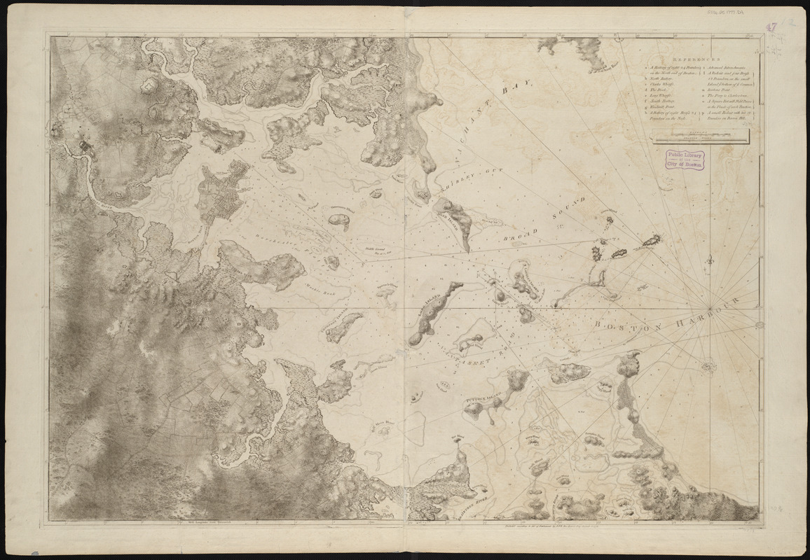
A chart of the harbour of Boston

This map is also available in American Revolutionary Geographies Online (ARGO), a collections portal especially built for material relating to the American Revolutionary War Era. Visit ARGO to learn more about this item and explore the historical geography of North America in the late eighteenth century.
Item Information
- Title:
- A chart of the harbour of Boston
- Cartographer:
- Des Barres, Joseph F. W. (Joseph Frederick Wallet), 1729-1824
- Writer of added text:
- Callendar, George
- Date:
-
1775
- Format:
-
Maps/Atlases
- Location:
-
Boston Public Library
Norman B. Leventhal Map & Education Center - Collection (local):
-
Norman B. Leventhal Map & Education Center Collection
- Subjects:
-
Nautical charts--Massachusetts--Boston Harbor--Early works to 1800
Boston (Mass.)--Maps--Early works to 1800
Boston Harbor (Mass.)--Maps--Early works to 1800
- Places:
-
MassachusettsBoston Harbor
MassachusettsSuffolk (county)Boston
- Extent:
- 1 chart : col. ; 70 x 103 cm. + text (1 page ; 78 x 57 cm)
- Terms of Use:
-
No known copyright restrictions.
No known restrictions on use.
- Publisher:
-
[London] :
J.F.W. Des Barres
- Edition:
- 1st state.
- Scale:
-
Scale [ca. 1:25,000]
- Language:
-
English
- Notes:
-
Title from published bibliography.
Relief shown by hachures and shading. Depths shown by soundings.
Table of references identifies major pre-Revolutionary fortification features of Boston.
Chart principally taken from surveys by George Callendar in 1769.
From the author's Atlantic Neptune.
Accompanied by nautical remarks and directions (1 page ; 78 x 57 cm)
- Identifier:
-
06_01_004985
06_01_008397
- Call #:
-
G1106.P5 D4 1777
- Barcode:
-
30000002807418


