A chart of the Atlantick Ocean describing the Coast of Africa from Cape Teffalana to Cape Formosa
Item Information
- Title:
- A chart of the Atlantick Ocean describing the Coast of Africa from Cape Teffalana to Cape Formosa
- Description:
-
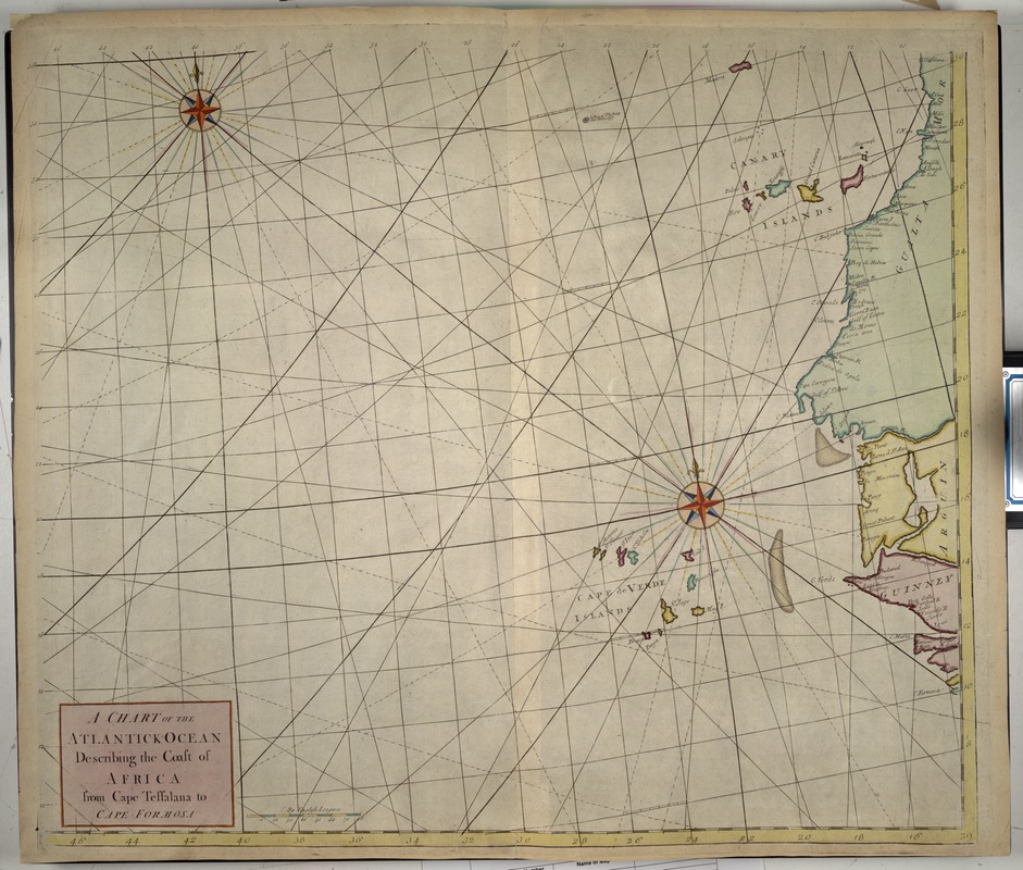
This portolan-style chart, with two colorful compass roses and radiating rhumb lines, undoubtedly dates from the early 18th century. It was apparently part of a series of charts prepared to aid sailors in navigating the Atlantic trade routes along western Africa. The geographic area depicted on this chart covers the North Atlantic from the Canary to the Cape Verde Islands and the west coast of Africa including portions of the present-day countries of Morocco, Western Sahara, Mauritania, Senegal, and Gambia.
- Date:
-
1725
- Format:
-
Maps/Atlases
- Location:
-
Boston Public Library
Norman B. Leventhal Map & Education Center - Collection (local):
-
Norman B. Leventhal Map & Education Center Collection
- Subjects:
-
Nautical charts--Atlantic Ocean--Early works to 1800
Atlantic Ocean--Maps--Early works to 1800
Atlantic Coast (Africa)--Maps--Early works to 1800
- Places:
-
Atlantic Ocean
- Extent:
- 1 map : col. ; 59 x 49 cm.
- Terms of Use:
-
No known copyright restrictions.
No known restrictions on use.
- Publisher:
-
London :
[s.n.]
- Scale:
-
Scale not given.
- Language:
-
English
- Notes:
-
Exhibited in “Faces and Places,” at the Boston Public Library, Boston, MA, October 2003 - September 2004. MB (BRL)
- Identifier:
-
05_04_000144
- Call #:
-
G9101.P5 1725 .C4
- Barcode:
-
39999052510003


